
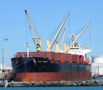
THOR NIRAMIT
Cargo
Current Trip
GUAYAQUIL
| Time Travelled | 1 day |
|---|---|
| Remaining Time | --- |
| Distance Travelled | 326.25 nm |
| Remaining Distance | --- |
| AVG Speed | 12.2 Knopen |
| MAX Speed | 15.4 Knopen |
| AVG Wind | 11.4 knots |
| MAX Wind | 20.9 knots |
| MIN Temp | 17.6°C / 63.68°F |
| MAX Temp | 32.1°C / 89.78°F |
| Diepgang | 8.3 M |
| Positie ontvangen | 9 d geleden |
Current Position
| Lengtegraad | -77.11668° |
|---|---|
| Breedtegraat | 3.84804° |
| Status | Under way using engine |
| Snelheid | 13.3 Knopen |
| Koers | 245.5° |
| Gebied | North Pacific Ocean |
| Station | T-AIS |
| Positie ontvangen | 9 d geleden |
Info
Information
The current position of THOR NIRAMIT is in North Pacific Ocean with coordinates 3.84804° / -77.11668° as reported on 2024-06-20 21:52 by AIS to our vessel tracker app. The vessel's current speed is 13.3 Knopen
The vessel THOR NIRAMIT (IMO: 9714800, MMSI: 563121200) is a Cargo It's sailing under the flag of [SG] Singapore.
In this page you can find informations about the vessels current position, last detected port calls, and current voyage information. If the vessels is not in coverage by AIS you will find the latest position.
The current position of THOR NIRAMIT is detected by our AIS receivers and we are not responsible for the reliability of the data. The last position was recorded while the vessel was in Coverage by the Ais receivers of our vessel tracking app.
The current draught of THOR NIRAMIT as reported by AIS is 8.3 meters
Weather
| Temperature | 18.2°C / 64.76°F |
|---|---|
| Wind Speed | 9 knots |
| Direction | 163° SSE |
| Pressure | 1010.6 hPa |
| Humidity | 87.6 % |
| Cloud Coverage | 7 % |
Featured Company
Last Port Calls
| Port | Arrival | Departure | Time In Port |
|---|---|---|---|
| 2024-06-22 23:41 | 2024-06-29 17:31 | 6 d | |
| 2024-06-16 18:29 | 2024-06-20 21:37 | 4 d | |
| 2024-06-08 10:52 | 2024-06-15 01:56 | 6 d | |
| 2024-04-25 12:22 | 2024-05-03 12:07 | 7 d |
Most Visited Ports (Last year)
| Port | Arrivals | |
|---|---|---|
| 2 | ||
| 2 | ||
| 2 | ||
| 1 | ||
| 1 | ||
| 1 |
Last Trips
| Origin | Departure | Destination | Arrival | Distance | |
|---|---|---|---|---|---|
| 2024-06-20 16:37 | 2024-06-22 18:41 | 584.92 nm | |||
| 2024-06-14 20:56 | 2024-06-16 13:29 | 44.26 nm | |||
| 2024-05-03 20:07 | 2024-06-08 05:52 | 9894.22 nm | |||
| 2024-02-22 20:18 | 2024-04-25 20:22 | 6998.18 nm |
Events
| Tijd | Evenement | Details | Positie / Bestemming | Info |
|---|---|---|---|---|
| 2024-06-30 00:22 | Start beweging |
-2.89041 / -80.69700
GUAYAQUIL
|
Snelheid: 12.4 kn Koers: 238° |
|
| 2024-06-29 23:38 | Stop beweging |
-2.87914 / -80.67860
GUAYAQUIL
|
Snelheid: 0.3 kn Koers: 242° |
|
| 2024-06-29 17:31 | Vertrekhaven |
|
-2.27499 / -79.91540
GUAYAQUIL
|
Snelheid: 4 kn Koers: 197° |
| 2024-06-29 17:21 | Start beweging |
-2.26112 / -79.91205
[EC] GUAYAQUIL
|
Snelheid: 4 kn Koers: 197° |
|
| 2024-06-23 00:08 | Stop beweging |
-2.25633 / -79.90916
[EC] GUAYAQUIL
|
Snelheid: Koers: 341° |
|
| 2024-06-22 23:41 | Aankomsthaven |
|
-2.26625 / -79.91362
[EC] GUAYAQUIL
|
Snelheid: 5.6 kn Koers: 5° |
| 2024-06-22 17:57 | Start beweging | 12.04 nm, West of POSORJA |
-2.72546 / -80.43966
GUAYAQUIL
|
Snelheid: 4.6 kn Koers: 149° |
| 2024-06-22 12:41 | Stop beweging | 12.35 nm, West of POSORJA |
-2.71777 / -80.44529
GUAYAQUIL
|
Snelheid: 0.3 kn Koers: 133° |
| 2024-06-20 21:59 | Status Changed | Default Under way using engine |
3.83706 / -77.14178
GUAYAQUIL
|
Snelheid: 13.3 kn Koers: 245.5° |
| 2024-06-20 21:52 | Buitenbereik |
3.84804 / -77.11668
North Pacific Ocean
GUAYAQUIL
|
Snelheid: 13.3 kn Koers: 245.5° |