
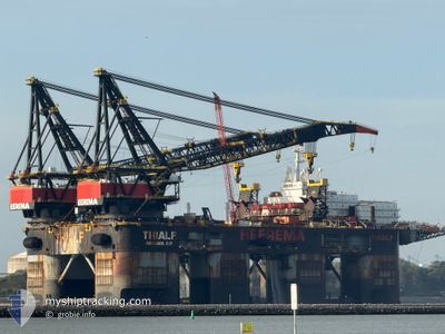
THIALF
Maintenance Platform
Current Trip
| Trip Time | 23 days |
|---|---|
| Trip Distance | 1070.61 nm |
| AVG Speed | 6.1 Knopen |
| MAX Speed | 8.7 Knopen |
| Diepgang | 16.5 M |
| AVG Wind | 9.7 knots |
| MAX Wind | 27.9 knots |
| MIN Temp | -0.7°C / 30.74°F |
| MAX Temp | 11.7°C / 53.06°F |
| Positie ontvangen | 1 m geleden |
Current Position
| Lengtegraad | --- |
|---|---|
| Breedtegraat | --- |
| Status | Under way using engine |
| Snelheid | |
| Koers | 308° |
| Gebied | North Sea |
| Station | T-AIS |
| Positie ontvangen | 1 m geleden |
Info
Information
The current position of THIALF is in North Sea with coordinates 51.92467° / 4.21183° as reported on 2025-03-15 22:49 by AIS to our vessel tracker app. The vessel's current speed is 0 Knopen and is currently inside the port of ROTTERDAM.
The vessel THIALF (IMO: 8757740, MMSI: 353979000) is a Maintenance Platform that was built in 1985 ( 40 Jaar oud ). It's sailing under the flag of [PA] Panama.
In this page you can find informations about the vessels current position, last detected port calls, and current voyage information. If the vessels is not in coverage by AIS you will find the latest position.
The current position of THIALF is detected by our AIS receivers and we are not responsible for the reliability of the data. The last position was recorded while the vessel was in Coverage by the Ais receivers of our vessel tracking app.
The current draught of THIALF as reported by AIS is 12 meters
Weather
| Temperature | 3.4°C / 38.12°F |
|---|---|
| Wind Speed | 10 knots |
| Direction | 44° NE |
| Pressure | 1022.7 hPa |
| Humidity | 70.1 % |
| Cloud Coverage | 19 % |
Featured Company
Most Visited Ports (Last year)
| Port | Arrivals | |
|---|---|---|
| 6 |
Events
| Tijd | Evenement | Details | Positie / Bestemming | Info |
|---|---|---|---|---|
| 2025-03-13 21:08 | Draught Changed | 12 16.5 |
51.92467 / 4.21183
[NL] ROTTERDAM
|
Snelheid: Koers: 308° |
| 2025-03-13 21:08 | ETA Changed | 2025/03/10 18:18 2025/03/10 18:00 |
51.92467 / 4.21183
[NL] ROTTERDAM
|
Snelheid: Koers: 308° |
| 2025-03-10 18:20 | Stop beweging |
51.92400 / 4.20683
[NL] ROTTERDAM
|
Snelheid: 0.3 kn Koers: 135° |
|
| 2025-03-10 17:25 | Aankomsthaven |
|
51.96600 / 4.12183
[NL] ROTTERDAM
|
Snelheid: 6.2 kn Koers: 119° |
| 2025-03-09 16:15 | Binnenbereik |
54.23867 / 4.96333
North Sea
ROTTERDAM
|
Snelheid: 6.8 kn Koers: 181° |
|
| 2025-03-09 13:52 | Buitenbereik |
54.51083 / 4.96333
North Sea
ROTTERDAM
|
Snelheid: 6.4 kn Koers: 186° |
|
| 2025-03-09 09:08 | Wijzig zee gebeid | Dutch part of the North Sea German part of the North Sea |
55.01867 / 4.95417
North Sea
ROTTERDAM
|
Snelheid: 6.5 kn Koers: 179° |
| 2025-03-09 06:19 | Wijzig zee gebeid | German part of the North Sea Danish part of the North Sea |
55.31750 / 4.96633
North Sea
ROTTERDAM
|
Snelheid: 6.2 kn Koers: 183° |
| 2025-03-08 18:10 | Wijzig zee gebeid | Danish part of the North Sea Norwegian part of the North Sea |
56.58567 / 5.02667
North Sea
ROTTERDAM
|
Snelheid: 6.5 kn Koers: 184° |
| 2025-03-07 11:23 | Draught Changed | 16.5 17 |
59.23017 / 5.63967
ROTTERDAM
|
Snelheid: 3.9 kn Koers: 216° |