
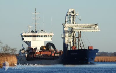
TERNESKJAER
General Cargo
Current Trip
| Time Travelled | 1 day |
|---|---|
| Remaining Time | 2 days |
| Distance Travelled | 278.91 nm |
| Remaining Distance | 670.97 nm |
| AVG Speed | 8.5 Knopen |
| MAX Speed | 11.7 Knopen |
| AVG Wind | 13.6 knots |
| MAX Wind | 30 knots |
| MIN Temp | -3.2°C / 26.24°F |
| MAX Temp | 8°C / 46.4°F |
| Diepgang | 4 M |
| Positie ontvangen | 3 m geleden |
Current Position
| Lengtegraad | --- |
|---|---|
| Breedtegraat | --- |
| Status | Under way using engine |
| Snelheid | 11.8 Knopen |
| Koers | 254.1° |
| Gebied | Norwegian Sea |
| Station | T-AIS |
| Positie ontvangen | 3 m geleden |
Info
Information
The current position of TERNESKJAER is in Norwegian Sea with coordinates 61.10991° / 5.65873° as reported on 2025-12-18 03:35 by AIS to our vessel tracker app. The vessel's current speed is 11.8 Knopen and is heading at the port of TROMSO. The estimated time of arrival as calculated by MyShipTracking vessel tracking app is 2025-12-21 00:22 LT
The vessel TERNESKJAER (IMO: 9375446, MMSI: 258015890) is a General Cargo that was built in 2008 ( 17 Jaar oud ). It's sailing under the flag of [NO] Norway.
In this page you can find informations about the vessels current position, last detected port calls, and current voyage information. If the vessels is not in coverage by AIS you will find the latest position.
The current position of TERNESKJAER is detected by our AIS receivers and we are not responsible for the reliability of the data. The last position was recorded while the vessel was in Coverage by the Ais receivers of our vessel tracking app.
The current draught of TERNESKJAER as reported by AIS is 4 meters
Weather
| Temperature | -0.6°C / 30.92°F |
|---|---|
| Wind Speed | 6 knots |
| Direction | 119° ESE |
| Pressure | 998.2 hPa |
| Humidity | 96.2 % |
| Cloud Coverage | 100 % |
Featured Company
Last Port Calls
| Port | Arrival | Departure | Time In Port |
|---|---|---|---|
| 2025-12-15 09:47 | 2025-12-16 10:50 | 1 d | |
| 2025-12-15 08:33 | 2025-12-15 09:14 | 41 m | |
| 2025-12-15 06:12 | 2025-12-15 08:12 | 1 h | |
| 2025-12-12 23:56 | 2025-12-13 00:45 | 48 m | |
| 2025-12-12 21:58 | 2025-12-12 23:27 | 1 h | |
| 2025-12-11 15:16 | 2025-12-11 15:24 | 8 m | |
| 2025-12-08 19:15 | 2025-12-09 09:46 | 14 h | |
| 2025-12-08 04:50 | 2025-12-08 18:56 | 14 h | |
| 2025-12-07 13:04 | 2025-12-07 16:21 | 3 h | |
| 2025-12-06 13:53 | 2025-12-06 14:34 | 41 m |
Most Visited Ports (Last year)
| Port | Arrivals | |
|---|---|---|
| 52 | ||
| 51 | ||
| 42 | ||
| 40 | ||
| 21 | ||
| 20 |
Last Trips
| Origin | Departure | Destination | Arrival | Distance | |
|---|---|---|---|---|---|
| 2025-12-15 09:14 | 2025-12-15 09:47 | 3.82 nm | |||
| 2025-12-15 08:12 | 2025-12-15 08:33 | 3.32 nm | |||
| 2025-12-13 00:45 | 2025-12-15 06:12 | 413.40 nm | |||
| 2025-12-12 23:27 | 2025-12-12 23:56 | 4.09 nm | |||
| 2025-12-11 15:24 | 2025-12-12 21:58 | 77.33 nm | |||
| 2025-12-09 09:46 | 2025-12-11 15:16 | 397.59 nm | |||
| 2025-12-08 18:56 | 2025-12-08 19:15 | 3.11 nm | |||
| 2025-12-07 16:21 | 2025-12-08 04:50 | 114.96 nm | |||
| 2025-12-06 14:34 | 2025-12-07 13:04 | 170.37 nm | |||
| 2025-12-05 23:10 | 2025-12-06 13:53 | 123.15 nm |
Events
| Tijd | Evenement | Details | Positie / Bestemming | Info |
|---|---|---|---|---|
| 2025-12-18 02:56 | Start beweging | 10 nm, South West of HOYANGER |
61.09590 / 5.82869
FISHFARMS
|
Snelheid: 5.6 kn Koers: 32.3° |
| 2025-12-18 01:24 | Stop beweging | 10.09 nm, South West of HOYANGER |
61.09642 / 5.82339
FISHFARMS
|
Snelheid: 0.3 kn Koers: 183° |
| 2025-12-18 01:08 | Start beweging | 9.11 nm, South West of HOYANGER |
61.10325 / 5.85720
FISHFARMS
|
Snelheid: 5 kn Koers: 240.8° |
| 2025-12-18 00:23 | Status Changed | Under way using engine Default |
61.10499 / 5.85924
FISHFARMS
|
Snelheid: Koers: 208° |
| 2025-12-18 00:17 | Status Changed | Default Under way using engine |
61.10499 / 5.85923
FISHFARMS
|
Snelheid: Koers: 208° |
| 2025-12-17 23:47 | Status Changed | Under way using engine Default |
61.10500 / 5.85926
FISHFARMS
|
Snelheid: Koers: -1° |
| 2025-12-17 23:42 | Status Changed | Default Under way using engine |
61.10333 / 5.85833
FISHFARMS
|
Snelheid: Koers: 207° |
| 2025-12-17 21:57 | Stop beweging | 9 nm, South West of HOYANGER |
61.10487 / 5.85920
FISHFARMS
|
Snelheid: Koers: 213° |
| 2025-12-17 21:19 | Start beweging | 11.31 nm, East of LEIRVIK |
61.09934 / 5.72410
FISHFARMS
|
Snelheid: 8 kn Koers: 321.9° |
| 2025-12-17 19:59 | Stop beweging | 11.61 nm, East of LEIRVIK |
61.09929 / 5.73442
FISHFARMS
|
Snelheid: Koers: 242° |