

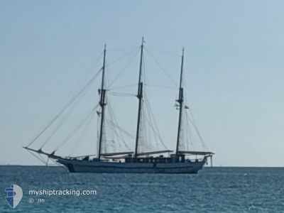
SY VELA
Passenger

Current Trip
PETER ISLAND
| Time Travelled | 5 days |
|---|---|
| Remaining Time | --- |
| Distance Travelled | 80.41 nm |
| Remaining Distance | --- |
| AVG Speed | 4.8 Knopen |
| MAX Speed | 6.7 Knopen |
| AVG Wind | 14.6 knots |
| MAX Wind | 22 knots |
| MIN Temp | 25.4°C / 77.72°F |
| MAX Temp | 26.8°C / 80.24°F |
| Diepgang | 4 M |
| Positie ontvangen | 1 m geleden |
Current Position
| Lengtegraad | --- |
|---|---|
| Breedtegraat | --- |
| Status | At anchor |
| Snelheid | 0.2 Knopen |
| Koers | --- |
| Gebied | Caribbean Sea |
| Station | T-AIS |
| Positie ontvangen | 1 m geleden |
Information
The current position of SY VELA is in Caribbean Sea with coordinates 18.31829° / -64.62579° as reported on 2025-03-27 14:15 by AIS to our vessel tracker app. The vessel's current speed is 0.2 Knopen
The vessel SY VELA (IMO: 867436400, MMSI: 341799000) is a Passenger It's sailing under the flag of [KN] St Kitts Nevis.
In this page you can find informations about the vessels current position, last detected port calls, and current voyage information. If the vessels is not in coverage by AIS you will find the latest position.
The current position of SY VELA is detected by our AIS receivers and we are not responsible for the reliability of the data. The last position was recorded while the vessel was in Coverage by the Ais receivers of our vessel tracking app.
The current draught of SY VELA as reported by AIS is 4 meters
Weather
| Temperature | 26.8°C / 80.24°F |
|---|---|
| Wind Speed | 14 knots |
| Direction | 127° SE |
| Pressure | 1017.6 hPa |
| Humidity | 75.4 % |
| Cloud Coverage | 11 % |


Featured Company
Last Port Calls
| Port | Arrival | Departure | Time In Port |
|---|---|---|---|
| 2025-03-20 18:52 | 2025-03-21 10:23 | 15 h | |
| 2025-03-14 15:15 | 2025-03-16 17:13 | 2 d | |
| 2025-03-07 15:00 | 2025-03-09 16:55 | 2 d | |
| 2025-02-28 15:19 | 2025-03-02 17:10 | 2 d | |
| 2025-02-21 15:56 | 2025-02-23 16:44 | 2 d | |
| 2025-02-14 15:35 | 2025-02-16 16:30 | 2 d | |
| 2025-02-07 15:21 | 2025-02-09 17:18 | 2 d | |
| 2025-01-31 16:04 | 2025-02-02 16:43 | 2 d | |
| 2025-01-24 16:05 | 2025-01-26 17:22 | 2 d | |
| 2025-01-18 09:59 | 2025-01-19 16:48 | 1 d |
Most Visited Ports (Last year)
| Port | Arrivals | |
|---|---|---|
| 27 | ||
| 12 | ||
| 7 | ||
| 4 | ||
| 1 | ||
| 1 |
Last Trips
| Origin | Departure | Destination | Arrival | Distance | |
|---|---|---|---|---|---|
| 2025-03-16 17:13 | 2025-03-20 18:52 | 114.37 nm | |||
| 2025-03-09 16:55 | 2025-03-14 15:15 | 70.52 nm | |||
| 2025-03-02 17:10 | 2025-03-07 15:00 | 75.03 nm | |||
| 2025-02-23 16:44 | 2025-02-28 15:19 | 77.65 nm | |||
| 2025-02-16 16:30 | 2025-02-21 15:56 | 76.57 nm | |||
| 2025-02-09 17:18 | 2025-02-14 15:35 | 53.70 nm | |||
| 2025-02-02 16:43 | 2025-02-07 15:21 | 76.22 nm | |||
| 2025-01-26 17:22 | 2025-01-31 16:04 | 76.12 nm | |||
| 2025-01-19 16:48 | 2025-01-24 16:05 | 81.19 nm | |||
| 2025-01-06 04:34 | 2025-01-18 09:59 | 355.60 nm |
Events
| Tijd | Evenement | Details | Positie / Bestemming | Info |
|---|---|---|---|---|
| 2025-03-27 13:39 | Status Changed | At anchor Default |
18.31865 / -64.62600
PETER ISLAND
|
Snelheid: 0.1 kn Koers: -1° |
| 2025-03-27 13:33 | Status Changed | Default At anchor |
18.31863 / -64.62601
PETER ISLAND
|
Snelheid: 0.1 kn Koers: 511° |
| 2025-03-27 03:40 | Status Changed | At anchor Under way sailing |
18.31867 / -64.62601
PETER ISLAND
|
Snelheid: 0.3 kn Koers: 511° |
| 2025-03-26 22:12 | Stop beweging | 0.6 nm, West of NORMAN ISLAND |
18.31869 / -64.62593
PETER ISLAND
|
Snelheid: Koers: 511° |
| 2025-03-26 21:25 | Start beweging | 2.89 nm, North East of NORMAN ISLAND |
18.35649 / -64.58547
PETER ISLAND
|
Snelheid: 4.5 kn Koers: 290° |
| 2025-03-26 18:04 | Status Changed | Under way sailing Default |
18.35642 / -64.58397
PETER ISLAND
|
Snelheid: 0.1 kn Koers: -1° |
| 2025-03-26 18:03 | Status Changed | Default Under way sailing |
18.35642 / -64.58398
PETER ISLAND
|
Snelheid: Koers: 511° |
| 2025-03-26 17:22 | Stop beweging | 2.97 nm, North East of NORMAN ISLAND |
18.35670 / -64.58340
PETER ISLAND
|
Snelheid: 0.3 kn Koers: 511° |
| 2025-03-26 16:59 | Destination Changed | PETER ISLAND JOST VAN DIKE |
18.36513 / -64.58833
PETER ISLAND
|
Snelheid: 4.7 kn Koers: 292° |
| 2025-03-26 16:57 | Start beweging | 3.41 nm, North East of NORMAN ISLAND |
18.36680 / -64.58548
JOST VAN DIKE
|
Snelheid: 5.7 kn Koers: 214.1° |