

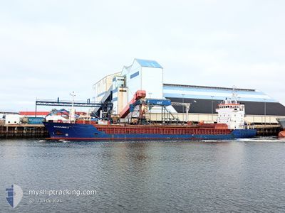
SUURHUSEN.S
General Cargo

Current Trip
| Time Travelled | 1 day |
|---|---|
| Remaining Time | --- |
| Distance Travelled | 292.54 nm |
| Remaining Distance | --- |
| AVG Speed | 8.5 Knopen |
| MAX Speed | 9.5 Knopen |
| AVG Wind | 5.6 knots |
| MAX Wind | 17.7 knots |
| MIN Temp | 6.4°C / 43.52°F |
| MAX Temp | 13.3°C / 55.94°F |
| Diepgang | 5.6 M |
| Positie ontvangen | 6 h, 49 m geleden |
Current Position
| Lengtegraad | --- |
|---|---|
| Breedtegraat | --- |
| Status | Under way using engine |
| Snelheid | 8.5 Knopen |
| Koers | 249.7° |
| Gebied | North Atlantic Ocean |
| Station | T-AIS |
| Positie ontvangen | 6 h, 49 m geleden |
Information
The current position of SUURHUSEN.S is in North Atlantic Ocean with coordinates 43.61078° / -9.04731° as reported on 2025-03-28 21:58 by AIS to our vessel tracker app. The vessel's current speed is 8.5 Knopen and is heading at the port of PORTO NOGARO. The estimated time of arrival as calculated by MyShipTracking vessel tracking app is 2025-04-10 10:00 LT
The vessel SUURHUSEN.S (IMO: 9123245, MMSI: 304369000) is a General Cargo that was built in 1996 ( 29 Jaar oud ). It's sailing under the flag of [AG] Antigua Barbuda.
In this page you can find informations about the vessels current position, last detected port calls, and current voyage information. If the vessels is not in coverage by AIS you will find the latest position.
The current position of SUURHUSEN.S is detected by our AIS receivers and we are not responsible for the reliability of the data. The last position was recorded while the vessel was in Coverage by the Ais receivers of our vessel tracking app.
The current draught of SUURHUSEN.S as reported by AIS is 5.6 meters
Weather
| Temperature | 12.2°C / 53.96°F |
|---|---|
| Wind Speed | 14 knots |
| Direction | 43° NE |
| Pressure | 1025.6 hPa |
| Humidity | 74.2 % |
| Cloud Coverage | 30 % |


Featured Company
Last Port Calls
| Port | Arrival | Departure | Time In Port |
|---|---|---|---|
| 2025-03-22 10:27 | 2025-03-27 19:23 | 5 d | |
| 2025-03-17 07:49 | 2025-03-18 22:05 | 1 d | |
| 2025-03-09 17:47 | 2025-03-09 20:57 | 3 h | |
| 2025-02-25 21:37 | 2025-02-27 10:29 | 1 d | |
| 2025-02-17 07:48 | 2025-02-20 18:24 | 3 d | |
| 2025-02-01 03:49 | 2025-02-05 17:29 | 4 d | |
| 2025-01-19 10:52 | 2025-01-20 11:57 | 1 d | |
| 2025-01-10 14:56 | 2025-01-14 13:53 | 3 d | |
| 2025-01-07 15:28 | 2025-01-10 09:23 | 2 d | |
| 2025-01-02 21:00 |
Most Visited Ports (Last year)
| Port | Arrivals | |
|---|---|---|
| 3 | ||
| 3 | ||
| 2 | ||
| 2 | ||
| 1 | ||
| 1 |
Last Trips
| Origin | Departure | Destination | Arrival | Distance | |
|---|---|---|---|---|---|
| 2025-03-18 22:05 | 2025-03-22 10:27 | 575.96 nm | |||
| 2025-03-09 20:57 | 2025-03-17 07:49 | 1193.78 nm | |||
| 2025-02-27 10:29 | 2025-03-09 17:47 | 2077.09 nm | |||
| 2025-02-20 18:24 | 2025-02-25 21:37 | 1119.00 nm | |||
| 2025-02-05 17:29 | 2025-02-17 07:48 | 1487.84 nm | |||
| 2025-01-20 11:57 | 2025-02-01 03:49 | 1335.31 nm | |||
| 2025-01-14 13:53 | 2025-01-19 10:52 | 917.11 nm | |||
| 2025-01-10 09:23 | 2025-01-10 14:56 | 55.71 nm | |||
| 2025-01-02 21:00 | 2025-01-07 15:28 | 950.78 nm |
Events
| Tijd | Evenement | Details | Positie / Bestemming | Info |
|---|---|---|---|---|
| 2025-03-28 22:03 | Status Changed | Default Under way using engine |
43.60725 / -9.06052
ITPNG
|
Snelheid: 8.5 kn Koers: 249.7° |
| 2025-03-28 21:58 | Buitenbereik |
43.61078 / -9.04731
North Atlantic Ocean
ITPNG
|
Snelheid: 8.5 kn Koers: 249.7° |
|
| 2025-03-28 21:16 | Status Changed | Under way using engine Default |
43.64509 / -8.91967
ITPNG
|
Snelheid: 8.5 kn Koers: 250° |
| 2025-03-28 20:58 | Status Changed | Default Under way using engine |
43.65996 / -8.86299
ITPNG
|
Snelheid: 8.5 kn Koers: 248° |
| 2025-03-28 20:51 | Status Changed | Under way using engine Default |
43.66559 / -8.84193
ITPNG
|
Snelheid: 8.6 kn Koers: 249° |
| 2025-03-28 19:58 | Status Changed | Default Under way using engine |
43.70849 / -8.68282
ITPNG
|
Snelheid: 8.4 kn Koers: 248.7° |
| 2025-03-28 19:49 | Wijzig zee gebeid | Spanish part of the North Atlantic Ocean Spanish part of the Bay of Biscay |
43.71620 / -8.65333
North Atlantic Ocean
ITPNG
|
Snelheid: 8.4 kn Koers: 249.3° |
| 2025-03-28 19:49 | Status Changed | Under way using engine Default |
43.71620 / -8.65333
ITPNG
|
Snelheid: 8.3 kn Koers: 252° |
| 2025-03-28 19:49 | Binnenbereik |
43.71620 / -8.65333
North Atlantic Ocean
ITPNG
|
Snelheid: 8.4 kn Koers: 249.3° |
|
| 2025-03-28 06:31 | Buitenbereik |
43.68702 / -6.17543
Bay of Biscay
ITPNG
|
Snelheid: 9 kn Koers: 269.5° |