
SUSAN BORCHARD
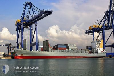
Container Ship
Current Trip
| Time Travelled | 2 days |
|---|---|
| Remaining Time | 9 h, 40 mins |
| Distance Travelled | 782.73 nm |
| Remaining Distance | 175.17 nm |
| AVG Speed | 15.3 Knopen |
| MAX Speed | 17.3 Knopen |
| AVG Wind | 10.2 knots |
| MAX Wind | 19.8 knots |
| MIN Temp | 11.7°C / 53.06°F |
| MAX Temp | 16.9°C / 62.42°F |
| Diepgang | 7.3 M |
| Positie ontvangen | 50 m geleden |
Current Position
| Lengtegraad | -9.70160° |
|---|---|
| Breedtegraat | 43.81324° |
| Status | Under way using engine |
| Snelheid | 15.8 Knopen |
| Koers | 210.1° |
| Gebied | North Atlantic Ocean |
| Station | T-AIS |
| Positie ontvangen | 50 m geleden |
Info
Information
The current position of SUSAN BORCHARD is in North Atlantic Ocean with coordinates 43.81324° / -9.70160° as reported on 2024-07-05 03:56 by AIS to our vessel tracker app. The vessel's current speed is 15.8 Knopen and is heading at the port of LEIXOES. The estimated time of arrival as calculated by MyShipTracking vessel tracking app is 2024-07-05 14:26 LT
The vessel SUSAN BORCHARD (IMO: 9231834, MMSI: 305299000) is a Container Ship that was built in 2001 ( 23 Jaar oud ). It's sailing under the flag of [AG] Antigua Barbuda.
In this page you can find informations about the vessels current position, last detected port calls, and current voyage information. If the vessels is not in coverage by AIS you will find the latest position.
The current position of SUSAN BORCHARD is detected by our AIS receivers and we are not responsible for the reliability of the data. The last position was recorded while the vessel was in Coverage by the Ais receivers of our vessel tracking app.
The current draught of SUSAN BORCHARD as reported by AIS is 7.3 meters
Weather
| Temperature | 16.8°C / 62.24°F |
|---|---|
| Wind Speed | 15 knots |
| Direction | 25° NNE |
| Pressure | 1014.4 hPa |
| Humidity | 86.2 % |
| Cloud Coverage | 8 % |
Featured Company
Last Port Calls
| Port | Arrival | Departure | Time In Port |
|---|---|---|---|
| 2024-07-01 21:04 | 2024-07-03 01:47 | 1 d | |
| 2024-06-29 08:59 | 2024-06-29 20:55 | 11 h | |
| 2024-06-28 11:52 | 2024-06-29 00:47 | 12 h | |
| 2024-06-25 05:01 | 2024-06-25 09:57 | 4 h | |
| 2024-06-22 04:33 | 2024-06-22 12:47 | 8 h | |
| 2024-06-19 20:00 | 2024-06-20 06:05 | 10 h | |
| 2024-06-14 01:53 | 2024-06-14 09:25 | 7 h | |
| 2024-06-08 04:06 | 2024-06-08 19:43 | 15 h | |
| 2024-06-02 17:02 | 2024-06-03 14:38 | 21 h | |
| 2024-05-27 17:01 | 2024-05-31 01:17 | 3 d |
Last Trips
| Origin | Departure | Destination | Arrival | Distance | |
|---|---|---|---|---|---|
| 2024-06-29 21:55 | 2024-07-01 23:04 | 639.59 nm | |||
| 2024-06-29 01:47 | 2024-06-29 09:59 | 120.55 nm | |||
| 2024-06-25 10:57 | 2024-06-28 12:52 | 855.66 nm | |||
| 2024-06-22 14:47 | 2024-06-25 06:01 | 894.13 nm | |||
| 2024-06-20 08:05 | 2024-06-22 06:33 | 688.79 nm | |||
| 2024-06-14 11:25 | 2024-06-19 22:00 | 1582.38 nm | |||
| 2024-06-08 21:43 | 2024-06-14 03:53 | 1665.37 nm | |||
| 2024-06-03 15:38 | 2024-06-08 06:06 | 1505.58 nm | |||
| 2024-05-31 03:17 | 2024-06-02 18:02 | 967.02 nm | |||
| 2024-05-25 20:57 | 2024-05-27 19:01 | 638.49 nm |
Events
| Tijd | Evenement | Details | Positie / Bestemming | Info |
|---|---|---|---|---|
| 2024-07-05 04:00 | Status Changed | Default Under way using engine |
43.79837 / -9.71348
PTLEI
|
Snelheid: 15.8 kn Koers: 210.1° |
| 2024-07-05 03:23 | Status Changed | Under way using engine Default |
43.94783 / -9.60144
PTLEI
|
Snelheid: 17 kn Koers: 207° |
| 2024-07-05 03:15 | Binnenbereik |
43.94370 / -9.60438
North Atlantic Ocean
PTLEI
|
Snelheid: 16.7 kn Koers: 208° |
|
| 2024-07-05 00:00 | Status Changed | Default Under way using engine |
44.78039 / -8.96533
PTLEI
|
Snelheid: 16.6 kn Koers: 204.4° |
| 2024-07-04 23:46 | Status Changed | Under way using engine Default |
44.83732 / -8.91985
PTLEI
|
Snelheid: 16.6 kn Koers: 204° |
| 2024-07-04 23:46 | Buitenbereik |
44.83732 / -8.91985
North Atlantic Ocean
PTLEI
|
Snelheid: 16.6 kn Koers: 204.4° |
|
| 2024-07-04 23:43 | Status Changed | Default Under way using engine |
44.84815 / -8.91242
PTLEI
|
Snelheid: 17 kn Koers: 207.2° |
| 2024-07-04 23:19 | Wijzig zee gebeid | Spanish part of the North Atlantic Ocean French part of the English Channel |
44.95205 / -8.83755
North Atlantic Ocean
PTLEI
|
Snelheid: 17.2 kn Koers: 210.2° |
| 2024-07-04 23:19 | Status Changed | Under way using engine Default |
44.95205 / -8.83755
PTLEI
|
Snelheid: 17.2 kn Koers: 208° |
| 2024-07-04 23:19 | Binnenbereik |
44.95205 / -8.83755
North Atlantic Ocean
PTLEI
|
Snelheid: 17.2 kn Koers: 210.2° |