
SUNDRY
General Cargo
Current Trip
| Time Travelled | 2 days |
|---|---|
| Remaining Time | --- |
| Distance Travelled | 281.52 nm |
| Remaining Distance | --- |
| AVG Speed | 7.2 Knopen |
| MAX Speed | 8.5 Knopen |
| AVG Wind | 5.2 knots |
| MAX Wind | 8.9 knots |
| MIN Temp | 14.4°C / 57.92°F |
| MAX Temp | 16.5°C / 61.7°F |
| Diepgang | 4.3 M |
| Positie ontvangen | 18 h, 30 m geleden |
Current Position
| Lengtegraad | --- |
|---|---|
| Breedtegraat | --- |
| Status | Under way using engine |
| Snelheid | 6.7 Knopen |
| Koers | 89.7° |
| Gebied | Mediterranean Sea - Western Basin |
| Station | T-AIS |
| Positie ontvangen | 18 h, 30 m geleden |
Info
Information
The current position of SUNDRY is in Mediterranean Sea - Western Basin with coordinates 38.55895° / 3.28641° as reported on 2025-02-16 21:58 by AIS to our vessel tracker app. The vessel's current speed is 6.7 Knopen and is heading at the port of ODESSA. The estimated time of arrival as calculated by MyShipTracking vessel tracking app is 2025-02-25 12:00 LT
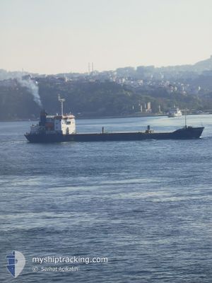
The vessel SUNDRY (IMO: 9045651, MMSI: 352978176) is a General Cargo that was built in 2000 ( 25 Jaar oud ). It's sailing under the flag of [PA] Panama.
In this page you can find informations about the vessels current position, last detected port calls, and current voyage information. If the vessels is not in coverage by AIS you will find the latest position.
The current position of SUNDRY is detected by our AIS receivers and we are not responsible for the reliability of the data. The last position was recorded while the vessel was in Coverage by the Ais receivers of our vessel tracking app.
The current draught of SUNDRY as reported by AIS is 4.3 meters
Weather
| Temperature | 14.5°C / 58.1°F |
|---|---|
| Wind Speed | 6 knots |
| Direction | 272° W |
| Pressure | 1016.4 hPa |
| Humidity | 74.3 % |
| Cloud Coverage | 8 % |
Featured Company
Last Port Calls
| Port | Arrival | Departure | Time In Port |
|---|---|---|---|
| 2025-02-13 14:39 | 2025-02-15 15:11 | 2 d | |
| 2025-01-31 21:10 | 2025-01-31 23:00 | 1 h | |
| 2024-12-15 23:12 | 2024-12-19 07:07 | 3 d |
Events
| Tijd | Evenement | Details | Positie / Bestemming | Info |
|---|---|---|---|---|
| 2025-02-16 22:05 | Status Changed | Default Under way using engine |
38.55918 / 3.30431
UAODS
|
Snelheid: 6.7 kn Koers: 89.7° |
| 2025-02-16 21:58 | Status Changed | Under way using engine Default |
38.55895 / 3.28641
UAODS
|
Snelheid: 6.7 kn Koers: 91° |
| 2025-02-16 21:58 | Buitenbereik |
38.55895 / 3.28641
Mediterranean Sea - Western Basin
UAODS
|
Snelheid: 6.7 kn Koers: 89.7° |
|
| 2025-02-16 21:44 | Status Changed | Default Under way using engine |
38.55885 / 3.25249
UAODS
|
Snelheid: 6.6 kn Koers: 89.3° |
| 2025-02-16 21:40 | Status Changed | Under way using engine Default |
38.55879 / 3.24288
UAODS
|
Snelheid: 6.8 kn Koers: 89° |
| 2025-02-16 21:17 | Status Changed | Default Under way using engine |
38.55714 / 3.18858
UAODS
|
Snelheid: 6.6 kn Koers: 88° |
| 2025-02-16 21:12 | Status Changed | Under way using engine Default |
38.55673 / 3.17620
UAODS
|
Snelheid: 6.7 kn Koers: 84° |
| 2025-02-16 20:29 | Status Changed | Default Under way using engine |
38.54961 / 3.07252
UAODS
|
Snelheid: 6.8 kn Koers: 84.4° |
| 2025-02-16 20:21 | Status Changed | Under way using engine Default |
38.54808 / 3.05141
UAODS
|
Snelheid: 6.9 kn Koers: 84° |
| 2025-02-16 20:05 | Binnenbereik |
38.54808 / 3.05141
Mediterranean Sea - Western Basin
UAODS
|
Snelheid: 6.8 kn Koers: 84.4° |