
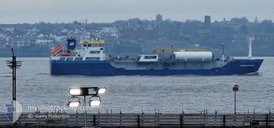
SUNDOWNER
Tanker
Current Trip
| Time Travelled | 1 day |
|---|---|
| Remaining Time | --- |
| Distance Travelled | 320.84 nm |
| Remaining Distance | --- |
| AVG Speed | 10.8 Knopen |
| MAX Speed | 12 Knopen |
| AVG Wind | 27.7 knots |
| MAX Wind | 38 knots |
| MIN Temp | 9.8°C / 49.64°F |
| MAX Temp | 11.6°C / 52.88°F |
| Diepgang | 4.3 M |
| Positie ontvangen | 4 m geleden |
Current Position
| Lengtegraad | --- |
|---|---|
| Breedtegraat | --- |
| Status | Under way using engine |
| Snelheid | 11.2 Knopen |
| Koers | 14.5° |
| Gebied | Celtic Sea |
| Station | T-AIS |
| Positie ontvangen | 4 m geleden |
Information
The current position of SUNDOWNER is in Celtic Sea with coordinates 52.66248° / -5.36272° as reported on 2025-02-24 02:33 by AIS to our vessel tracker app. The vessel's current speed is 11.2 Knopen and is heading at the port of DOUGLAS. The estimated time of arrival as calculated by MyShipTracking vessel tracking app is 2025-02-22 02:00 LT
The vessel SUNDOWNER (IMO: 9715713, MMSI: 244830182) is a Tanker It's sailing under the flag of [NL] Netherlands.
In this page you can find informations about the vessels current position, last detected port calls, and current voyage information. If the vessels is not in coverage by AIS you will find the latest position.
The current position of SUNDOWNER is detected by our AIS receivers and we are not responsible for the reliability of the data. The last position was recorded while the vessel was in Coverage by the Ais receivers of our vessel tracking app.
The current draught of SUNDOWNER as reported by AIS is 4.3 meters
Weather
| Temperature | 9.8°C / 49.64°F |
|---|---|
| Wind Speed | 23 knots |
| Direction | 216° SW |
| Pressure | 1004.6 hPa |
| Humidity | 87 % |
| Cloud Coverage | 100 % |
Featured Company
Last Port Calls
| Port | Arrival | Departure | Time In Port |
|---|---|---|---|
| 2025-02-22 08:15 | 2025-02-22 19:51 | 11 h | |
| 2025-02-19 23:42 | 2025-02-20 18:41 | 18 h | |
| 2025-02-16 09:00 | 2025-02-16 15:19 | 6 h | |
| 2025-02-13 19:55 | 2025-02-15 09:24 | 1 d | |
| 2025-01-30 16:01 | 2025-02-03 06:51 | 3 d | |
| 2025-01-22 01:12 | 2025-01-22 12:42 | 11 h | |
| 2025-01-21 03:00 | 2025-01-21 16:23 | 13 h | |
| 2025-01-16 01:01 | 2025-01-18 04:45 | 2 d | |
| 2025-01-10 16:07 | 2025-01-12 05:23 | 1 d | |
| 2025-01-07 17:45 | 2025-01-09 10:59 | 1 d |
Last Trips
| Origin | Departure | Destination | Arrival | Distance | |
|---|---|---|---|---|---|
| 2025-02-20 19:41 | 2025-02-22 08:15 | 349.96 nm | |||
| 2025-02-16 16:19 | 2025-02-20 00:42 | 75.80 nm | |||
| 2025-02-15 10:24 | 2025-02-16 10:00 | 190.82 nm | |||
| 2025-02-03 07:51 | 2025-02-13 20:55 | 475.31 nm | |||
| 2025-01-22 12:42 | 2025-01-30 17:01 | 790.68 nm | |||
| 2025-01-21 16:23 | 2025-01-22 01:12 | 93.51 nm | |||
| 2025-01-18 05:45 | 2025-01-21 03:00 | 660.36 nm | |||
| 2025-01-12 06:23 | 2025-01-16 02:01 | 128.30 nm | |||
| 2025-01-09 11:59 | 2025-01-10 17:07 | 233.90 nm | |||
| 2024-12-19 12:57 | 2025-01-07 18:45 | 2557.91 nm |
Events
| Tijd | Evenement | Details | Positie / Bestemming | Info |
|---|---|---|---|---|
| 2025-02-24 02:33 | Gevonden in zee | United Kingdom part of the Irish Sea and St. George's Channel |
52.66248 / -5.36272
Irish Sea and St. George's Channel
|
Snelheid: 11.2 kn Koers: 14.5° |
| 2025-02-24 02:33 | Status Changed | Under way using engine Default |
52.66248 / -5.36272
IMDGS
|
Snelheid: 11.3 kn Koers: 16° |
| 2025-02-24 02:31 | Binnenbereik |
52.66248 / -5.36272
Irish Sea and St. George's Channel
|
Snelheid: 11.2 kn Koers: 14.5° |
|
| 2025-02-23 18:51 | Status Changed | Default Under way using engine |
51.37877 / -5.88369
IMDGS
|
Snelheid: 11.1 kn Koers: 358° |
| 2025-02-23 18:45 | Status Changed | Under way using engine Default |
51.35886 / -5.88417
IMDGS
|
Snelheid: 11.2 kn Koers: 360° |
| 2025-02-23 18:45 | Buitenbereik |
51.35886 / -5.88417
Celtic Sea
|
Snelheid: 11.1 kn Koers: 358° |
|
| 2025-02-23 17:59 | Status Changed | Default Under way using engine |
51.21963 / -5.88839
IMDGS
|
Snelheid: 10.8 kn Koers: 0.2° |
| 2025-02-23 17:41 | Status Changed | Under way using engine Default |
51.16330 / -5.89018
IMDGS
|
Snelheid: 10.8 kn Koers: 359° |
| 2025-02-23 17:40 | Status Changed | Default Under way using engine |
51.15930 / -5.89031
IMDGS
|
Snelheid: 11.3 kn Koers: 3.8° |
| 2025-02-23 17:31 | Status Changed | Under way using engine Default |
51.13331 / -5.89097
IMDGS
|
Snelheid: 11 kn Koers: 2° |