
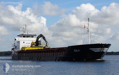
SULA
General Cargo
Current Trip
NOHSA
| Time Travelled | 5 days |
|---|---|
| Remaining Time | --- |
| Distance Travelled | 922.26 nm |
| Remaining Distance | --- |
| AVG Speed | 9 Knopen |
| MAX Speed | 12.6 Knopen |
| AVG Wind | 26.1 knots |
| MAX Wind | 35.8 knots |
| MIN Temp | -13.9°C / 6.98°F |
| MAX Temp | 9.4°C / 48.92°F |
| Diepgang | 5 M |
| Positie ontvangen | Nu |
Current Position
| Lengtegraad | --- |
|---|---|
| Breedtegraat | --- |
| Status | Under way using engine |
| Snelheid | 8 Knopen |
| Koers | 336.3° |
| Gebied | North Sea |
| Station | T-AIS |
| Positie ontvangen | Nu |
Info
Information
The current position of SULA is in North Sea with coordinates 59.01931° / 5.04207° as reported on 2024-11-25 22:18 by AIS to our vessel tracker app. The vessel's current speed is 8 Knopen
The vessel SULA (IMO: 9006306, MMSI: 257115000) is a General Cargo that was built in 1992 ( 32 Jaar oud ). It's sailing under the flag of [NO] Norway.
In this page you can find informations about the vessels current position, last detected port calls, and current voyage information. If the vessels is not in coverage by AIS you will find the latest position.
The current position of SULA is detected by our AIS receivers and we are not responsible for the reliability of the data. The last position was recorded while the vessel was in Coverage by the Ais receivers of our vessel tracking app.
The current draught of SULA as reported by AIS is 5 meters
Weather
| Temperature | 9.2°C / 48.56°F |
|---|---|
| Wind Speed | 35 knots |
| Direction | 200° SSW |
| Pressure | 983.1 hPa |
| Humidity | 86.4 % |
| Cloud Coverage | 100 % |
Featured Company
Last Port Calls
| Port | Arrival | Departure | Time In Port |
|---|---|---|---|
| 2024-11-19 16:25 | 2024-11-20 07:27 | 15 h | |
| 2024-11-19 15:25 | 2024-11-19 16:08 | 42 m | |
| 2024-11-11 23:43 | 2024-11-11 23:58 | 14 m | |
| 2024-11-06 20:46 | 2024-11-09 01:39 | 2 d | |
| 2024-11-01 09:26 | 2024-11-02 04:49 | 19 h | |
| 2024-10-31 19:21 | 2024-10-31 21:02 | 1 h | |
| 2024-10-22 00:02 | 2024-10-22 16:27 | 16 h | |
| 2024-10-20 19:20 | 2024-10-21 13:52 | 18 h | |
| 2024-10-18 12:16 | 2024-10-18 13:39 | 1 h | |
| 2024-10-17 06:00 | 2024-10-18 01:42 | 19 h |
Last Trips
| Origin | Departure | Destination | Arrival | Distance | |
|---|---|---|---|---|---|
| 2024-11-19 16:08 | 2024-11-19 16:25 | 0.41 nm | |||
| 2024-11-11 23:58 | 2024-11-19 15:25 | 666.82 nm | |||
| 2024-11-09 01:39 | 2024-11-11 23:43 | 567.32 nm | |||
| 2024-11-02 04:49 | 2024-11-06 20:46 | 650.13 nm | |||
| 2024-10-31 21:02 | 2024-11-01 09:26 | 108.63 nm | |||
| 2024-10-22 16:27 | 2024-10-31 19:21 | 1389.91 nm | |||
| 2024-10-21 13:52 | 2024-10-22 00:02 | 67.46 nm | |||
| 2024-10-18 13:39 | 2024-10-20 19:20 | 457.20 nm | |||
| 2024-10-18 01:42 | 2024-10-18 12:16 | 92.45 nm | |||
| 2024-10-14 19:34 | 2024-10-17 06:00 | 574.77 nm |
Events
| Tijd | Evenement | Details | Positie / Bestemming | Info |
|---|---|---|---|---|
| 2024-11-25 14:03 | Start beweging | 0.81 nm, South West of EGERSUND |
58.43863 / 5.98530
NOHSA
|
Snelheid: 4.1 kn Koers: 103° |
| 2024-11-25 13:53 | Status Changed | Under way using engine Moored |
58.43715 / 5.98959
NOHSA
|
Snelheid: 0.1 kn Koers: 197° |
| 2024-11-25 11:11 | Draught Changed | 5 3.8 |
58.43713 / 5.98959
NOHSA
|
Snelheid: Koers: 196° |
| 2024-11-25 08:16 | ETA Changed | 2024/11/28 07:00 2024/11/23 17:00 |
58.43725 / 5.98968
NOHSA
|
Snelheid: Koers: 197° |
| 2024-11-25 08:09 | Destination Changed | NOHSA NOEGE |
58.43726 / 5.98967
NOHSA
|
Snelheid: Koers: 197° |
| 2024-11-24 07:06 | Status Changed | Moored Default |
58.43725 / 5.98969
NOEGE
|
Snelheid: Koers: 196° |
| 2024-11-24 07:03 | Status Changed | Default Moored |
58.43729 / 5.98968
NOEGE
|
Snelheid: Koers: 196° |
| 2024-11-24 02:06 | Status Changed | Moored Default |
58.43711 / 5.98966
NOEGE
|
Snelheid: Koers: 196° |
| 2024-11-24 02:03 | Status Changed | Default Moored |
58.43723 / 5.98964
NOEGE
|
Snelheid: Koers: 196° |
| 2024-11-23 20:24 | Status Changed | Moored Default |
58.43729 / 5.98968
NOEGE
|
Snelheid: Koers: 195° |