
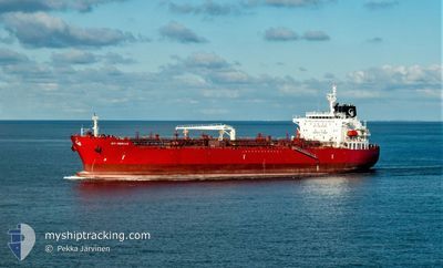
STI MERAUX
Tanker
Current Trip
| Time Travelled | 22 h, 40 mins |
|---|---|
| Remaining Time | --- |
| Distance Travelled | 175.69 nm |
| Remaining Distance | --- |
| AVG Speed | 7.9 Knopen |
| MAX Speed | 13.9 Knopen |
| AVG Wind | 26.7 knots |
| MAX Wind | 46 knots |
| MIN Temp | 5.1°C / 41.18°F |
| MAX Temp | 12.8°C / 55.04°F |
| Diepgang | 8.3 M |
| Positie ontvangen | 26 m geleden |
Current Position
| Lengtegraad | --- |
|---|---|
| Breedtegraat | --- |
| Status | Under way using engine |
| Snelheid | 4.8 Knopen |
| Koers | 212° |
| Gebied | Irish Sea and St. George's Channel |
| Station | T-AIS |
| Positie ontvangen | 26 m geleden |
Info
Information
The current position of STI MERAUX is in Irish Sea and St. George's Channel with coordinates 52.16796° / -5.80782° as reported on 2025-12-06 04:17 by AIS to our vessel tracker app. The vessel's current speed is 4.8 Knopen
The vessel STI MERAUX (IMO: 9681118, MMSI: 538005419) is a Tanker It's sailing under the flag of [MH] Marshall Is.
In this page you can find informations about the vessels current position, last detected port calls, and current voyage information. If the vessels is not in coverage by AIS you will find the latest position.
The current position of STI MERAUX is detected by our AIS receivers and we are not responsible for the reliability of the data. The last position was recorded while the vessel was in Coverage by the Ais receivers of our vessel tracking app.
The current draught of STI MERAUX as reported by AIS is 8.3 meters
Weather
| Temperature | 11.1°C / 51.98°F |
|---|---|
| Wind Speed | 29 knots |
| Direction | 244° WSW |
| Pressure | 984.6 hPa |
| Humidity | 86.4 % |
| Cloud Coverage | 100 % |
Featured Company
Events
| Tijd | Evenement | Details | Positie / Bestemming | Info |
|---|---|---|---|---|
| 2025-12-06 02:47 | Binnenbereik |
52.34034 / -5.73936
Irish Sea and St. George's Channel
GBMLF
|
Snelheid: 10.5 kn Koers: 197.6° |
|
| 2025-12-06 02:45 | Status Changed | Under way using engine Default |
52.34645 / -5.73663
GBMLF
|
Snelheid: 9.9 kn Koers: 193° |
| 2025-12-06 00:51 | Status Changed | Default Under way using engine |
52.69454 / -5.57043
GBMLF
|
Snelheid: 11.5 kn Koers: 197° |
| 2025-12-06 00:43 | Status Changed | Under way using engine Default |
52.71837 / -5.55710
GBMLF
|
Snelheid: 11.5 kn Koers: 200° |
| 2025-12-06 00:43 | Buitenbereik |
52.71837 / -5.55710
Irish Sea and St. George's Channel
GBMLF
|
Snelheid: 11.5 kn Koers: 197° |
|
| 2025-12-06 00:39 | Status Changed | Default Under way using engine |
52.73013 / -5.55008
GBMLF
|
Snelheid: 11.1 kn Koers: 201.2° |
| 2025-12-05 20:42 | ETA Changed | 2025/12/06 10:00 2025/12/06 04:00 |
53.25930 / -5.37228
GBMLF
|
Snelheid: 5.8 kn Koers: 189.6° |
| 2025-12-05 19:20 | Status Changed | Under way using engine Default |
53.36750 / -5.34531
GBMLF
|
Snelheid: 5.5 kn Koers: 190° |
| 2025-12-05 19:19 | Status Changed | Default Under way using engine |
53.36840 / -5.34502
GBMLF
|
Snelheid: 5.4 kn Koers: 189.6° |
| 2025-12-05 19:04 | Status Changed | Under way using engine Default |
53.38900 / -5.33923
GBMLF
|
Snelheid: 4.5 kn Koers: 186° |