
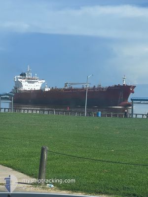
STI BOSPHORUS
Tanker
Current Trip
| Time Travelled | 7 days |
|---|---|
| Remaining Time | --- |
| Distance Travelled | 1901.17 nm |
| Remaining Distance | --- |
| AVG Speed | 12.9 Knopen |
| MAX Speed | 16.8 Knopen |
| AVG Wind | 11.1 knots |
| MAX Wind | 21.8 knots |
| MIN Temp | 26.5°C / 79.7°F |
| MAX Temp | 30.2°C / 86.36°F |
| Diepgang | 10.8 M |
| Positie ontvangen | 2 d geleden |
Current Position
| Lengtegraad | --- |
|---|---|
| Breedtegraat | --- |
| Status | Under way using engine |
| Snelheid | 15.6 Knopen |
| Koers | 19° |
| Gebied | North Atlantic Ocean |
| Station | T-AIS |
| Positie ontvangen | 2 d geleden |
Info
Information
The current position of STI BOSPHORUS is in North Atlantic Ocean with coordinates 26.22880° / -79.44467° as reported on 2024-09-28 13:46 by AIS to our vessel tracker app. The vessel's current speed is 15.6 Knopen and is heading at the port of ROTTERDAM. The estimated time of arrival as calculated by MyShipTracking vessel tracking app is 2024-10-11 20:00 LT
The vessel STI BOSPHORUS (IMO: 9785691, MMSI: 538007038) is a Tanker It's sailing under the flag of [MH] Marshall Is.
In this page you can find informations about the vessels current position, last detected port calls, and current voyage information. If the vessels is not in coverage by AIS you will find the latest position.
The current position of STI BOSPHORUS is detected by our AIS receivers and we are not responsible for the reliability of the data. The last position was recorded while the vessel was in Coverage by the Ais receivers of our vessel tracking app.
The current draught of STI BOSPHORUS as reported by AIS is 10.8 meters
Weather
| Temperature | 26.8°C / 80.24°F |
|---|---|
| Wind Speed | 11 knots |
| Direction | 283° WNW |
| Pressure | 1013.6 hPa |
| Humidity | 80.9 % |
| Cloud Coverage | --- |
Featured Company
Last Port Calls
| Port | Arrival | Departure | Time In Port |
|---|---|---|---|
| 2024-09-19 03:43 | 2024-09-23 16:17 | 4 d | |
| 2024-09-11 00:06 | 2024-09-12 02:14 | 1 d | |
| 2024-09-07 13:03 | 2024-09-08 14:55 | 1 d | |
| 2024-09-03 05:19 | 2024-09-04 22:48 | 1 d | |
| 2024-08-23 10:46 | 2024-08-27 20:35 | 4 d | |
| 2024-08-19 22:34 | 2024-08-20 12:51 | 14 h | |
| 2024-08-14 03:35 | 2024-08-16 09:10 | 2 d | |
| 2024-08-12 20:02 | 2024-08-13 22:05 | 1 d | |
| 2024-08-10 10:44 | 2024-08-10 10:49 | 5 m | |
| 2024-08-05 16:35 | 2024-08-07 09:39 | 1 d |
Most Visited Ports (Last year)
| Port | Arrivals | |
|---|---|---|
| 3 | ||
| 3 | ||
| 3 | ||
| 3 | ||
| 2 | ||
| 2 |
Last Trips
| Origin | Departure | Destination | Arrival | Distance | |
|---|---|---|---|---|---|
| 2024-09-11 22:14 | 2024-09-18 22:43 | 1964.62 nm | |||
| 2024-09-08 09:55 | 2024-09-10 20:06 | 736.99 nm | |||
| 2024-09-04 18:48 | 2024-09-07 08:03 | 593.37 nm | |||
| 2024-08-27 15:35 | 2024-09-03 01:19 | 1688.86 nm | |||
| 2024-08-20 06:51 | 2024-08-23 05:46 | 987.82 nm | |||
| 2024-08-16 03:10 | 2024-08-19 16:34 | 18.18 nm | |||
| 2024-08-13 16:05 | 2024-08-13 21:35 | 60.90 nm | |||
| 2024-08-10 04:49 | 2024-08-12 14:02 | 3.00 nm | |||
| 2024-08-07 04:39 | 2024-08-10 04:44 | 926.93 nm | |||
| 2024-07-30 19:02 | 2024-08-05 11:35 | 1659.27 nm |
Events
| Tijd | Evenement | Details | Positie / Bestemming | Info |
|---|---|---|---|---|
| 2024-09-28 13:55 | Status Changed | Default Under way using engine |
26.26755 / -79.42901
NLRTM
|
Snelheid: 15.6 kn Koers: 19° |
| 2024-09-28 13:46 | Buitenbereik |
26.22880 / -79.44467
North Atlantic Ocean
NLRTM
|
Snelheid: 15.6 kn Koers: 19° |
|
| 2024-09-28 13:03 | Status Changed | Under way using engine Default |
26.05078 / -79.51203
NLRTM
|
Snelheid: 15.8 kn Koers: 18° |
| 2024-09-28 12:54 | Status Changed | Default Under way using engine |
26.01612 / -79.52454
NLRTM
|
Snelheid: 15.8 kn Koers: 17° |
| 2024-09-28 12:48 | Status Changed | Under way using engine Default |
25.99042 / -79.53320
NLRTM
|
Snelheid: 15.8 kn Koers: 16° |
| 2024-09-28 12:38 | Status Changed | Default Under way using engine |
25.94698 / -79.54724
NLRTM
|
Snelheid: 15.9 kn Koers: 15.4° |
| 2024-09-28 12:17 | Status Changed | Under way using engine Default |
25.85564 / -79.55863
NLRTM
|
Snelheid: 15.8 kn Koers: 9° |
| 2024-09-28 12:14 | Status Changed | Default Under way using engine |
25.84338 / -79.56024
NLRTM
|
Snelheid: 15.8 kn Koers: 8.6° |
| 2024-09-28 12:12 | Status Changed | Under way using engine Default |
25.83207 / -79.56233
NLRTM
|
Snelheid: 15.9 kn Koers: 14° |
| 2024-09-28 12:09 | Status Changed | Default Under way using engine |
25.82129 / -79.56532
NLRTM
|
Snelheid: 15.9 kn Koers: 14.5° |