
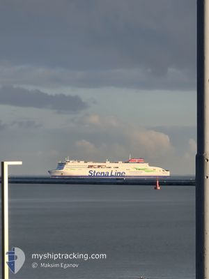
STENA ESTELLE
Passenger
Current Trip
| Time Travelled | 8 h, 41 mins |
|---|---|
| Remaining Time | 2 h, 53 mins |
| Distance Travelled | 114.80 nm |
| Remaining Distance | --- |
| AVG Speed | 13.8 Knopen |
| MAX Speed | 16.2 Knopen |
| AVG Wind | 9.7 knots |
| MAX Wind | 11 knots |
| MIN Temp | 5.3°C / 41.54°F |
| MAX Temp | 8°C / 46.4°F |
| Diepgang | 5.5 M |
| Positie ontvangen | 3 m geleden |
Current Position
| Lengtegraad | --- |
|---|---|
| Breedtegraat | --- |
| Status | Under way using engine |
| Snelheid | 13.7 Knopen |
| Koers | 304.9° |
| Gebied | Baltic Sea |
| Station | T-AIS |
| Positie ontvangen | 3 m geleden |
Information
The current position of STENA ESTELLE is in Baltic Sea with coordinates 55.64111° / 16.66262° as reported on 2025-03-29 03:07 by AIS to our vessel tracker app. The vessel's current speed is 13.7 Knopen and is heading at the port of KARLSKRONA. The estimated time of arrival as calculated by MyShipTracking vessel tracking app is 2025-03-29 06:03 LT
The vessel STENA ESTELLE (IMO: 9862994, MMSI: 219030885) is a Passenger It's sailing under the flag of [DK] Denmark.
In this page you can find informations about the vessels current position, last detected port calls, and current voyage information. If the vessels is not in coverage by AIS you will find the latest position.
The current position of STENA ESTELLE is detected by our AIS receivers and we are not responsible for the reliability of the data. The last position was recorded while the vessel was in Coverage by the Ais receivers of our vessel tracking app.
The current draught of STENA ESTELLE as reported by AIS is 5.5 meters
Weather
| Temperature | 5.3°C / 41.54°F |
|---|---|
| Wind Speed | 9 knots |
| Direction | 174° S |
| Pressure | 1011.6 hPa |
| Humidity | 84.6 % |
| Cloud Coverage | 2 % |
Featured Company
Last Port Calls
| Port | Arrival | Departure | Time In Port |
|---|---|---|---|
| 2025-03-28 08:26 | 2025-03-28 18:29 | 10 h | |
| 2025-03-27 18:58 | 2025-03-27 23:00 | 4 h | |
| 2025-03-27 05:57 | 2025-03-27 08:15 | 2 h | |
| 2025-03-26 17:22 | 2025-03-26 20:09 | 2 h | |
| 2025-03-26 05:43 | 2025-03-26 07:56 | 2 h | |
| 2025-03-25 17:24 | 2025-03-25 20:12 | 2 h | |
| 2025-03-25 05:42 | 2025-03-25 07:59 | 2 h | |
| 2025-03-24 09:39 | 2025-03-24 19:58 | 10 h | |
| 2025-03-24 05:21 | 2025-03-24 06:36 | 1 h | |
| 2025-03-23 08:26 | 2025-03-23 18:40 | 10 h |
Most Visited Ports (Last year)
| Port | Arrivals | |
|---|---|---|
| 306 | ||
| 289 | ||
| 1 |
Last Trips
| Origin | Departure | Destination | Arrival | Distance | |
|---|---|---|---|---|---|
| 2025-03-28 00:00 | 2025-03-28 09:26 | 166.01 nm | |||
| 2025-03-27 09:15 | 2025-03-27 19:58 | 166.28 nm | |||
| 2025-03-26 21:09 | 2025-03-27 06:57 | 165.18 nm | |||
| 2025-03-26 08:56 | 2025-03-26 18:22 | 168.25 nm | |||
| 2025-03-25 21:12 | 2025-03-26 06:43 | 166.42 nm | |||
| 2025-03-25 08:59 | 2025-03-25 18:24 | 165.47 nm | |||
| 2025-03-24 20:58 | 2025-03-25 06:42 | 166.19 nm | |||
| 2025-03-24 07:36 | 2025-03-24 10:39 | 0.70 nm | |||
| 2025-03-23 19:40 | 2025-03-24 06:21 | 170.62 nm | |||
| 2025-03-22 20:57 | 2025-03-23 09:26 | 166.05 nm |
Events
| Tijd | Evenement | Details | Positie / Bestemming | Info |
|---|---|---|---|---|
| 2025-03-29 03:07 | Status Changed | Under way using engine Default |
55.64042 / 16.66437
PLGDY-SEKAA-PLGDY
|
Snelheid: 13.8 kn Koers: 305° |
| 2025-03-29 02:54 | Status Changed | Default Under way using engine |
55.61208 / 16.73601
PLGDY-SEKAA-PLGDY
|
Snelheid: 13.6 kn Koers: 304.6° |
| 2025-03-29 02:48 | Gevonden in zee | Swedish part of the Baltic Sea |
55.59951 / 16.76808
Baltic Sea
PLGDY-SEKAA-PLGDY
|
Snelheid: 13.6 kn Koers: 304.6° |
| 2025-03-29 02:48 | Status Changed | Under way using engine Default |
55.59951 / 16.76808
PLGDY-SEKAA-PLGDY
|
Snelheid: 13.6 kn Koers: 305° |
| 2025-03-29 02:48 | Binnenbereik |
55.59951 / 16.76808
Baltic Sea
PLGDY-SEKAA-PLGDY
|
Snelheid: 13.6 kn Koers: 304.6° |
|
| 2025-03-29 01:54 | Status Changed | Default Under way using engine |
55.48140 / 17.05900
PLGDY-SEKAA-PLGDY
|
Snelheid: 13.5 kn Koers: 305.2° |
| 2025-03-29 01:47 | Status Changed | Under way using engine Default |
55.46607 / 17.09670
PLGDY-SEKAA-PLGDY
|
Snelheid: 13.5 kn Koers: 305° |
| 2025-03-29 01:47 | Buitenbereik |
55.46607 / 17.09670
Baltic Sea
PLGDY-SEKAA-PLGDY
|
Snelheid: 13.5 kn Koers: 305.2° |
|
| 2025-03-29 01:21 | Status Changed | Default Under way using engine |
55.41224 / 17.23327
PLGDY-SEKAA-PLGDY
|
Snelheid: 13.5 kn Koers: 306.1° |
| 2025-03-29 00:58 | Status Changed | Under way using engine Default |
55.36245 / 17.35982
PLGDY-SEKAA-PLGDY
|
Snelheid: 13.5 kn Koers: 309° |