
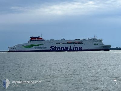
STENA EBBA
Passenger A
Current Trip
| Time Travelled | 5 h, 41 mins |
|---|---|
| Remaining Time | 2 h, 42 mins |
| Distance Travelled | 113.03 nm |
| Remaining Distance | 57.58 nm |
| AVG Speed | 20 Knopen |
| MAX Speed | 21.1 Knopen |
| AVG Wind | 9.2 knots |
| MAX Wind | 11 knots |
| MIN Temp | 4.1°C / 39.38°F |
| MAX Temp | 6°C / 42.8°F |
| Diepgang | 6.3 M |
| Positie ontvangen | 1 m geleden |
Current Position
| Lengtegraad | --- |
|---|---|
| Breedtegraat | --- |
| Status | Under way using engine |
| Snelheid | 20.2 Knopen |
| Koers | 125.8° |
| Gebied | Baltic Sea |
| Station | T-AIS |
| Positie ontvangen | 1 m geleden |
Information
The current position of STENA EBBA is in Baltic Sea with coordinates 55.01160° / 18.18630° as reported on 2025-03-29 02:58 by AIS to our vessel tracker app. The vessel's current speed is 20.2 Knopen and is heading at the port of GDYNIA. The estimated time of arrival as calculated by MyShipTracking vessel tracking app is 2025-03-29 05:42 LT
The vessel STENA EBBA (IMO: 9863003, MMSI: 219031310) is a Passenger A It's sailing under the flag of [DK] Denmark.
In this page you can find informations about the vessels current position, last detected port calls, and current voyage information. If the vessels is not in coverage by AIS you will find the latest position.
The current position of STENA EBBA is detected by our AIS receivers and we are not responsible for the reliability of the data. The last position was recorded while the vessel was in Coverage by the Ais receivers of our vessel tracking app.
The current draught of STENA EBBA as reported by AIS is 6.3 meters
Weather
| Temperature | 5.8°C / 42.44°F |
|---|---|
| Wind Speed | 9 knots |
| Direction | 146° SE |
| Pressure | 1012.6 hPa |
| Humidity | 81.3 % |
| Cloud Coverage | --- |
Featured Company
Last Port Calls
| Port | Arrival | Departure | Time In Port |
|---|---|---|---|
| 2025-03-28 18:58 | 2025-03-28 21:19 | 2 h | |
| 2025-03-28 05:35 | 2025-03-28 07:53 | 2 h | |
| 2025-03-27 07:29 | 2025-03-27 18:44 | 11 h | |
| 2025-03-26 17:05 | 2025-03-26 19:59 | 2 h | |
| 2025-03-26 05:47 | 2025-03-26 08:12 | 2 h | |
| 2025-03-25 17:04 | 2025-03-25 20:09 | 3 h | |
| 2025-03-25 05:45 | 2025-03-25 07:57 | 2 h | |
| 2025-03-24 07:42 | 2025-03-24 20:06 | 12 h | |
| 2025-03-23 17:46 | 2025-03-23 20:01 | 2 h | |
| 2025-03-22 20:22 | 2025-03-23 08:00 | 11 h |
Most Visited Ports (Last year)
| Port | Arrivals | |
|---|---|---|
| 307 | ||
| 282 | ||
| 1 |
Last Trips
| Origin | Departure | Destination | Arrival | Distance | |
|---|---|---|---|---|---|
| 2025-03-28 08:53 | 2025-03-28 19:58 | 168.55 nm | |||
| 2025-03-27 19:44 | 2025-03-28 06:35 | 166.24 nm | |||
| 2025-03-26 20:59 | 2025-03-27 08:29 | 168.74 nm | |||
| 2025-03-26 09:12 | 2025-03-26 18:05 | 166.68 nm | |||
| 2025-03-25 21:09 | 2025-03-26 06:47 | 167.74 nm | |||
| 2025-03-25 08:57 | 2025-03-25 18:04 | 166.61 nm | |||
| 2025-03-24 21:06 | 2025-03-25 06:45 | 167.73 nm | |||
| 2025-03-23 21:01 | 2025-03-24 08:42 | 166.40 nm | |||
| 2025-03-23 09:00 | 2025-03-23 18:46 | 167.94 nm | |||
| 2025-03-22 10:10 | 2025-03-22 21:22 | 166.04 nm |
Events
| Tijd | Evenement | Details | Positie / Bestemming | Info |
|---|---|---|---|---|
| 2025-03-29 02:42 | Gevonden in zee | Polish part of the Baltic Sea |
55.06634 / 18.05334
Baltic Sea
PLGDY->SEKAA->PLGDY
|
Snelheid: 20.2 kn Koers: 125.4° |
| 2025-03-29 02:41 | Status Changed | Under way using engine Default |
55.06893 / 18.04695
PLGDY->SEKAA->PLGDY
|
Snelheid: 20.3 kn Koers: 121° |
| 2025-03-29 02:41 | Binnenbereik |
55.06634 / 18.05334
Baltic Sea
PLGDY->SEKAA->PLGDY
|
Snelheid: 20.2 kn Koers: 125.4° |
|
| 2025-03-29 00:31 | Status Changed | Default Under way using engine |
55.49538 / 16.99453
PLGDY->SEKAA->PLGDY
|
Snelheid: 20.7 kn Koers: 125.2° |
| 2025-03-29 00:29 | Buitenbereik |
55.50067 / 16.98119
Baltic Sea
PLGDY->SEKAA->PLGDY
|
Snelheid: 20.7 kn Koers: 125.2° |
|
| 2025-03-29 00:27 | Status Changed | Under way using engine Default |
55.50894 / 16.96045
PLGDY->SEKAA->PLGDY
|
Snelheid: 20.7 kn Koers: 125° |
| 2025-03-29 00:02 | Status Changed | Default Under way using engine |
55.59002 / 16.75470
PLGDY->SEKAA->PLGDY
|
Snelheid: 20.8 kn Koers: 124.9° |
| 2025-03-28 23:59 | Status Changed | Under way using engine Default |
55.60111 / 16.72626
PLGDY->SEKAA->PLGDY
|
Snelheid: 20.8 kn Koers: 125° |
| 2025-03-28 23:30 | Status Changed | Default Under way using engine |
55.69640 / 16.48664
PLGDY->SEKAA->PLGDY
|
Snelheid: 20.8 kn Koers: 125.3° |
| 2025-03-28 21:19 | Vertrekhaven |
|
56.15804 / 15.62028
PLGDY->SEKAA->PLGDY
|
Snelheid: 7.1 kn Koers: 207° |