
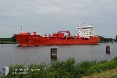
STEN NORDIC
Oil/Chemical Tanker
Current Trip
| Time Travelled | 1 day |
|---|---|
| Remaining Time | 6 h, 35 mins |
| Distance Travelled | 118.40 nm |
| Remaining Distance | 146.22 nm |
| AVG Speed | 10.5 Knopen |
| MAX Speed | 15 Knopen |
| AVG Wind | 14.8 knots |
| MAX Wind | 23.1 knots |
| MIN Temp | 13.6°C / 56.48°F |
| MAX Temp | 16.4°C / 61.52°F |
| Diepgang | 6.5 M |
| Positie ontvangen | 8 h, 18 m geleden |
Current Position
| Lengtegraad | -5.56007° |
|---|---|
| Breedtegraat | 51.60728° |
| Status | Under way using engine |
| Snelheid | 9.8 Knopen |
| Koers | 277.5° |
| Gebied | Celtic Sea |
| Station | T-AIS |
| Positie ontvangen | 8 h, 18 m geleden |
Info
Information
The current position of STEN NORDIC is in Celtic Sea with coordinates 51.60728° / -5.56007° as reported on 2024-06-28 03:23 by AIS to our vessel tracker app. The vessel's current speed is 9.8 Knopen and is heading at the port of LIVERPOOL ANCH. The estimated time of arrival as calculated by MyShipTracking vessel tracking app is 2024-06-28 19:16 LT
The vessel STEN NORDIC (IMO: 9351567, MMSI: 257667000) is a Oil/Chemical Tanker that was built in 2005 ( 19 Jaar oud ). It's sailing under the flag of [NO] Norway.
In this page you can find informations about the vessels current position, last detected port calls, and current voyage information. If the vessels is not in coverage by AIS you will find the latest position.
The current position of STEN NORDIC is detected by our AIS receivers and we are not responsible for the reliability of the data. The last position was recorded while the vessel was in Coverage by the Ais receivers of our vessel tracking app.
The current draught of STEN NORDIC as reported by AIS is 6.5 meters
Weather
| Temperature | 13.1°C / 55.58°F |
|---|---|
| Wind Speed | 13 knots |
| Direction | 249° WSW |
| Pressure | 1016.4 hPa |
| Humidity | 83.3 % |
| Cloud Coverage | 66 % |
Featured Company
Last Port Calls
| Port | Arrival | Departure | Time In Port |
|---|---|---|---|
| 2024-06-25 22:02 | 2024-06-26 22:13 | 1 d | |
| 2024-06-21 17:23 | 2024-06-23 22:24 | 2 d | |
| 2024-06-15 20:57 | 2024-06-20 11:46 | 4 d | |
| 2024-06-08 21:34 | 2024-06-10 05:48 | 1 d | |
| 2024-06-05 14:22 | 2024-06-08 09:33 | 2 d | |
| 2024-06-01 11:01 | 2024-06-02 19:58 | 1 d | |
| 2024-05-30 15:08 | 2024-05-31 18:11 | 1 d | |
| 2024-05-30 14:49 | 2024-05-30 14:53 | 3 m | |
| 2024-05-26 02:29 | 2024-05-28 03:15 | 2 d | |
| 2024-05-23 03:32 | 2024-05-24 02:36 | 23 h |
Last Trips
| Origin | Departure | Destination | Arrival | Distance | |
|---|---|---|---|---|---|
| 2024-06-23 22:24 | 2024-06-25 22:02 | 597.97 nm | |||
| 2024-06-20 11:46 | 2024-06-21 17:23 | 150.77 nm | |||
| 2024-06-10 05:48 | 2024-06-15 20:57 | 667.57 nm | |||
| 2024-06-08 09:33 | 2024-06-08 21:34 | 141.43 nm | |||
| 2024-06-02 19:58 | 2024-06-05 14:22 | 528.08 nm | |||
| 2024-05-31 18:11 | 2024-06-01 11:01 | 143.63 nm | |||
| 2024-05-30 14:53 | 2024-05-30 15:08 | 1.09 nm | |||
| 2024-05-28 03:15 | 2024-05-30 14:49 | 600.33 nm | |||
| 2024-05-24 02:36 | 2024-05-26 02:29 | 541.09 nm | |||
| 2024-05-21 06:22 | 2024-05-23 03:32 | 495.71 nm |
Events
| Tijd | Evenement | Details | Positie / Bestemming | Info |
|---|---|---|---|---|
| 2024-06-28 03:31 | Status Changed | Default Under way using engine |
51.61029 / -5.59190
GB SOW
|
Snelheid: 9.8 kn Koers: 277.5° |
| 2024-06-28 03:23 | Buitenbereik |
51.60728 / -5.56007
Celtic Sea
GB SOW
|
Snelheid: 9.8 kn Koers: 277.5° |
|
| 2024-06-28 00:44 | ETA Changed | 2024/06/29 00:00 2024/06/25 18:45 |
51.48708 / -4.88136
GB SOW
|
Snelheid: 10 kn Koers: 285.8° |
| 2024-06-28 00:41 | Wijzig zee gebeid | United Kingdom part of the Celtic Sea United Kingdom part of the Bristol Channel |
51.48466 / -4.86620
Celtic Sea
|
Snelheid: 10.5 kn Koers: 281.4° |
| 2024-06-28 00:16 | Status Changed | Under way using engine Default |
51.46864 / -4.75998
GB SOW
|
Snelheid: 10.5 kn Koers: 282° |
| 2024-06-28 00:16 | Binnenbereik |
51.46864 / -4.75998
Bristol Channel
|
Snelheid: 9.5 kn Koers: 284.1° |
|
| 2024-06-27 17:23 | Start beweging | 5.41 nm, North West of WATCHET |
51.24390 / -3.43423
GB SOW
|
Snelheid: 6.1 kn Koers: 295° |
| 2024-06-27 00:29 | Stop beweging | 4.05 nm, North West of WATCHET |
51.22881 / -3.40728
GB SOW
|
Snelheid: 0.2 kn Koers: 110° |
| 2024-06-26 23:13 | Status Changed | Default Under way using engine |
51.34135 / -3.28221
GB SOW
|
Snelheid: 14.4 kn Koers: 250.7° |
| 2024-06-26 23:08 | Buitenbereik |
51.35594 / -3.25925
Bristol Channel
|
Snelheid: 14.4 kn Koers: 250.7° |