
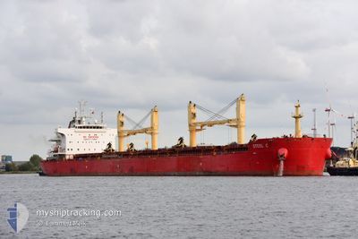
STEEL C
Cargo
Current Trip
CI ABJ
| Time Travelled | 8 h, 12 mins |
|---|---|
| Remaining Time | --- |
| Distance Travelled | 53.40 nm |
| Remaining Distance | --- |
| AVG Speed | 9.3 Knopen |
| MAX Speed | 12.3 Knopen |
| AVG Wind | 5.9 knots |
| MAX Wind | 7 knots |
| MIN Temp | 27.4°C / 81.32°F |
| MAX Temp | 28.3°C / 82.94°F |
| Diepgang | 13 M |
| Positie ontvangen | 17 d geleden |
Current Position
| Lengtegraad | --- |
|---|---|
| Breedtegraat | --- |
| Status | Under way using engine |
| Snelheid | 11.9 Knopen |
| Koers | 214.6° |
| Gebied | North Atlantic Ocean |
| Station | T-AIS |
| Positie ontvangen | 17 d geleden |
Info
Information
The current position of STEEL C is in North Atlantic Ocean with coordinates 27.27769° / -14.30949° as reported on 2025-02-13 05:11 by AIS to our vessel tracker app. The vessel's current speed is 11.9 Knopen
The vessel STEEL C (IMO: 9700330, MMSI: 636022811) is a Cargo It's sailing under the flag of [LR] Liberia.
In this page you can find informations about the vessels current position, last detected port calls, and current voyage information. If the vessels is not in coverage by AIS you will find the latest position.
The current position of STEEL C is detected by our AIS receivers and we are not responsible for the reliability of the data. The last position was recorded while the vessel was in Coverage by the Ais receivers of our vessel tracking app.
The current draught of STEEL C as reported by AIS is 13 meters
Weather
| Temperature | 28.3°C / 82.94°F |
|---|---|
| Wind Speed | 6 knots |
| Direction | 194° SSW |
| Pressure | 1010.8 hPa |
| Humidity | 77.1 % |
| Cloud Coverage | 100 % |
Featured Company
Last Port Calls
| Port | Arrival | Departure | Time In Port |
|---|---|---|---|
| 2025-02-27 19:43 | 2025-03-02 01:39 | 2 d | |
| 2025-02-21 09:23 | 2025-02-25 09:59 | 4 d | |
| 2025-01-28 01:16 | 2025-01-31 18:53 | 3 d | |
| 2025-01-15 10:12 | 2025-01-21 17:11 | 6 d |
Most Visited Ports (Last year)
| Port | Arrivals | |
|---|---|---|
| 2 | ||
| 2 | ||
| 2 | ||
| 2 | ||
| 2 | ||
| 1 |
Last Trips
| Origin | Departure | Destination | Arrival | Distance | |
|---|---|---|---|---|---|
| 2025-02-25 09:59 | 2025-02-27 19:43 | 20.09 nm | |||
| 2025-01-21 19:11 | 2025-02-21 09:23 | 5064.47 nm | |||
| 2025-01-21 19:11 | 2025-01-28 03:16 | 305.40 nm | |||
| 2024-12-22 05:13 | 2025-01-15 12:12 | 5352.79 nm |
Events
| Tijd | Evenement | Details | Positie / Bestemming | Info |
|---|---|---|---|---|
| 2025-03-02 01:39 | Vertrekhaven |
|
5.24331 / -3.99661
CI ABJ
|
Snelheid: 7 kn Koers: 134° |
| 2025-03-02 01:07 | Start beweging |
5.28996 / -4.01899
[CI] ABIDJAN
|
Snelheid: 5 kn Koers: 221° |
|
| 2025-02-27 19:43 | Stop beweging |
5.29742 / -4.01744
[CI] ABIDJAN
|
Snelheid: 0.3 kn Koers: 126° |
|
| 2025-02-27 19:43 | Aankomsthaven |
|
5.29742 / -4.01744
[CI] ABIDJAN
|
Snelheid: 0.6 kn Koers: 133° |
| 2025-02-27 17:07 | Start beweging | 7.46 nm, South of ABIDJAN |
5.19193 / -4.01801
CI ABJ
|
Snelheid: 3.2 kn Koers: 100° |
| 2025-02-25 11:40 | Stop beweging | 7.41 nm, South of ABIDJAN |
5.19250 / -4.02355
CI ABJ
|
Snelheid: 0.1 kn Koers: 87° |
| 2025-02-25 09:59 | Vertrekhaven |
|
5.24319 / -3.99589
CI ABJ
|
Snelheid: 8.6 kn Koers: 132° |
| 2025-02-25 09:27 | Start beweging |
5.29283 / -4.02012
[CI] ABIDJAN
|
Snelheid: 3.5 kn Koers: 215° |
|
| 2025-02-21 10:19 | Stop beweging |
5.29477 / -4.02118
[CI] ABIDJAN
|
Snelheid: 0.3 kn Koers: 98° |
|
| 2025-02-21 09:23 | Aankomsthaven |
|
5.25100 / -4.00534
[CI] ABIDJAN
|
Snelheid: 8 kn Koers: 311° |