
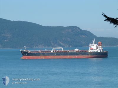
ST. MARY
Oil/Chemical Tanker
Current Trip
USCRP
| Time Travelled | 7 days |
|---|---|
| Remaining Time | --- |
| Distance Travelled | 591.76 nm |
| Remaining Distance | --- |
| AVG Speed | 11.1 Knopen |
| MAX Speed | 13.1 Knopen |
| AVG Wind | 11 knots |
| MAX Wind | 19.5 knots |
| MIN Temp | 22.8°C / 73.04°F |
| MAX Temp | 31.6°C / 88.88°F |
| Diepgang | 8.8 M |
| Positie ontvangen | 9 d geleden |
Current Position
| Lengtegraad | -96.95279° |
|---|---|
| Breedtegraat | 27.82473° |
| Status | At anchor |
| Snelheid | 0.1 Knopen |
| Koers | 96° |
| Gebied | Gulf of Mexico |
| Station | T-AIS |
| Positie ontvangen | 9 d geleden |
Info
Information
The current position of ST. MARY is in Gulf of Mexico with coordinates 27.82473° / -96.95279° as reported on 2024-04-19 08:45 by AIS to our vessel tracker app. The vessel's current speed is 0.1 Knopen
The vessel ST. MARY (IMO: 9439797, MMSI: 538005320) is a Oil/Chemical Tanker that was built in 2009 ( 15 Jaar oud ). It's sailing under the flag of [MH] Marshall Is.
In this page you can find informations about the vessels current position, last detected port calls, and current voyage information. If the vessels is not in coverage by AIS you will find the latest position.
The current position of ST. MARY is detected by our AIS receivers and we are not responsible for the reliability of the data. The last position was recorded while the vessel was in Coverage by the Ais receivers of our vessel tracking app.
The current draught of ST. MARY as reported by AIS is 8.8 meters
Weather
| Temperature | 26.8°C / 80.24°F |
|---|---|
| Wind Speed | 4 knots |
| Direction | 166° SSE |
| Pressure | 1005.8 hPa |
| Humidity | 70.9 % |
| Cloud Coverage | 39 % |
Featured Company
Last Port Calls
| Port | Arrival | Departure | Time In Port |
|---|---|---|---|
| 2024-04-20 12:30 | 2024-04-20 13:06 | 36 m | |
| 2024-03-20 02:52 | 2024-03-21 02:31 | 23 h | |
| 2024-03-11 12:10 | 2024-03-13 19:13 | 2 d | |
| 2024-03-05 18:07 | 2024-03-08 12:27 | 2 d | |
| 2024-02-09 10:40 | 2024-02-10 23:27 | 1 d | |
| 2024-02-02 03:58 |
Last Trips
| Origin | Departure | Destination | Arrival | Distance | |
|---|---|---|---|---|---|
| 2024-03-20 21:31 | 2024-04-20 07:30 | 5537.24 nm | |||
| 2024-03-13 14:13 | 2024-03-19 21:52 | 1639.61 nm | |||
| 2024-03-08 06:27 | 2024-03-11 07:10 | 68.59 nm | |||
| 2024-02-11 00:27 | 2024-03-05 12:07 | 5691.27 nm | |||
| 2024-02-02 04:58 | 2024-02-09 11:40 | 613.14 nm |
Events
| Tijd | Evenement | Details | Positie / Bestemming | Info |
|---|---|---|---|---|
| 2024-04-26 17:37 | Stop beweging | 3.64 nm, North West of VERACRUZ |
19.24593 / -96.17107
USCRP
|
Snelheid: 0.2 kn Koers: 173° |
| 2024-04-26 14:09 | Start beweging | 18.41 nm, South East of LAGUNA VERDE |
19.59958 / -96.10181
USCRP
|
Snelheid: 4.2 kn Koers: 194° |
| 2024-04-26 08:23 | Stop beweging |
19.55925 / -96.02334
USCRP
|
Snelheid: 0.3 kn Koers: 169° |
|
| 2024-04-23 16:50 | Start beweging | 4.81 nm, West of CORPUS CHRISTI |
27.81863 / -97.47353
USCRP
|
Snelheid: 4.3 kn Koers: 105° |
| 2024-04-20 14:02 | Stop beweging | 5.17 nm, West of CORPUS CHRISTI |
27.82002 / -97.48019
USCRP
|
Snelheid: 0.1 kn Koers: 110° |
| 2024-04-20 13:06 | Vertrekhaven |
|
27.82294 / -97.44229
USCRP
|
Snelheid: 5.4 kn Koers: 295° |
| 2024-04-20 12:30 | Aankomsthaven |
|
27.81064 / -97.38326
[US] CORPUS CHRISTI
|
Snelheid: 9.8 kn Koers: 265° |
| 2024-04-20 10:06 | Start beweging | 6.43 nm, East of PORT ARANSAS |
27.81959 / -96.94882
USCRP
|
Snelheid: 4.8 kn Koers: 228° |
| 2024-04-19 09:03 | Status Changed | Default At anchor |
27.82493 / -96.95276
USCRP
|
Snelheid: 0.1 kn Koers: 96° |
| 2024-04-19 08:45 | Buitenbereik |
27.82473 / -96.95279
Gulf of Mexico
|
Snelheid: 0.1 kn Koers: 139.9° |