
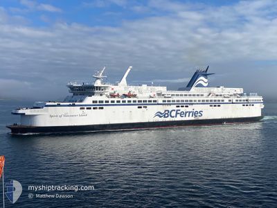
SPIRIT OF VI
Ro-Ro/Passenger Ship
Current Trip
| Trip Time | 1 h, 14 mins |
|---|---|
| Trip Distance | 23.66 nm |
| AVG Speed | 18.9 Knopen |
| MAX Speed | 21.9 Knopen |
| Diepgang | 4.4 M |
| AVG Wind | 5.5 knots |
| MAX Wind | 13 knots |
| MIN Temp | 8.2°C / 46.76°F |
| MAX Temp | 9.9°C / 49.82°F |
| Positie ontvangen | 3 m geleden |
Current Position
| Lengtegraad | --- |
|---|---|
| Breedtegraat | --- |
| Status | Moored |
| Snelheid | |
| Koers | 322° |
| Gebied | The Coastal Waters of Southeast Alaska and British Columbia |
| Station | T-AIS |
| Positie ontvangen | 3 m geleden |
Info
Information
The current position of SPIRIT OF VI is in The Coastal Waters of Southeast Alaska and British Columbia with coordinates 48.69047° / -123.41267° as reported on 2024-10-21 06:45 by AIS to our vessel tracker app. The vessel's current speed is 0 Knopen and is currently inside the port of SWARTZ BAY.
The vessel SPIRIT OF VI (IMO: 9030682, MMSI: 316001269) is a Ro-Ro/Passenger Ship that was built in 1994 ( 30 Jaar oud ). It's sailing under the flag of [CA] Canada.
In this page you can find informations about the vessels current position, last detected port calls, and current voyage information. If the vessels is not in coverage by AIS you will find the latest position.
The current position of SPIRIT OF VI is detected by our AIS receivers and we are not responsible for the reliability of the data. The last position was recorded while the vessel was in Coverage by the Ais receivers of our vessel tracking app.
The current draught of SPIRIT OF VI as reported by AIS is 4.4 meters
Weather
| Temperature | 7.7°C / 45.86°F |
|---|---|
| Wind Speed | 1 knots |
| Direction | 36° NE |
| Pressure | 1014.5 hPa |
| Humidity | 91.6 % |
| Cloud Coverage | 94 % |
Featured Company
Last Port Calls
| Port | Arrival | Departure | Time In Port |
|---|---|---|---|
| 2024-10-21 05:23 | |||
| 2024-10-21 03:29 | 2024-10-21 04:09 | 39 m | |
| 2024-10-21 01:32 | 2024-10-21 02:07 | 34 m | |
| 2024-10-20 23:26 | 2024-10-21 00:08 | 42 m | |
| 2024-10-20 21:29 | 2024-10-20 22:08 | 38 m | |
| 2024-10-20 19:29 | 2024-10-20 20:12 | 42 m | |
| 2024-10-20 17:25 | 2024-10-20 18:06 | 41 m | |
| 2024-10-20 15:29 | 2024-10-20 16:07 | 37 m | |
| 2024-10-20 05:21 | 2024-10-20 14:03 | 8 h | |
| 2024-10-20 03:29 | 2024-10-20 04:07 | 38 m |
Most Visited Ports (Last year)
| Port | Arrivals | |
|---|---|---|
| 1237 | ||
| 1233 | ||
| 1 |
Last Trips
| Origin | Departure | Destination | Arrival | Distance | |
|---|---|---|---|---|---|
| 2024-10-20 21:09 | 2024-10-20 22:23 | 23.66 nm | |||
| 2024-10-20 19:07 | 2024-10-20 20:29 | 25.00 nm | |||
| 2024-10-20 17:08 | 2024-10-20 18:32 | 21.72 nm | |||
| 2024-10-20 15:08 | 2024-10-20 16:26 | 24.82 nm | |||
| 2024-10-20 13:12 | 2024-10-20 14:29 | 21.54 nm | |||
| 2024-10-20 11:06 | 2024-10-20 12:29 | 24.93 nm | |||
| 2024-10-20 09:07 | 2024-10-20 10:25 | 21.63 nm | |||
| 2024-10-20 07:03 | 2024-10-20 08:29 | 24.94 nm | |||
| 2024-10-19 21:07 | 2024-10-19 22:21 | 22.96 nm | |||
| 2024-10-19 19:01 | 2024-10-19 20:29 | 24.92 nm |
Events
| Tijd | Evenement | Details | Positie / Bestemming | Info |
|---|---|---|---|---|
| 2024-10-21 06:33 | Status Changed | Moored Default |
48.69047 / -123.41267
[CA] SWARTZ BAY
|
Snelheid: Koers: 322° |
| 2024-10-21 06:30 | Status Changed | Default Moored |
48.69046 / -123.41267
[CA] SWARTZ BAY
|
Snelheid: Koers: 322° |
| 2024-10-21 05:57 | Status Changed | Moored Default |
48.69047 / -123.41267
[CA] SWARTZ BAY
|
Snelheid: Koers: 322° |
| 2024-10-21 05:54 | Status Changed | Default Moored |
48.69047 / -123.41267
[CA] SWARTZ BAY
|
Snelheid: Koers: 321° |
| 2024-10-21 05:25 | Status Changed | Moored Under way using engine |
48.69059 / -123.41273
[CA] SWARTZ BAY
|
Snelheid: 0.5 kn Koers: 321° |
| 2024-10-21 05:23 | Stop beweging |
48.69073 / -123.41287
[CA] SWARTZ BAY
|
Snelheid: 0.2 kn Koers: 295° |
|
| 2024-10-21 05:23 | Aankomsthaven |
|
48.69074 / -123.41285
[CA] SWARTZ BAY
|
Snelheid: 0.9 kn Koers: 291° |
| 2024-10-21 04:23 | Wijzig zee gebeid | Canadian part of the The Coastal Waters of Southeast Alaska and British Columbia United States part of the The Coastal Waters of Southeast Alaska and British Columbia |
48.93892 / -123.23379
The Coastal Waters of Southeast Alaska and British Columbia
|
Snelheid: 21.1 kn Koers: 223.3° |
| 2024-10-21 04:11 | Wijzig zee gebeid | United States part of the The Coastal Waters of Southeast Alaska and British Columbia Canadian part of the The Coastal Waters of Southeast Alaska and British Columbia |
48.98926 / -123.16132
The Coastal Waters of Southeast Alaska and British Columbia
|
Snelheid: 19.9 kn Koers: 220.7° |
| 2024-10-21 04:09 | Vertrekhaven |
|
48.99809 / -123.15002
X
|
Snelheid: 17.6 kn Koers: 222° |