
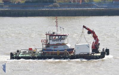
SOPHIA D
Dredging or underwater ops
Current Trip
ARDERSIER
| Time Travelled | 28 days |
|---|---|
| Remaining Time | --- |
| Distance Travelled | 86.38 nm |
| Remaining Distance | --- |
| AVG Speed | 5.6 Knopen |
| MAX Speed | 8.9 Knopen |
| AVG Wind | 7.4 knots |
| MAX Wind | 18.6 knots |
| MIN Temp | 5.1°C / 41.18°F |
| MAX Temp | 20.6°C / 69.08°F |
| Diepgang | 2 M |
| Positie ontvangen | Nu |
Current Position
| Lengtegraad | -3.99159° |
|---|---|
| Breedtegraat | 57.59610° |
| Status | Under way using engine |
| Snelheid | |
| Koers | --- |
| Gebied | North Sea |
| Station | T-AIS |
| Positie ontvangen | Nu |
Info
Information
The current position of SOPHIA D is in North Sea with coordinates 57.59610° / -3.99159° as reported on 2024-09-17 23:18 by AIS to our vessel tracker app. The vessel's current speed is 0 Knopen
The vessel SOPHIA D (IMO: 910640500, MMSI: 235021489) is a Dredging or underwater ops It's sailing under the flag of [GB] United Kingdom.
In this page you can find informations about the vessels current position, last detected port calls, and current voyage information. If the vessels is not in coverage by AIS you will find the latest position.
The current position of SOPHIA D is detected by our AIS receivers and we are not responsible for the reliability of the data. The last position was recorded while the vessel was in Coverage by the Ais receivers of our vessel tracking app.
The current draught of SOPHIA D as reported by AIS is 2 meters
Weather
| Temperature | 14°C / 57.2°F |
|---|---|
| Wind Speed | 1 knots |
| Direction | 250° WSW |
| Pressure | 1032.1 hPa |
| Humidity | 92.7 % |
| Cloud Coverage | 100 % |
Featured Company
Most Visited Ports (Last year)
| Port | Arrivals | |
|---|---|---|
| 44 | ||
| 3 | ||
| 1 |
Events
| Tijd | Evenement | Details | Positie / Bestemming | Info |
|---|---|---|---|---|
| 2024-09-17 12:34 | Stop beweging | 4.22 nm, West of NAIRN |
57.59615 / -3.99163
ARDERSIER
|
Snelheid: 0.1 kn Koers: 511° |
| 2024-09-17 12:25 | Start beweging | 4.11 nm, North East of FORTROSE |
57.60594 / -4.01593
ARDERSIER
|
Snelheid: 6.3 kn Koers: 149.1° |
| 2024-09-17 12:20 | Stop beweging | 4.15 nm, North East of FORTROSE |
57.60787 / -4.01633
ARDERSIER
|
Snelheid: 0.1 kn Koers: 511° |
| 2024-09-17 12:11 | Start beweging | 4.33 nm, West of NAIRN |
57.59724 / -3.99490
ARDERSIER
|
Snelheid: 7.2 kn Koers: 304.6° |
| 2024-09-17 12:04 | Stop beweging | 4.22 nm, West of NAIRN |
57.59615 / -3.99158
ARDERSIER
|
Snelheid: Koers: 511° |
| 2024-09-17 11:52 | Start beweging | 4.12 nm, North East of FORTROSE |
57.60599 / -4.01569
ARDERSIER
|
Snelheid: 4.8 kn Koers: 162.4° |
| 2024-09-17 11:44 | Stop beweging | 4.14 nm, North East of FORTROSE |
57.60781 / -4.01658
ARDERSIER
|
Snelheid: Koers: 511° |
| 2024-09-17 11:34 | Start beweging | 4.33 nm, West of NAIRN |
57.59723 / -3.99469
ARDERSIER
|
Snelheid: 7.1 kn Koers: 302.9° |
| 2024-09-16 11:55 | Stop beweging | 4.22 nm, West of NAIRN |
57.59614 / -3.99160
ARDERSIER
|
Snelheid: Koers: 511° |
| 2024-09-16 11:43 | Start beweging | 4.11 nm, North East of FORTROSE |
57.60768 / -4.01752
ARDERSIER
|
Snelheid: 3.3 kn Koers: 229.4° |