

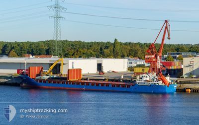
SONORO
General Cargo

Current Trip
| Trip Time | 1 day |
|---|---|
| Trip Distance | 315.67 nm |
| AVG Speed | 11.8 Knopen |
| MAX Speed | 12.7 Knopen |
| Diepgang | 3.6 M |
| AVG Wind | 10.3 knots |
| MAX Wind | 18 knots |
| MIN Temp | 2.3°C / 36.14°F |
| MAX Temp | 4°C / 39.2°F |
| Positie ontvangen | 1 d geleden |
Current Position
| Lengtegraad | --- |
|---|---|
| Breedtegraat | --- |
| Status | Under way using engine |
| Snelheid | 11.9 Knopen |
| Koers | 156.5° |
| Gebied | Baltic Sea |
| Station | T-AIS |
| Positie ontvangen | 1 d geleden |
Information
The current position of SONORO is in Baltic Sea with coordinates 59.54923° / 20.06614° as reported on 2025-03-20 06:07 by AIS to our vessel tracker app. The vessel's current speed is 11.9 Knopen and is currently inside the port of MERSRAGS.
The vessel SONORO (IMO: 9199397, MMSI: 209726000) is a General Cargo that was built in 2000 ( 25 Jaar oud ). It's sailing under the flag of [CY] Cyprus.
In this page you can find informations about the vessels current position, last detected port calls, and current voyage information. If the vessels is not in coverage by AIS you will find the latest position.
The current position of SONORO is detected by our AIS receivers and we are not responsible for the reliability of the data. The last position was recorded while the vessel was in Coverage by the Ais receivers of our vessel tracking app.
The current draught of SONORO as reported by AIS is 3.6 meters
Weather
| Temperature | 3.7°C / 38.66°F |
|---|---|
| Wind Speed | 11 knots |
| Direction | 28° NNE |
| Pressure | 1027.1 hPa |
| Humidity | 75.3 % |
| Cloud Coverage | --- |


Featured Company
Last Port Calls
| Port | Arrival | Departure | Time In Port |
|---|---|---|---|
| 2025-03-21 00:58 | |||
| 2025-03-19 05:38 | 2025-03-19 19:49 | 14 h | |
| 2025-03-14 10:25 | 2025-03-15 17:46 | 1 d | |
| 2025-03-12 22:01 | 2025-03-13 10:13 | 12 h | |
| 2025-03-10 06:00 | 2025-03-11 10:20 | 1 d | |
| 2025-03-07 06:05 | 2025-03-07 19:18 | 13 h | |
| 2025-03-05 07:10 | 2025-03-06 15:13 | 1 d | |
| 2025-03-03 06:57 | 2025-03-04 19:21 | 1 d | |
| 2025-02-26 07:41 | 2025-02-27 12:29 | 1 d | |
| 2025-02-24 10:01 | 2025-02-25 03:49 | 17 h |
Last Trips
| Origin | Departure | Destination | Arrival | Distance | |
|---|---|---|---|---|---|
| 2025-03-19 19:49 | 2025-03-21 00:58 | 315.67 nm | |||
| 2025-03-15 17:46 | 2025-03-19 05:38 | 692.82 nm | |||
| 2025-03-13 10:13 | 2025-03-14 10:25 | 280.44 nm | |||
| 2025-03-11 10:20 | 2025-03-12 22:01 | 425.98 nm | |||
| 2025-03-07 19:18 | 2025-03-10 06:00 | 611.61 nm | |||
| 2025-03-06 15:13 | 2025-03-07 06:05 | 126.48 nm | |||
| 2025-03-04 19:21 | 2025-03-05 07:10 | 125.60 nm | |||
| 2025-02-27 12:29 | 2025-03-03 06:57 | 697.02 nm | |||
| 2025-02-25 03:49 | 2025-02-26 07:41 | 327.36 nm | |||
| 2025-02-22 16:46 | 2025-02-24 10:01 | 391.25 nm |
Events
| Tijd | Evenement | Details | Positie / Bestemming | Info |
|---|---|---|---|---|
| 2025-03-20 23:06 | Stop beweging |
57.33439 / 23.13552
[LV] MERSRAGS
|
Snelheid: Koers: 148° |
|
| 2025-03-20 22:58 | Aankomsthaven |
|
57.33477 / 23.13732
[LV] MERSRAGS
|
Snelheid: 2.3 kn Koers: 265° |
| 2025-03-20 06:14 | Status Changed | Default Under way using engine |
59.52968 / 20.08098
LV MRX
|
Snelheid: 11.9 kn Koers: 156.5° |
| 2025-03-20 06:07 | Buitenbereik |
59.54923 / 20.06614
Baltic Sea
LV MRX
|
Snelheid: 11.9 kn Koers: 156.5° |
|
| 2025-03-20 04:29 | Wijzig zee gebeid | Finnish part of the Baltic Sea Finnish part of the Gulf of Bothnia |
59.80257 / 19.64772
Baltic Sea
LV MRX
|
Snelheid: 12.4 kn Koers: 138° |
| 2025-03-20 04:23 | Gevonden in zee | Finnish part of the Gulf of Bothnia |
59.81788 / 19.62085
Gulf of Bothnia
LV MRX
|
Snelheid: 11.8 kn Koers: 140.1° |
| 2025-03-20 00:32 | Draught Changed | 3.6 4.5 |
60.49397 / 18.96271
LV MRX
|
Snelheid: 12.1 kn Koers: 173° |
| 2025-03-20 00:32 | Destination Changed | LV MRX SE VAL |
60.49397 / 18.96271
LV MRX
|
Snelheid: 12.1 kn Koers: 173° |
| 2025-03-20 00:32 | ETA Changed | 2025/03/20 23:30 2025/03/19 05:00 |
60.49397 / 18.96271
LV MRX
|
Snelheid: 12.1 kn Koers: 173° |
| 2025-03-20 00:29 | Status Changed | Under way using engine Default |
60.50180 / 18.95424
SE VAL
|
Snelheid: 12.4 kn Koers: 136° |