

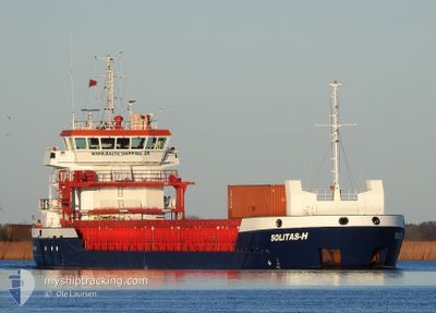
SOLITAS-H
Cargo

Current Trip
| Time Travelled | 2 days |
|---|---|
| Remaining Time | 1 day |
| Distance Travelled | 376.59 nm |
| Remaining Distance | 396.97 nm |
| AVG Speed | 9.6 Knopen |
| MAX Speed | 12.6 Knopen |
| AVG Wind | 5.8 knots |
| MAX Wind | 18.7 knots |
| MIN Temp | 11.2°C / 52.16°F |
| MAX Temp | 12.2°C / 53.96°F |
| Diepgang | 3.5 M |
| Positie ontvangen | 3 h, 25 m geleden |
Current Position
| Lengtegraad | --- |
|---|---|
| Breedtegraat | --- |
| Status | Under way using engine |
| Snelheid | 11.2 Knopen |
| Koers | 55.4° |
| Gebied | Celtic Sea |
| Station | T-AIS |
| Positie ontvangen | 3 h, 25 m geleden |
Information
The current position of SOLITAS-H is in Celtic Sea with coordinates 48.78359° / -5.60375° as reported on 2025-03-28 00:39 by AIS to our vessel tracker app. The vessel's current speed is 11.2 Knopen and is heading at the port of ANTWERP. The estimated time of arrival as calculated by MyShipTracking vessel tracking app is 2025-03-29 14:17 LT
The vessel SOLITAS-H (IMO: 9858670, MMSI: 210290000) is a Cargo It's sailing under the flag of [CY] Cyprus.
In this page you can find informations about the vessels current position, last detected port calls, and current voyage information. If the vessels is not in coverage by AIS you will find the latest position.
The current position of SOLITAS-H is detected by our AIS receivers and we are not responsible for the reliability of the data. The last position was recorded while the vessel was in Coverage by the Ais receivers of our vessel tracking app.
The current draught of SOLITAS-H as reported by AIS is 3.5 meters
Weather
| Temperature | 11.4°C / 52.52°F |
|---|---|
| Wind Speed | 19 knots |
| Direction | 261° W |
| Pressure | 1015.6 hPa |
| Humidity | 93.9 % |
| Cloud Coverage | 79 % |


Featured Company
Last Port Calls
| Port | Arrival | Departure | Time In Port |
|---|---|---|---|
| 2025-03-24 14:38 | 2025-03-25 21:19 | 1 d | |
| 2025-03-15 11:26 | 2025-03-19 17:59 | 4 d | |
| 2025-03-13 07:43 | 2025-03-14 15:52 | 1 d | |
| 2025-03-11 11:08 | 2025-03-12 14:29 | 1 d | |
| 2025-03-07 16:42 | 2025-03-10 19:44 | 3 d | |
| 2025-03-04 23:44 | 2025-03-06 11:38 | 1 d | |
| 2025-03-03 08:02 | 2025-03-04 17:55 | 1 d | |
| 2025-03-02 22:43 | 2025-03-02 22:48 | 4 m | |
| 2025-02-28 15:10 | 2025-03-01 09:32 | 18 h | |
| 2025-02-25 15:24 | 2025-02-27 06:51 | 1 d |
Most Visited Ports (Last year)
| Port | Arrivals | |
|---|---|---|
| 5 | ||
| 5 | ||
| 3 | ||
| 3 | ||
| 3 | ||
| 3 |
Last Trips
| Origin | Departure | Destination | Arrival | Distance | |
|---|---|---|---|---|---|
| 2025-03-19 17:59 | 2025-03-24 14:38 | 1077.51 nm | |||
| 2025-03-14 15:52 | 2025-03-15 11:26 | 140.24 nm | |||
| 2025-03-12 14:29 | 2025-03-13 07:43 | 99.05 nm | |||
| 2025-03-10 19:44 | 2025-03-11 11:08 | 156.87 nm | |||
| 2025-03-06 11:38 | 2025-03-07 16:42 | 131.19 nm | |||
| 2025-03-04 17:55 | 2025-03-04 23:44 | 56.86 nm | |||
| 2025-03-02 22:48 | 2025-03-03 08:02 | 84.71 nm | |||
| 2025-03-01 09:32 | 2025-03-02 22:43 | 302.88 nm | |||
| 2025-02-27 06:51 | 2025-02-28 15:10 | 291.49 nm | |||
| 2025-02-24 12:28 | 2025-02-25 15:24 | 249.63 nm |
Events
| Tijd | Evenement | Details | Positie / Bestemming | Info |
|---|---|---|---|---|
| 2025-03-28 00:43 | Status Changed | Default Under way using engine |
48.79147 / -5.58650
BEANR
|
Snelheid: 11.2 kn Koers: 55.4° |
| 2025-03-28 00:39 | Wijzig zee gebeid | French part of the Celtic Sea Spanish part of the Bay of Biscay |
48.78359 / -5.60375
Celtic Sea
BEANR
|
Snelheid: 11.2 kn Koers: 55.4° |
| 2025-03-28 00:39 | Buitenbereik |
48.78359 / -5.60375
Celtic Sea
BEANR
|
Snelheid: 11.2 kn Koers: 55.4° |
|
| 2025-03-28 00:38 | Status Changed | Under way using engine Default |
48.78238 / -5.60637
BEANR
|
Snelheid: 11.5 kn Koers: 24° |
| 2025-03-28 00:31 | Binnenbereik |
48.78359 / -5.60375
Celtic Sea
BEANR
|
Snelheid: 11.2 kn Koers: 55.4° |
|
| 2025-03-26 17:16 | Status Changed | Default Under way using engine |
43.65223 / -3.80991
BEANR
|
Snelheid: 10.4 kn Koers: 340.6° |
| 2025-03-26 17:10 | Buitenbereik |
43.63708 / -3.80271
Bay of Biscay
BEANR
|
Snelheid: 10.4 kn Koers: 340.6° |
|
| 2025-03-26 16:25 | Status Changed | Under way using engine At anchor |
43.51129 / -3.76363
BEANR
|
Snelheid: 10.2 kn Koers: 341° |
| 2025-03-26 16:14 | Start beweging | 2.44 nm, North East of SANTANDER |
43.48286 / -3.76054
BEANR
|
Snelheid: 7.3 kn Koers: 6.3° |
| 2025-03-26 15:59 | ETA Changed | 2025/03/29 14:00 2025/03/31 20:00 |
43.47957 / -3.76049
BEANR
|
Snelheid: 0.2 kn Koers: 39° |