
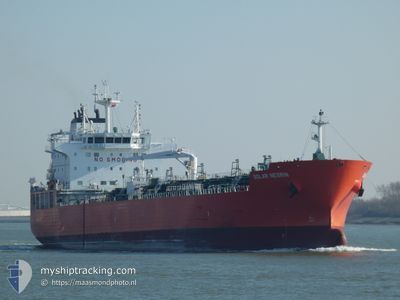
SOLAR NESRIN
Tanker
Current Trip
GOLFITO,COSTARICA
| Time Travelled | 2 days |
|---|---|
| Remaining Time | --- |
| Distance Travelled | 747.35 nm |
| Remaining Distance | --- |
| AVG Speed | 11 Knopen |
| MAX Speed | 13.8 Knopen |
| AVG Wind | 14.5 knots |
| MAX Wind | 25 knots |
| MIN Temp | 9.5°C / 49.1°F |
| MAX Temp | 18.5°C / 65.3°F |
| Diepgang | 7.5 M |
| Positie ontvangen | 9 h, 49 m geleden |
Current Position
| Lengtegraad | -119.56002° |
|---|---|
| Breedtegraat | 29.32878° |
| Status | Under way using engine |
| Snelheid | 11.9 Knopen |
| Koers | 153.8° |
| Gebied | North Pacific Ocean |
| Station | T-AIS |
| Positie ontvangen | 9 h, 49 m geleden |
Info
Information
The current position of SOLAR NESRIN is in North Pacific Ocean with coordinates 29.32878° / -119.56002° as reported on 2024-05-08 03:44 by AIS to our vessel tracker app. The vessel's current speed is 11.9 Knopen
The vessel SOLAR NESRIN (IMO: 9877626, MMSI: 538008704) is a Tanker It's sailing under the flag of [MH] Marshall Is.
In this page you can find informations about the vessels current position, last detected port calls, and current voyage information. If the vessels is not in coverage by AIS you will find the latest position.
The current position of SOLAR NESRIN is detected by our AIS receivers and we are not responsible for the reliability of the data. The last position was recorded while the vessel was in Coverage by the Ais receivers of our vessel tracking app.
The current draught of SOLAR NESRIN as reported by AIS is 7.5 meters
Weather
| Temperature | 16.3°C / 61.34°F |
|---|---|
| Wind Speed | 15 knots |
| Direction | 322° NW |
| Pressure | 1013.7 hPa |
| Humidity | 78.1 % |
| Cloud Coverage | --- |
Featured Company
Last Trips
| Origin | Departure | Destination | Arrival | Distance | |
|---|---|---|---|---|---|
| 2024-04-12 08:48 | 2024-05-03 14:44 | 4795.53 nm | |||
| 2024-03-27 16:05 | 2024-04-10 15:11 | 3706.51 nm | |||
| 2024-03-23 04:49 | 2024-03-25 22:39 | 180.77 nm | |||
| 2024-03-21 08:20 | 2024-03-22 03:37 | 163.77 nm |
Events
| Tijd | Evenement | Details | Positie / Bestemming | Info |
|---|---|---|---|---|
| 2024-05-08 03:53 | Status Changed | Default Under way using engine |
29.30201 / -119.54539
GOLFITO,COSTARICA
|
Snelheid: 11.9 kn Koers: 153.8° |
| 2024-05-08 03:44 | Buitenbereik |
29.32878 / -119.56002
North Pacific Ocean
GOLFITO,COSTARICA
|
Snelheid: 11.9 kn Koers: 153.8° |
|
| 2024-05-08 03:41 | Status Changed | Under way using engine Default |
29.33869 / -119.56552
GOLFITO,COSTARICA
|
Snelheid: 11.9 kn Koers: 155° |
| 2024-05-08 03:38 | Status Changed | Default Under way using engine |
29.34793 / -119.57066
GOLFITO,COSTARICA
|
Snelheid: 11.9 kn Koers: 154° |
| 2024-05-08 03:32 | Status Changed | Under way using engine Default |
29.36444 / -119.57977
GOLFITO,COSTARICA
|
Snelheid: 11.9 kn Koers: 154° |
| 2024-05-08 03:17 | Binnenbereik |
29.35949 / -119.57704
North Pacific Ocean
GOLFITO,COSTARICA
|
Snelheid: 11.9 kn Koers: 154° |
|
| 2024-05-08 01:13 | Status Changed | Default Under way using engine |
29.78516 / -119.81345
GOLFITO,COSTARICA
|
Snelheid: 11.8 kn Koers: 152.2° |
| 2024-05-08 01:07 | Buitenbereik |
29.80234 / -119.82352
North Pacific Ocean
GOLFITO,COSTARICA
|
Snelheid: 11.8 kn Koers: 152.2° |
|
| 2024-05-08 00:38 | Status Changed | Under way using engine Default |
29.88935 / -119.87159
GOLFITO,COSTARICA
|
Snelheid: 11.6 kn Koers: 155° |
| 2024-05-07 23:45 | Status Changed | Default Under way using engine |
30.04572 / -119.95466
GOLFITO,COSTARICA
|
Snelheid: 11.7 kn Koers: 154.4° |