
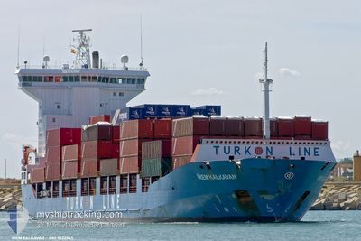
SOL PROGRESS
Container Ship
Current Trip
COLOMBO
| Time Travelled | 17 days |
|---|---|
| Remaining Time | --- |
| Distance Travelled | 2263.04 nm |
| Remaining Distance | --- |
| AVG Speed | 11.4 Knopen |
| MAX Speed | 18.1 Knopen |
| AVG Wind | 8.9 knots |
| MAX Wind | 21 knots |
| MIN Temp | 11.7°C / 53.06°F |
| MAX Temp | 29.9°C / 85.82°F |
| Diepgang | 6.3 M |
| Positie ontvangen | 18 d geleden |
Current Position
| Lengtegraad | --- |
|---|---|
| Breedtegraat | --- |
| Status | Under way using engine |
| Snelheid | 10 Knopen |
| Koers | 347° |
| Gebied | Laccadive Sea |
| Station | T-AIS |
| Positie ontvangen | 18 d geleden |
Info
Information
The current position of SOL PROGRESS is in Laccadive Sea with coordinates 6.53586° / 79.85261° as reported on 2025-12-15 06:16 by AIS to our vessel tracker app. The vessel's current speed is 10 Knopen
The vessel SOL PROGRESS (IMO: 9322865, MMSI: 351018000) is a Container Ship that was built in 2006 ( 20 Jaar oud ). It's sailing under the flag of [PA] Panama.
In this page you can find informations about the vessels current position, last detected port calls, and current voyage information. If the vessels is not in coverage by AIS you will find the latest position.
The current position of SOL PROGRESS is detected by our AIS receivers and we are not responsible for the reliability of the data. The last position was recorded while the vessel was in Coverage by the Ais receivers of our vessel tracking app.
The current draught of SOL PROGRESS as reported by AIS is 6.3 meters
Weather
| Temperature | 27°C / 80.6°F |
|---|---|
| Wind Speed | 19 knots |
| Direction | 39° NE |
| Pressure | 1013.7 hPa |
| Humidity | 70.4 % |
| Cloud Coverage | 30 % |
Featured Company
Most Visited Ports (Last year)
| Port | Arrivals | |
|---|---|---|
| 22 | ||
| 2 |
Events
| Tijd | Evenement | Details | Positie / Bestemming | Info |
|---|---|---|---|---|
| 2025-12-31 11:04 | Start beweging |
22.02234 / 88.08700
COLOMBO
|
Snelheid: 3.2 kn Koers: 235° |
|
| 2025-12-30 01:00 | Stop beweging |
22.02207 / 88.08994
COLOMBO
|
Snelheid: Koers: 237° |
|
| 2025-12-29 18:16 | Start beweging |
21.14297 / 87.87740
COLOMBO
|
Snelheid: 6 kn Koers: 344° |
|
| 2025-12-29 07:53 | Stop beweging |
21.14039 / 87.87593
COLOMBO
|
Snelheid: 0.3 kn Koers: 118° |
|
| 2025-12-29 06:05 | Start beweging |
21.07265 / 87.86902
COLOMBO
|
Snelheid: 3.5 kn Koers: 301° |
|
| 2025-12-28 19:05 | Stop beweging |
21.06747 / 87.87204
COLOMBO
|
Snelheid: 0.3 kn Koers: 76° |
|
| 2025-12-28 17:21 | Start beweging |
21.06733 / 87.86493
COLOMBO
|
Snelheid: 3.6 kn Koers: 351° |
|
| 2025-12-27 20:41 | Stop beweging |
21.06636 / 87.87049
COLOMBO
|
Snelheid: 0.3 kn Koers: 114° |