
SOGNU DI VELA
Sailing
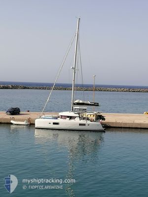
Current Trip
Unknown
| Time Travelled | 12 days |
|---|---|
| Remaining Time | --- |
| Distance Travelled | 105.16 nm |
| Remaining Distance | --- |
| AVG Speed | 6.1 Knopen |
| MAX Speed | 7.5 Knopen |
| AVG Wind | 13.5 knots |
| MAX Wind | 18 knots |
| MIN Temp | 24.7°C / 76.46°F |
| MAX Temp | 25.9°C / 78.62°F |
| Diepgang | --- |
| Positie ontvangen | 2 d geleden |
Current Position
| Lengtegraad | 26.68174° |
|---|---|
| Breedtegraat | 37.70018° |
| Status | Default |
| Snelheid | 5.5 Knopen |
| Koers | 69.3° |
| Gebied | Aegean Sea |
| Station | T-AIS |
| Positie ontvangen | 2 d geleden |
Info
Information
The current position of SOGNU DI VELA is in Aegean Sea with coordinates 37.70018° / 26.68174° as reported on 2024-09-14 08:40 by AIS to our vessel tracker app. The vessel's current speed is 5.5 Knopen
The vessel SOGNU DI VELA (MMSI: 227481420) is a Sailing It's sailing under the flag of [FR] France.
In this page you can find informations about the vessels current position, last detected port calls, and current voyage information. If the vessels is not in coverage by AIS you will find the latest position.
The current position of SOGNU DI VELA is detected by our AIS receivers and we are not responsible for the reliability of the data. The last position was recorded while the vessel was in Coverage by the Ais receivers of our vessel tracking app.
Weather
| Temperature | 25.8°C / 78.44°F |
|---|---|
| Wind Speed | 8 knots |
| Direction | 214° SW |
| Pressure | 1009.5 hPa |
| Humidity | 66.8 % |
| Cloud Coverage | 39 % |
Featured Company
Last Port Calls
| Port | Arrival | Departure | Time In Port |
|---|---|---|---|
| 2024-09-04 07:11 | |||
| 2024-08-17 06:44 | 2024-08-25 12:07 | 8 d | |
| 2024-08-15 07:07 | 2024-08-15 08:25 | 1 h | |
| 2024-08-12 09:12 | 2024-08-13 06:17 | 21 h | |
| 2024-08-07 08:48 | 2024-08-08 13:35 | 1 d | |
| 2024-08-05 10:31 | 2024-08-05 10:45 | 14 m | |
| 2024-08-01 08:02 | 2024-08-02 06:59 | 22 h | |
| 2024-07-30 07:15 | 2024-08-01 07:28 | 2 d | |
| 2024-07-23 10:21 | 2024-07-27 07:53 | 3 d | |
| 2024-07-21 06:45 |
Last Trips
| Origin | Departure | Destination | Arrival | Distance | |
|---|---|---|---|---|---|
| 2024-08-15 11:25 | 2024-08-17 09:44 | 1.77 nm | |||
| 2024-08-13 09:17 | 2024-08-15 10:07 | 12.19 nm | |||
| 2024-08-08 16:35 | 2024-08-12 12:12 | 64.85 nm | |||
| 2024-08-05 13:45 | 2024-08-07 11:48 | 23.41 nm | |||
| 2024-08-02 09:59 | 2024-08-05 13:31 | 64.41 nm | |||
| 2024-08-01 10:28 | 2024-08-01 11:02 | 2.99 nm | |||
| 2024-07-27 10:53 | 2024-07-30 10:15 | 78.37 nm | |||
| 2024-07-21 09:45 | 2024-07-23 13:21 | 27.80 nm | |||
| 2024-07-09 09:16 | 2024-07-17 16:17 | 68.66 nm |
Events
| Tijd | Evenement | Details | Positie / Bestemming | Info |
|---|---|---|---|---|
| 2024-09-14 08:40 | Buitenbereik |
37.70018 / 26.68174
Aegean Sea
|
Snelheid: 5.5 kn Koers: 69.3° |
|
| 2024-09-14 08:26 | Binnenbereik |
37.70018 / 26.68174
Aegean Sea
|
Snelheid: 5.5 kn Koers: 69.3° |
|
| 2024-09-14 06:02 | Buitenbereik |
37.57215 / 26.47070
Aegean Sea
|
Snelheid: 0.1 kn Koers: 511° |
|
| 2024-09-13 17:11 | Binnenbereik |
37.57212 / 26.47099
Aegean Sea
|
Snelheid: Koers: 511° |
|
| 2024-09-13 15:05 | Buitenbereik |
37.57214 / 26.47124
Aegean Sea
|
Snelheid: 0.1 kn Koers: 511° |
|
| 2024-09-13 14:53 | Stop beweging | 0.46 nm, South West of FOURNI |
37.57212 / 26.47113
|
Snelheid: 0.2 kn Koers: 200° |
| 2024-09-13 14:50 | Binnenbereik |
37.57209 / 26.47083
Aegean Sea
|
Snelheid: 0.9 kn Koers: 145.4° |
|
| 2024-09-13 07:01 | Buitenbereik |
37.36033 / 26.74336
Aegean Sea
|
Snelheid: 4.7 kn Koers: 129.6° |
|
| 2024-09-13 07:01 | Binnenbereik |
37.36033 / 26.74336
Aegean Sea
|
Snelheid: 4.7 kn Koers: 129.6° |
|
| 2024-09-12 09:09 | Buitenbereik |
37.33516 / 26.62612
Aegean Sea
|
Snelheid: 5.8 kn Koers: 72.7° |