
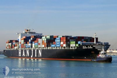
SM LONG BEACH
Container Ship
Current Trip
| Time Travelled | 5 days |
|---|---|
| Remaining Time | 6 days |
| Distance Travelled | 2420.31 nm |
| Remaining Distance | 2880.32 nm |
| AVG Speed | 19.1 Knopen |
| MAX Speed | 20.9 Knopen |
| AVG Wind | 13.9 knots |
| MAX Wind | 22.9 knots |
| MIN Temp | -1.5°C / 29.3°F |
| MAX Temp | 5.1°C / 41.18°F |
| Diepgang | 12.8 M |
| Positie ontvangen | 3 d geleden |
Current Position
| Lengtegraad | --- |
|---|---|
| Breedtegraat | --- |
| Status | Under way using engine |
| Snelheid | 19.9 Knopen |
| Koers | 89° |
| Gebied | North Pacific Ocean |
| Station | T-AIS |
| Positie ontvangen | 3 d geleden |
Info
Information
The current position of SM LONG BEACH is in North Pacific Ocean with coordinates 41.59957° / 142.13963° as reported on 2025-02-24 07:06 by AIS to our vessel tracker app. The vessel's current speed is 19.9 Knopen and is heading at the port of LOS ANGELES. The estimated time of arrival as calculated by MyShipTracking vessel tracking app is 2025-03-05 23:23 LT
The vessel SM LONG BEACH (IMO: 9312755, MMSI: 441701000) is a Container Ship that was built in 2007 ( 18 Jaar oud ). It's sailing under the flag of [KR] Korea.
In this page you can find informations about the vessels current position, last detected port calls, and current voyage information. If the vessels is not in coverage by AIS you will find the latest position.
The current position of SM LONG BEACH is detected by our AIS receivers and we are not responsible for the reliability of the data. The last position was recorded while the vessel was in Coverage by the Ais receivers of our vessel tracking app.
The current draught of SM LONG BEACH as reported by AIS is 12.8 meters
Weather
| Temperature | --- |
|---|---|
| Wind Speed | --- |
| Direction | --- |
| Pressure | --- |
| Humidity | --- |
| Cloud Coverage | --- |
Featured Company
Last Port Calls
| Port | Arrival | Departure | Time In Port |
|---|---|---|---|
| 2025-02-21 18:49 | 2025-02-22 23:38 | 1 d | |
| 2025-02-19 10:12 | 2025-02-20 00:05 | 13 h | |
| 2025-02-17 03:25 | 2025-02-18 02:01 | 22 h | |
| 2025-02-14 21:45 | 2025-02-15 12:57 | 15 h | |
| 2025-02-10 17:42 | 2025-02-11 07:31 | 13 h | |
| 2025-02-08 20:55 | 2025-02-09 18:23 | 21 h | |
| 2025-01-25 05:07 | 2025-01-26 02:55 | 21 h | |
| 2025-01-19 04:15 | 2025-01-22 05:16 | 3 d | |
| 2025-01-05 16:56 | 2025-01-06 12:28 | 19 h | |
| 2025-01-03 13:21 | 2025-01-04 08:17 | 18 h |
Most Visited Ports (Last year)
| Port | Arrivals | |
|---|---|---|
| 16 | ||
| 8 | ||
| 8 | ||
| 8 | ||
| 8 | ||
| 8 |
Last Trips
| Origin | Departure | Destination | Arrival | Distance | |
|---|---|---|---|---|---|
| 2025-02-20 00:05 | 2025-02-21 18:49 | 526.04 nm | |||
| 2025-02-18 02:01 | 2025-02-19 10:12 | 224.27 nm | |||
| 2025-02-15 12:57 | 2025-02-17 03:25 | 389.84 nm | |||
| 2025-02-11 07:31 | 2025-02-14 21:45 | 469.58 nm | |||
| 2025-02-09 18:23 | 2025-02-10 17:42 | 155.27 nm | |||
| 2025-01-26 02:55 | 2025-02-08 20:55 | 4754.42 nm | |||
| 2025-01-22 05:16 | 2025-01-25 05:07 | 1017.53 nm | |||
| 2025-01-06 12:28 | 2025-01-19 04:15 | 5322.04 nm | |||
| 2025-01-04 08:17 | 2025-01-05 16:56 | 529.17 nm | |||
| 2025-01-02 11:45 | 2025-01-03 13:21 | 226.37 nm |
Events
| Tijd | Evenement | Details | Positie / Bestemming | Info |
|---|---|---|---|---|
| 2025-02-24 07:14 | Status Changed | Default Under way using engine |
41.60005 / 142.19496
USLGB
|
Snelheid: 19.9 kn Koers: 89° |
| 2025-02-24 07:06 | Buitenbereik |
41.59957 / 142.13963
North Pacific Ocean
USLGB
|
Snelheid: 19.9 kn Koers: 89° |
|
| 2025-02-24 07:00 | Status Changed | Under way using engine Default |
41.59905 / 142.09155
USLGB
|
Snelheid: 19.8 kn Koers: 89° |
| 2025-02-24 06:58 | Status Changed | Default Under way using engine |
41.59910 / 142.07680
USLGB
|
Snelheid: 19.8 kn Koers: 90° |
| 2025-02-24 05:14 | Wijzig zee gebeid | Japanese part of the North Pacific Ocean Japanese part of the Japan Sea |
41.61285 / 141.31430
North Pacific Ocean
USLGB
|
Snelheid: 20 kn Koers: 89° |
| 2025-02-24 02:23 | Status Changed | Under way using engine Default |
41.28077 / 140.21943
USLGB
|
Snelheid: 19.2 kn Koers: 48° |
| 2025-02-24 02:21 | Status Changed | Default Under way using engine |
41.27462 / 140.20956
USLGB
|
Snelheid: 19.3 kn Koers: 48° |
| 2025-02-24 01:12 | Draught Changed | 12.8 10 |
41.03168 / 139.82887
USLGB
|
Snelheid: 19.9 kn Koers: 46° |
| 2025-02-24 01:12 | Destination Changed | USLGB KRPUS |
41.03168 / 139.82887
USLGB
|
Snelheid: 19.9 kn Koers: 46° |
| 2025-02-24 01:12 | ETA Changed | 2025/03/05 23:00 2025/02/08 11:00 |
41.03168 / 139.82887
USLGB
|
Snelheid: 19.9 kn Koers: 46° |