
SKY MARINE
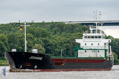
General Cargo
Current Trip
Current Position
| Lengtegraad | -3.33142° |
|---|---|
| Breedtegraat | 49.78338° |
| Status | Under way using engine |
| Snelheid | 13.1 Knopen |
| Koers | 82.9° |
| Gebied | English Channel |
| Station | T-AIS |
| Positie ontvangen | 35 m geleden |
Info
Information
The current position of SKY MARINE is in English Channel with coordinates 49.78338° / -3.33142° as reported on 2024-08-30 02:43 by AIS to our vessel tracker app. The vessel's current speed is 13.1 Knopen and is heading at the port of ROUEN. The estimated time of arrival as calculated by MyShipTracking vessel tracking app is 2024-08-30 19:49 LT
The vessel SKY MARINE (IMO: 9143269, MMSI: 352002352) is a General Cargo that was built in 1998 ( 26 Jaar oud ). It's sailing under the flag of [PA] Panama.
In this page you can find informations about the vessels current position, last detected port calls, and current voyage information. If the vessels is not in coverage by AIS you will find the latest position.
The current position of SKY MARINE is detected by our AIS receivers and we are not responsible for the reliability of the data. The last position was recorded while the vessel was in Coverage by the Ais receivers of our vessel tracking app.
The current draught of SKY MARINE as reported by AIS is 3.6 meters
Weather
| Temperature | 16.4°C / 61.52°F |
|---|---|
| Wind Speed | 10 knots |
| Direction | 38° NE |
| Pressure | 1021.4 hPa |
| Humidity | 80.1 % |
| Cloud Coverage | 6 % |
Featured Company
Last Port Calls
| Port | Arrival | Departure | Time In Port |
|---|---|---|---|
| 2024-08-21 15:52 | |||
| 2024-07-30 12:11 | 2024-08-12 22:00 | 13 d | |
| 2024-07-26 15:31 | 2024-07-26 20:21 | 4 h | |
| 2024-07-17 14:09 | 2024-07-22 10:04 | 4 d | |
| 2024-07-08 09:36 | 2024-07-09 16:04 | 1 d | |
| 2024-07-08 04:30 | |||
| 2024-07-07 21:21 | |||
| 2024-07-07 15:42 | 2024-07-07 21:18 | 5 h | |
| 2024-07-07 09:06 | |||
| 2024-07-07 09:06 |
Most Visited Ports (Last year)
| Port | Arrivals | |
|---|---|---|
| 5 | ||
| 4 | ||
| 3 | ||
| 3 | ||
| 2 | ||
| 2 |
Last Trips
| Origin | Departure | Destination | Arrival | Distance | |
|---|---|---|---|---|---|
| 2024-08-12 23:00 | 2024-08-21 16:52 | 1877.60 nm | |||
| 2024-07-26 22:21 | 2024-07-30 13:11 | 614.68 nm | |||
| 2024-07-22 12:04 | 2024-07-26 17:31 | 985.78 nm | |||
| 2024-07-09 18:04 | 2024-07-17 16:09 | 1261.16 nm | |||
| 2024-07-07 23:18 | 2024-07-08 11:36 | 0.76 nm | |||
| 2024-07-07 23:18 | 2024-07-08 06:30 | 0.33 nm | |||
| 2024-07-07 23:18 | 2024-07-07 23:21 | 0.03 nm | |||
| 2024-07-07 11:06 | 2024-07-07 17:42 | 0.59 nm | |||
| 2024-07-04 16:09 | 2024-07-07 11:06 | 16.82 nm | |||
| 2024-07-04 16:09 | 2024-07-07 08:54 | 16.38 nm |
Events
| Tijd | Evenement | Details | Positie / Bestemming | Info |
|---|---|---|---|---|
| 2024-08-30 02:44 | Status Changed | Default Under way using engine |
49.78388 / -3.32512
FR URO
|
Snelheid: 13.1 kn Koers: 82.9° |
| 2024-08-30 02:23 | Status Changed | Under way using engine Default |
49.77576 / -3.43956
FR URO
|
Snelheid: 12.6 kn Koers: 86° |
| 2024-08-30 02:13 | Status Changed | Default Under way using engine |
49.77369 / -3.49628
FR URO
|
Snelheid: 12.6 kn Koers: 86.5° |
| 2024-08-29 21:58 | Status Changed | Under way using engine Default |
49.71890 / -4.85067
FR URO
|
Snelheid: 11.9 kn Koers: 88° |
| 2024-08-29 21:44 | Status Changed | Default Under way using engine |
49.71746 / -4.90873
FR URO
|
Snelheid: 12 kn Koers: 87.6° |
| 2024-08-29 20:23 | Wijzig zee gebeid | United Kingdom part of the English Channel United Kingdom part of the Celtic Sea |
49.69830 / -5.33500
English Channel
FR URO
|
Snelheid: 12 kn Koers: 84° |
| 2024-08-29 18:03 | Status Changed | Under way using engine Default |
49.65080 / -6.04838
FR URO
|
Snelheid: 12.1 kn Koers: 84° |
| 2024-08-29 17:55 | Binnenbereik |
49.65080 / -6.04838
Celtic Sea
FR URO
|
Snelheid: 11.9 kn Koers: 83.9° |
|
| 2024-08-29 12:33 | Buitenbereik |
50.14198 / -7.53244
Celtic Sea
FR URO
|
Snelheid: 12.8 kn Koers: 125.7° |
|
| 2024-08-29 12:33 | Gevonden in zee | United Kingdom part of the Celtic Sea |
50.14198 / -7.53244
Celtic Sea
FR URO
|
Snelheid: 12.8 kn Koers: 125.7° |