

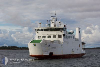
SKIFTET
Ro-Ro/Passenger Ship

Current Trip
KOKAR<>LANGNAS
| Time Travelled | 10 h, 28 mins |
|---|---|
| Remaining Time | --- |
| Distance Travelled | 21.25 nm |
| Remaining Distance | --- |
| AVG Speed | 12.2 Knopen |
| MAX Speed | 12.4 Knopen |
| AVG Wind | 8.5 knots |
| MAX Wind | 9.5 knots |
| MIN Temp | -3.2°C / 26.24°F |
| MAX Temp | -2.2°C / 28.04°F |
| Diepgang | 4 M |
| Positie ontvangen | 2 d geleden |
Current Position
| Lengtegraad | --- |
|---|---|
| Breedtegraat | --- |
| Status | Under way using engine |
| Snelheid | |
| Koers | --- |
| Gebied | Gulf of Bothnia |
| Station | T-AIS |
| Positie ontvangen | 2 d geleden |
Information
The current position of SKIFTET is in Gulf of Bothnia with coordinates 60.11802° / 20.29662° as reported on 2025-02-12 13:05 by AIS to our vessel tracker app. The vessel's current speed is 0 Knopen
The vessel SKIFTET (IMO: 8412807, MMSI: 230992740) is a Ro-Ro/Passenger Ship that was built in 1985 ( 40 Jaar oud ). It's sailing under the flag of [FI] Finland.
In this page you can find informations about the vessels current position, last detected port calls, and current voyage information. If the vessels is not in coverage by AIS you will find the latest position.
The current position of SKIFTET is detected by our AIS receivers and we are not responsible for the reliability of the data. The last position was recorded while the vessel was in Coverage by the Ais receivers of our vessel tracking app.
The current draught of SKIFTET as reported by AIS is 4 meters
Weather
| Temperature | -2.7°C / 27.14°F |
|---|---|
| Wind Speed | 11 knots |
| Direction | 7° N |
| Pressure | 1019.7 hPa |
| Humidity | 76.5 % |
| Cloud Coverage | 100 % |


Featured Company
Last Port Calls
| Port | Arrival | Departure | Time In Port |
|---|---|---|---|
| 2025-02-14 17:35 | 2025-02-14 22:56 | 5 h | |
| 2025-02-12 09:22 | 2025-02-14 17:00 | 2 d | |
| 2025-02-11 16:53 | 2025-02-11 17:01 | 7 m | |
| 2025-02-11 15:26 | 2025-02-11 16:17 | 51 m | |
| 2025-02-11 14:49 | 2025-02-11 14:57 | 7 m | |
| 2025-02-11 06:54 | 2025-02-11 07:21 | 27 m | |
| 2025-02-10 15:21 | 2025-02-10 16:14 | 52 m | |
| 2025-02-10 10:47 | 2025-02-10 11:01 | 14 m | |
| 2025-02-10 07:01 | 2025-02-10 10:02 | 3 h | |
| 2025-02-10 06:21 | 2025-02-10 06:29 | 7 m |
Last Trips
| Origin | Departure | Destination | Arrival | Distance | |
|---|---|---|---|---|---|
| 2025-02-14 19:00 | 2025-02-14 19:35 | 6.05 nm | |||
| 2025-02-11 19:01 | 2025-02-12 11:22 | 41.58 nm | |||
| 2025-02-11 18:17 | 2025-02-11 18:53 | 6.17 nm | |||
| 2025-02-11 16:57 | 2025-02-11 17:26 | 5.78 nm | |||
| 2025-02-11 09:21 | 2025-02-11 16:49 | 43.30 nm | |||
| 2025-02-10 18:14 | 2025-02-11 08:54 | 47.44 nm | |||
| 2025-02-10 13:01 | 2025-02-10 17:21 | 38.41 nm | |||
| 2025-02-10 12:02 | 2025-02-10 12:47 | 6.40 nm | |||
| 2025-02-10 08:29 | 2025-02-10 09:01 | 6.19 nm | |||
| 2025-02-09 17:28 | 2025-02-10 08:21 | 36.73 nm |
Events
| Tijd | Evenement | Details | Positie / Bestemming | Info |
|---|---|---|---|---|
| 2025-02-15 05:40 | Start beweging | 13.28 nm, South East of OVERO |
59.96863 / 20.84583
KOKAR<>LANGNAS
|
Snelheid: 12.3 kn Koers: 295° |
| 2025-02-14 22:56 | Vertrekhaven |
|
59.94566 / 20.89192
KOKAR<>LANGNAS
|
Snelheid: 2.5 kn Koers: 109° |
| 2025-02-14 17:35 | Aankomsthaven |
|
60.11184 / 20.50983
[FI] OVERO
|
Snelheid: 12.2 kn Koers: 88° |
| 2025-02-14 17:00 | Start beweging | 0.41 nm, South East of LANGNAS |
60.11319 / 20.31045
KOKAR<>LANGNAS
|
Snelheid: 11.7 kn Koers: 100° |
| 2025-02-14 17:00 | Vertrekhaven |
|
60.11319 / 20.31045
KOKAR<>LANGNAS
|
Snelheid: 6 kn Koers: 121° |
| 2025-02-12 13:05 | Buitenbereik |
60.11802 / 20.29662
Gulf of Bothnia
[FI] LANGNAS
|
Snelheid: Koers: 185.1° |
|
| 2025-02-12 13:05 | Status Changed | Under way using engine Default |
60.11802 / 20.29662
[FI] LANGNAS
|
Snelheid: Koers: 185° |
| 2025-02-12 12:37 | Status Changed | Default Under way using engine |
60.11798 / 20.29667
[FI] LANGNAS
|
Snelheid: Koers: 0° |
| 2025-02-12 12:04 | Status Changed | Under way using engine Default |
60.11800 / 20.29665
[FI] LANGNAS
|
Snelheid: Koers: 185° |
| 2025-02-12 11:45 | Binnenbereik |
60.11796 / 20.29664
Gulf of Bothnia
[FI] LANGNAS
|
Snelheid: Koers: 185.1° |