
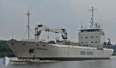
SILVER STORM
Reefer
Current Trip
| Time Travelled | 2 days |
|---|---|
| Remaining Time | 3 days |
| Distance Travelled | 318.06 nm |
| Remaining Distance | 1173.27 nm |
| AVG Speed | 13.2 Knopen |
| MAX Speed | 15.1 Knopen |
| AVG Wind | 19.1 knots |
| MAX Wind | 28.3 knots |
| MIN Temp | 5.2°C / 41.36°F |
| MAX Temp | 10°C / 50°F |
| Diepgang | 5.4 M |
| Positie ontvangen | 1 m geleden |
Current Position
| Lengtegraad | 2.07440° |
|---|---|
| Breedtegraat | 59.94373° |
| Status | Under way using engine |
| Snelheid | 13.4 Knopen |
| Koers | 124.9° |
| Gebied | North Sea |
| Station | T-AIS |
| Positie ontvangen | 1 m geleden |
Info
Information
The current position of SILVER STORM is in North Sea with coordinates 59.94373° / 2.07440° as reported on 2024-05-01 10:09 by AIS to our vessel tracker app. The vessel's current speed is 13.4 Knopen and is heading at the port of ST PETERSBURG. The estimated time of arrival as calculated by MyShipTracking vessel tracking app is 2024-05-05 03:18 LT
The vessel SILVER STORM (IMO: 9143374, MMSI: 257918000) is a Reefer that was built in 1998 ( 26 Jaar oud ). It's sailing under the flag of [NO] Norway.
In this page you can find informations about the vessels current position, last detected port calls, and current voyage information. If the vessels is not in coverage by AIS you will find the latest position.
The current position of SILVER STORM is detected by our AIS receivers and we are not responsible for the reliability of the data. The last position was recorded while the vessel was in Coverage by the Ais receivers of our vessel tracking app.
The current draught of SILVER STORM as reported by AIS is 5.4 meters
Weather
| Temperature | 8.5°C / 47.3°F |
|---|---|
| Wind Speed | 10 knots |
| Direction | 106° ESE |
| Pressure | 1020.4 hPa |
| Humidity | 89.4 % |
| Cloud Coverage | 99 % |
Featured Company
Last Port Calls
| Port | Arrival | Departure | Time In Port |
|---|---|---|---|
| 2024-04-26 06:49 | 2024-04-28 22:17 | 2 d | |
| 2024-04-21 12:08 | 2024-04-22 21:49 | 1 d | |
| 2024-04-19 17:39 | 2024-04-20 12:27 | 18 h | |
| 2024-04-15 14:31 | 2024-04-16 19:10 | 1 d | |
| 2024-04-11 05:58 | 2024-04-12 16:53 | 1 d | |
| 2024-04-05 22:03 | 2024-04-10 10:19 | 4 d | |
| 2024-03-19 18:24 | 2024-03-22 23:27 | 3 d | |
| 2024-03-12 19:38 | 2024-03-14 20:07 | 2 d | |
| 2024-03-07 23:47 |
Most Visited Ports (Last year)
| Port | Arrivals | |
|---|---|---|
| 6 | ||
| 4 | ||
| 4 | ||
| 4 | ||
| 2 | ||
| 2 |
Last Trips
| Origin | Departure | Destination | Arrival | Distance | |
|---|---|---|---|---|---|
| 2024-04-23 00:49 | 2024-04-26 07:49 | 1089.26 nm | |||
| 2024-04-20 14:27 | 2024-04-21 15:08 | 309.79 nm | |||
| 2024-04-16 20:10 | 2024-04-19 19:39 | 930.82 nm | |||
| 2024-04-12 16:53 | 2024-04-15 15:31 | 274.60 nm | |||
| 2024-04-10 11:19 | 2024-04-11 05:58 | 262.11 nm | |||
| 2024-03-23 02:27 | 2024-04-05 23:03 | 1530.88 nm | |||
| 2024-03-14 20:07 | 2024-03-19 21:24 | 1474.27 nm | |||
| 2024-03-07 23:47 | 2024-03-12 19:38 | 1.10 nm |
Events
| Tijd | Evenement | Details | Positie / Bestemming | Info |
|---|---|---|---|---|
| 2024-05-01 09:39 | Draught Changed | 5.4 4.8 |
60.00948 / 1.88689
RU LED
|
Snelheid: 13.2 kn Koers: 125° |
| 2024-05-01 09:39 | Destination Changed | RU LED FO TVO |
60.00948 / 1.88689
RU LED
|
Snelheid: 13.2 kn Koers: 125° |
| 2024-05-01 09:39 | ETA Changed | 2024/05/05 01:00 2024/04/29 01:00 |
60.00948 / 1.88689
RU LED
|
Snelheid: 13.2 kn Koers: 125° |
| 2024-05-01 09:19 | Gevonden in zee | United Kingdom part of the North Sea |
60.04918 / 1.77319
North Sea
|
Snelheid: 12.5 kn Koers: 125.8° |
| 2024-05-01 09:17 | Status Changed | Under way using engine Default |
60.05406 / 1.75941
FO TVO
|
Snelheid: 13 kn Koers: 125° |
| 2024-05-01 09:01 | Binnenbereik |
60.04918 / 1.77319
North Sea
|
Snelheid: 12.5 kn Koers: 125.8° |
|
| 2024-04-30 12:19 | Start beweging | 2.6 nm, North West of HOV |
61.54500 / -6.79500
FO TVO
|
Snelheid: 8 kn Koers: 136° |
| 2024-04-29 01:19 | Stop beweging | 2.69 nm, North East of FAMJIN |
61.55167 / -6.81000
FO TVO
|
Snelheid: Koers: -1° |
| 2024-04-28 23:34 | Status Changed | Default Under way using engine |
61.86666 / -6.62833
FO TVO
|
Snelheid: 15.1 kn Koers: 159.9° |
| 2024-04-28 23:28 | Buitenbereik |
61.89442 / -6.64881
North Atlantic Ocean
FO TVO
|
Snelheid: 15.1 kn Koers: 159.9° |