
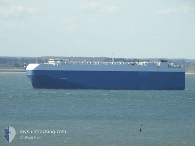
SILVER RAY
Vehicles Carrier
Current Trip
| Time Travelled | 14 days |
|---|---|
| Remaining Time | --- |
| Distance Travelled | 5323.63 nm |
| Remaining Distance | --- |
| AVG Speed | 16.1 Knopen |
| MAX Speed | 19.1 Knopen |
| AVG Wind | 12.9 knots |
| MAX Wind | 30.5 knots |
| MIN Temp | 15.9°C / 60.62°F |
| MAX Temp | 28.3°C / 82.94°F |
| Diepgang | 8.5 M |
| Positie ontvangen | 1 d geleden |
Current Position
| Lengtegraad | --- |
|---|---|
| Breedtegraat | --- |
| Status | Under way using engine |
| Snelheid | 1.2 Knopen |
| Koers | 284° |
| Gebied | North Atlantic Ocean |
| Station | T-AIS |
| Positie ontvangen | 1 d geleden |
Info
Information
The current position of SILVER RAY is in North Atlantic Ocean with coordinates 28.54855° / -13.20748° as reported on 2025-02-19 07:00 by AIS to our vessel tracker app. The vessel's current speed is 1.2 Knopen and is heading at the port of EMDEN. The estimated time of arrival as calculated by MyShipTracking vessel tracking app is 2025-02-22 18:00 LT
The vessel SILVER RAY (IMO: 9181376, MMSI: 355137000) is a Vehicles Carrier that was built in 1999 ( 26 Jaar oud ). It's sailing under the flag of [PA] Panama.
In this page you can find informations about the vessels current position, last detected port calls, and current voyage information. If the vessels is not in coverage by AIS you will find the latest position.
The current position of SILVER RAY is detected by our AIS receivers and we are not responsible for the reliability of the data. The last position was recorded while the vessel was in Coverage by the Ais receivers of our vessel tracking app.
The current draught of SILVER RAY as reported by AIS is 8.5 meters
Weather
| Temperature | 17°C / 62.6°F |
|---|---|
| Wind Speed | 9 knots |
| Direction | 63° ENE |
| Pressure | 1024.8 hPa |
| Humidity | 82.5 % |
| Cloud Coverage | 6 % |
Featured Company
Last Port Calls
| Port | Arrival | Departure | Time In Port |
|---|---|---|---|
| 2025-02-03 02:46 | 2025-02-05 20:23 | 2 d | |
| 2025-01-20 22:31 | 2025-01-23 10:01 | 2 d | |
| 2025-01-20 03:29 | 2025-01-20 11:57 | 8 h | |
| 2025-01-19 00:29 | 2025-01-19 20:57 | 20 h | |
| 2024-12-31 16:35 | 2025-01-03 09:39 | 2 d | |
| 2024-12-22 11:58 | 2024-12-24 08:22 | 1 d | |
| 2024-12-21 20:07 | 2024-12-22 11:54 | 15 h | |
| 2024-12-06 23:31 | 2024-12-11 14:34 | 4 d | |
| 2024-12-05 11:22 | 2024-12-06 05:04 | 17 h | |
| 2024-12-04 00:34 | 2024-12-04 18:58 | 18 h |
Most Visited Ports (Last year)
| Port | Arrivals | |
|---|---|---|
| 5 | ||
| 5 | ||
| 5 | ||
| 5 | ||
| 5 | ||
| 4 |
Last Trips
| Origin | Departure | Destination | Arrival | Distance | |
|---|---|---|---|---|---|
| 2025-01-23 11:01 | 2025-02-03 04:46 | 3050.58 nm | |||
| 2025-01-20 11:57 | 2025-01-20 23:31 | 147.64 nm | |||
| 2025-01-19 21:57 | 2025-01-20 03:29 | 84.88 nm | |||
| 2025-01-03 03:39 | 2025-01-19 01:29 | 6113.27 nm | |||
| 2024-12-24 03:22 | 2024-12-31 10:35 | 2135.66 nm | |||
| 2024-12-22 06:54 | 2024-12-22 06:58 | 0.68 nm | |||
| 2024-12-11 15:34 | 2024-12-21 15:07 | 3702.86 nm | |||
| 2024-12-06 05:04 | 2024-12-07 00:31 | 268.05 nm | |||
| 2024-12-04 19:58 | 2024-12-05 11:22 | 204.24 nm | |||
| 2024-12-03 02:08 | 2024-12-04 01:34 | 331.44 nm |
Events
| Tijd | Evenement | Details | Positie / Bestemming | Info |
|---|---|---|---|---|
| 2025-02-19 07:15 | Status Changed | Default Under way using engine |
28.54462 / -13.20461
ZAPLZ-DEEME
|
Snelheid: 1.2 kn Koers: 284° |
| 2025-02-19 07:00 | Status Changed | Under way using engine Default |
28.54855 / -13.20748
ZAPLZ-DEEME
|
Snelheid: 1.2 kn Koers: 283° |
| 2025-02-19 07:00 | Buitenbereik |
28.54855 / -13.20748
North Atlantic Ocean
ZAPLZ-DEEME
|
Snelheid: 1.2 kn Koers: 143.5° |
|
| 2025-02-19 06:50 | Binnenbereik |
28.54855 / -13.20748
North Atlantic Ocean
ZAPLZ-DEEME
|
Snelheid: 1.2 kn Koers: 143.5° |
|
| 2025-02-19 01:51 | Status Changed | Default Under way using engine |
28.61812 / -13.29098
ZAPLZ-DEEME
|
Snelheid: 1.5 kn Koers: 275° |
| 2025-02-19 01:32 | Status Changed | Under way using engine Default |
28.62435 / -13.29494
ZAPLZ-DEEME
|
Snelheid: 1.3 kn Koers: 271° |
| 2025-02-19 01:32 | Binnenbereik |
28.62435 / -13.29494
North Atlantic Ocean
ZAPLZ-DEEME
|
Snelheid: 1.5 kn Koers: 162.3° |
|
| 2025-02-19 01:32 | Buitenbereik |
28.62435 / -13.29494
North Atlantic Ocean
ZAPLZ-DEEME
|
Snelheid: 1.5 kn Koers: 162.3° |
|
| 2025-02-18 11:02 | Status Changed | Default Under way using engine |
28.64515 / -13.48422
ZAPLZ-DEEME
|
Snelheid: 1.4 kn Koers: 240° |
| 2025-02-18 10:57 | Buitenbereik |
28.64727 / -13.48452
North Atlantic Ocean
ZAPLZ-DEEME
|
Snelheid: 1.4 kn Koers: 175.9° |