
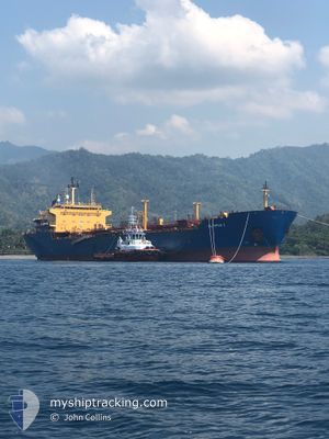
SILVER PHOENIX
Crude Oil Tanker
Current Trip
| Time Travelled | 6 days |
|---|---|
| Remaining Time | 38 mins |
| Distance Travelled | 691.69 nm |
| Remaining Distance | 4.75 nm |
| AVG Speed | 9.1 Knopen |
| MAX Speed | 14 Knopen |
| AVG Wind | 7.6 knots |
| MAX Wind | 16 knots |
| MIN Temp | 25°C / 77°F |
| MAX Temp | 34.4°C / 93.92°F |
| Diepgang | 10 M |
| Positie ontvangen | 2 m geleden |
Current Position
| Lengtegraad | --- |
|---|---|
| Breedtegraat | --- |
| Status | Under way using engine |
| Snelheid | 4.1 Knopen |
| Koers | 37° |
| Gebied | Java Sea |
| Station | T-AIS |
| Positie ontvangen | 2 m geleden |
Info
Information
The current position of SILVER PHOENIX is in Java Sea with coordinates -6.82822° / 110.42408° as reported on 2024-10-01 16:58 by AIS to our vessel tracker app. The vessel's current speed is 4.1 Knopen and is heading at the port of SEMARANG. The estimated time of arrival as calculated by MyShipTracking vessel tracking app is 2024-10-01 17:38 LT
The vessel SILVER PHOENIX (IMO: 9214757, MMSI: 525007413) is a Crude Oil Tanker that was built in 2001 ( 23 Jaar oud ). It's sailing under the flag of [ID] Indonesia.
In this page you can find informations about the vessels current position, last detected port calls, and current voyage information. If the vessels is not in coverage by AIS you will find the latest position.
The current position of SILVER PHOENIX is detected by our AIS receivers and we are not responsible for the reliability of the data. The last position was recorded while the vessel was in Coverage by the Ais receivers of our vessel tracking app.
The current draught of SILVER PHOENIX as reported by AIS is 10 meters
Weather
| Temperature | 26.5°C / 79.7°F |
|---|---|
| Wind Speed | 10 knots |
| Direction | 139° SE |
| Pressure | 1011.1 hPa |
| Humidity | 80 % |
| Cloud Coverage | 100 % |
Featured Company
Last Port Calls
| Port | Arrival | Departure | Time In Port |
|---|---|---|---|
| 2024-09-23 10:55 | 2024-09-25 10:27 | 1 d | |
| 2024-09-14 17:56 | 2024-09-15 23:12 | 1 d | |
| 2024-09-03 11:13 | 2024-09-05 08:40 | 1 d | |
| 2024-08-11 10:55 | 2024-08-13 18:21 | 2 d |
Most Visited Ports (Last year)
| Port | Arrivals | |
|---|---|---|
| 11 | ||
| 3 | ||
| 2 | ||
| 2 | ||
| 1 | ||
| 1 |
Last Trips
| Origin | Departure | Destination | Arrival | Distance | |
|---|---|---|---|---|---|
| 2024-09-16 06:12 | 2024-09-23 18:55 | 633.36 nm | |||
| 2024-09-05 16:40 | 2024-09-15 00:56 | 1353.22 nm | |||
| 2024-08-14 02:21 | 2024-09-03 19:13 | 1523.95 nm | |||
| 2024-07-27 13:58 | 2024-08-11 18:55 | 1501.70 nm |
Events
| Tijd | Evenement | Details | Positie / Bestemming | Info |
|---|---|---|---|---|
| 2024-10-01 16:21 | Start beweging | 3.76 nm, North of SEMARANG |
-6.87611 / 110.41062
SEMARANG ID
|
Snelheid: 3.1 kn Koers: 104° |
| 2024-10-01 15:46 | Status Changed | Under way using engine At anchor |
-6.87376 / 110.40808
SEMARANG ID
|
Snelheid: 0.1 kn Koers: 186° |
| 2024-10-01 00:02 | ETA Changed | 2025/09/28 04:00 2024/09/28 04:00 |
-6.87339 / 110.40790
SEMARANG ID
|
Snelheid: Koers: 165° |
| 2024-09-28 07:41 | Status Changed | At anchor Default |
-6.87427 / 110.40660
SEMARANG ID
|
Snelheid: Koers: 100° |
| 2024-09-28 07:38 | Status Changed | Default At anchor |
-6.87426 / 110.40659
SEMARANG ID
|
Snelheid: Koers: 100° |
| 2024-09-28 04:29 | Stop beweging | 3.92 nm, North of SEMARANG |
-6.87400 / 110.40685
SEMARANG ID
|
Snelheid: 0.1 kn Koers: 111° |
| 2024-09-28 04:26 | Status Changed | At anchor Under way using engine |
-6.87414 / 110.40718
SEMARANG ID
|
Snelheid: 0.7 kn Koers: 108° |
| 2024-09-28 01:50 | Draught Changed | 10 9.9 |
-6.51410 / 110.29116
SEMARANG ID
|
Snelheid: 11.9 kn Koers: 165.2° |
| 2024-09-28 01:44 | ETA Changed | 2024/09/28 04:00 2024/09/28 07:00 |
-6.49371 / 110.28584
SEMARANG ID
|
Snelheid: 11.9 kn Koers: 165.4° |
| 2024-09-27 19:48 | Destination Changed | SEMARANG ID EOPL |
-5.56522 / 109.64475
SEMARANG ID
|
Snelheid: 12.4 kn Koers: 134° |