
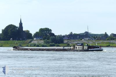
SILJA 2
Other Type
Current Trip
| Time Travelled | 3 days |
|---|---|
| Remaining Time | --- |
| Distance Travelled | 5.17 nm |
| Remaining Distance | --- |
| AVG Speed | 6 Knopen |
| MAX Speed | 7.3 Knopen |
| AVG Wind | 9 knots |
| MAX Wind | 9 knots |
| MIN Temp | 22.9°C / 73.22°F |
| MAX Temp | 23°C / 73.4°F |
| Diepgang | 0.3 M |
| Positie ontvangen | 3 d geleden |
Current Position
| Lengtegraad | 4.35856° |
|---|---|
| Breedtegraat | 51.03590° |
| Status | Under way using engine |
| Snelheid | 1.6 Knopen |
| Koers | --- |
| Gebied | North Sea |
| Station | T-AIS |
| Positie ontvangen | 3 d geleden |
Info
Information
The current position of SILJA 2 is in North Sea with coordinates 51.03590° / 4.35856° as reported on 2024-05-11 14:40 by AIS to our vessel tracker app. The vessel's current speed is 1.6 Knopen
The vessel SILJA 2 (MMSI: 270332000) is a Other Type It's sailing under the flag of [CZ] Czech Republic.
In this page you can find informations about the vessels current position, last detected port calls, and current voyage information. If the vessels is not in coverage by AIS you will find the latest position.
The current position of SILJA 2 is detected by our AIS receivers and we are not responsible for the reliability of the data. The last position was recorded while the vessel was in Coverage by the Ais receivers of our vessel tracking app.
The current draught of SILJA 2 as reported by AIS is 0.3 meters
Weather
| Temperature | 23°C / 73.4°F |
|---|---|
| Wind Speed | 9 knots |
| Direction | 89° E |
| Pressure | 1019.3 hPa |
| Humidity | 51.8 % |
| Cloud Coverage | 32 % |
Featured Company
Last Port Calls
| Port | Arrival | Departure | Time In Port |
|---|---|---|---|
| 2024-05-11 06:49 | 2024-05-11 12:55 | 6 h | |
| 2024-05-10 17:26 | 2024-05-11 04:56 | 11 h | |
| 2024-05-10 05:53 | 2024-05-10 07:04 | 1 h | |
| 2024-05-08 07:20 | 2024-05-08 09:13 | 1 h | |
| 2024-04-22 14:53 | 2024-04-22 15:32 | 38 m | |
| 2024-04-19 11:43 | 2024-04-20 05:16 | 17 h | |
| 2024-04-18 09:32 | 2024-04-19 07:42 | 22 h | |
| 2024-04-12 15:49 | 2024-04-15 04:28 | 2 d | |
| 2024-04-12 07:58 | 2024-04-12 09:43 | 1 h | |
| 2024-04-09 15:24 | 2024-04-09 16:27 | 1 h |
Last Trips
| Origin | Departure | Destination | Arrival | Distance | |
|---|---|---|---|---|---|
| 2024-05-11 06:56 | 2024-05-11 08:49 | 11.75 nm | |||
| 2024-05-10 09:04 | 2024-05-10 19:26 | 84.33 nm | |||
| 2024-05-08 11:13 | 2024-05-10 07:53 | 57.71 nm | |||
| 2024-04-22 17:32 | 2024-05-08 09:20 | 283.73 nm | |||
| 2024-04-20 07:16 | 2024-04-22 16:53 | 126.46 nm | |||
| 2024-04-19 09:42 | 2024-04-19 13:43 | 3.24 nm | |||
| 2024-04-15 06:28 | 2024-04-18 11:32 | 141.28 nm | |||
| 2024-04-12 11:43 | 2024-04-12 17:49 | 45.02 nm | |||
| 2024-04-09 18:27 | 2024-04-12 09:58 | 59.49 nm | |||
| 2024-04-09 06:45 | 2024-04-09 17:24 | 41.28 nm |
Events
| Tijd | Evenement | Details | Positie / Bestemming | Info |
|---|---|---|---|---|
| 2024-05-11 14:40 | Buitenbereik |
51.03590 / 4.35856
North Sea
|
Snelheid: 1.6 kn Koers: 198° |
|
| 2024-05-11 14:16 | Status Changed | Under way using engine Moored |
51.06692 / 4.36464
BRUSSEL
|
Snelheid: 0.3 kn Koers: 511° |
| 2024-05-11 14:16 | Start beweging | 4.51 nm, South East of RUPELMONDE |
51.06692 / 4.36464
BRUSSEL
|
Snelheid: 4.6 kn Koers: 184.5° |
| 2024-05-11 14:10 | Stop beweging | 4.43 nm, South East of RUPELMONDE |
51.06877 / 4.36492
BRUSSEL
|
Snelheid: 0.3 kn Koers: 511° |
| 2024-05-11 14:10 | Status Changed | Moored Under way using engine |
51.06883 / 4.36491
BRUSSEL
|
Snelheid: 0.4 kn Koers: 511° |
| 2024-05-11 13:57 | Status Changed | Under way using engine Moored |
51.08512 / 4.35061
BRUSSEL
|
Snelheid: 0.6 kn Koers: 511° |
| 2024-05-11 13:57 | Start beweging | 3.34 nm, South East of RUPELMONDE |
51.08512 / 4.35061
BRUSSEL
|
Snelheid: 4.7 kn Koers: 139.1° |
| 2024-05-11 13:47 | Stop beweging | 3.18 nm, South East of RUPELMONDE |
51.08710 / 4.34799
BRUSSEL
|
Snelheid: 0.3 kn Koers: 511° |
| 2024-05-11 13:46 | Status Changed | Moored Under way using engine |
51.08714 / 4.34793
BRUSSEL
|
Snelheid: 0.9 kn Koers: 511° |
| 2024-05-11 13:26 | Binnenbereik |
51.10008 / 4.31182
North Sea
|
Snelheid: 7.1 kn Koers: 133.1° |