
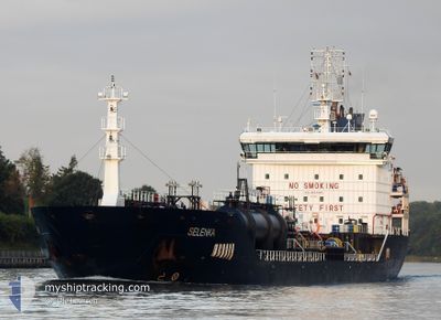
SELENKA
Oil/Chemical Tanker
Current Trip
ES BCN
| Time Travelled | 10 days |
|---|---|
| Remaining Time | --- |
| Distance Travelled | 2869.45 nm |
| Remaining Distance | --- |
| AVG Speed | 11.4 Knopen |
| MAX Speed | 13.6 Knopen |
| AVG Wind | 15.4 knots |
| MAX Wind | 31 knots |
| MIN Temp | 15.7°C / 60.26°F |
| MAX Temp | 29.6°C / 85.28°F |
| Diepgang | 8.8 M |
| Positie ontvangen | 3 h, 10 m geleden |
Current Position
| Lengtegraad | -4.44450° |
|---|---|
| Breedtegraat | 36.09983° |
| Status | Under way using engine |
| Snelheid | 13.4 Knopen |
| Koers | 82.9° |
| Gebied | Alboran Sea |
| Station | T-AIS |
| Positie ontvangen | 3 h, 10 m geleden |
Info
Information
The current position of SELENKA is in Alboran Sea with coordinates 36.09983° / -4.44450° as reported on 2024-05-09 08:25 by AIS to our vessel tracker app. The vessel's current speed is 13.4 Knopen
The vessel SELENKA (IMO: 9447067, MMSI: 249598000) is a Oil/Chemical Tanker that was built in 2009 ( 15 Jaar oud ). It's sailing under the flag of [MT] Malta.
In this page you can find informations about the vessels current position, last detected port calls, and current voyage information. If the vessels is not in coverage by AIS you will find the latest position.
The current position of SELENKA is detected by our AIS receivers and we are not responsible for the reliability of the data. The last position was recorded while the vessel was in Coverage by the Ais receivers of our vessel tracking app.
The current draught of SELENKA as reported by AIS is 8.8 meters
Weather
| Temperature | 18.8°C / 65.84°F |
|---|---|
| Wind Speed | 22 knots |
| Direction | 88° E |
| Pressure | 1017.8 hPa |
| Humidity | 64.3 % |
| Cloud Coverage | 80 % |
Featured Company
Last Port Calls
| Port | Arrival | Departure | Time In Port |
|---|---|---|---|
| 2024-04-28 22:22 | |||
| 2024-04-18 05:58 | 2024-04-18 16:52 | 10 h | |
| 2024-04-13 02:18 | 2024-04-16 12:32 | 3 d | |
| 2024-03-27 21:49 | 2024-03-31 06:46 | 3 d | |
| 2024-03-18 14:57 |
Most Visited Ports (Last year)
| Port | Arrivals | |
|---|---|---|
| 6 | ||
| 5 | ||
| 3 | ||
| 2 | ||
| 2 | ||
| 2 |
Last Trips
| Origin | Departure | Destination | Arrival | Distance | |
|---|---|---|---|---|---|
| 2024-04-16 13:32 | 2024-04-18 06:58 | 557.82 nm | |||
| 2024-03-31 08:46 | 2024-04-13 02:18 | 2120.27 nm | |||
| 2024-03-18 17:57 | 2024-03-27 23:49 | 833.43 nm |
Events
| Tijd | Evenement | Details | Positie / Bestemming | Info |
|---|---|---|---|---|
| 2024-05-09 08:28 | Status Changed | Default Under way using engine |
36.10143 / -4.42942
ES BCN
|
Snelheid: 13.4 kn Koers: 82.9° |
| 2024-05-09 08:25 | Buitenbereik |
36.09983 / -4.44450
Alboran Sea
|
Snelheid: 13.4 kn Koers: 82.9° |
|
| 2024-05-09 05:08 | Wijzig zee gebeid | Spanish part of the Alboran Sea Spanish part of the Strait of Gibraltar |
35.98928 / -5.31642
Alboran Sea
|
Snelheid: 13.1 kn Koers: 79° |
| 2024-05-09 04:55 | Wijzig zee gebeid | Spanish part of the Strait of Gibraltar Moroccan part of the Strait of Gibraltar |
35.97932 / -5.37344
Strait of Gibraltar
|
Snelheid: 13 kn Koers: 77.6° |
| 2024-05-09 03:11 | Status Changed | Under way using engine Default |
35.88983 / -5.78400
ES BCN
|
Snelheid: 11.3 kn Koers: 76° |
| 2024-05-09 03:02 | Status Changed | Default Under way using engine |
35.88450 / -5.81717
ES BCN
|
Snelheid: 10.2 kn Koers: 89.1° |
| 2024-05-09 02:50 | Wijzig zee gebeid | Moroccan part of the Strait of Gibraltar Moroccan part of the North Atlantic Ocean |
35.88409 / -5.86022
Strait of Gibraltar
|
Snelheid: 10.2 kn Koers: 87.1° |
| 2024-05-09 02:49 | Status Changed | Under way using engine Default |
35.88400 / -5.86433
ES BCN
|
Snelheid: 10.3 kn Koers: 83° |
| 2024-05-09 02:39 | Binnenbereik |
35.88409 / -5.86022
Strait of Gibraltar
|
Snelheid: 10.2 kn Koers: 87.1° |
|
| 2024-05-08 23:56 | Buitenbereik |
35.62600 / -6.35067
North Atlantic Ocean
|
Snelheid: 9.6 kn Koers: 52.1° |