

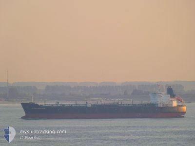
SEAWAYS MADELEINE
Oil/Chemical Tanker

Current Trip
| Time Travelled | 2 days |
|---|---|
| Remaining Time | 2 days |
| Distance Travelled | 750.85 nm |
| Remaining Distance | 1006.61 nm |
| AVG Speed | 13 Knopen |
| MAX Speed | 15.4 Knopen |
| AVG Wind | 17.5 knots |
| MAX Wind | 32 knots |
| MIN Temp | 13.2°C / 55.76°F |
| MAX Temp | 17.1°C / 62.78°F |
| Diepgang | 10.8 M |
| Positie ontvangen | 11 h, 46 m geleden |
Current Position
| Lengtegraad | --- |
|---|---|
| Breedtegraat | --- |
| Status | Under way using engine |
| Snelheid | 13.1 Knopen |
| Koers | 2.6° |
| Gebied | North Atlantic Ocean |
| Station | T-AIS |
| Positie ontvangen | 11 h, 46 m geleden |
Information
The current position of SEAWAYS MADELEINE is in North Atlantic Ocean with coordinates 39.71042° / -9.91335° as reported on 2025-03-06 06:19 by AIS to our vessel tracker app. The vessel's current speed is 13.1 Knopen and is heading at the port of ROTTERDAM. The estimated time of arrival as calculated by MyShipTracking vessel tracking app is 2025-03-09 11:55 LT
The vessel SEAWAYS MADELEINE (IMO: 9380518, MMSI: 477110300) is a Oil/Chemical Tanker that was built in 2008 ( 17 Jaar oud ). It's sailing under the flag of [HK] Hong Kong.
In this page you can find informations about the vessels current position, last detected port calls, and current voyage information. If the vessels is not in coverage by AIS you will find the latest position.
The current position of SEAWAYS MADELEINE is detected by our AIS receivers and we are not responsible for the reliability of the data. The last position was recorded while the vessel was in Coverage by the Ais receivers of our vessel tracking app.
The current draught of SEAWAYS MADELEINE as reported by AIS is 10.8 meters
Weather
| Temperature | 13.1°C / 55.58°F |
|---|---|
| Wind Speed | 8 knots |
| Direction | 243° WSW |
| Pressure | 1010 hPa |
| Humidity | 62.2 % |
| Cloud Coverage | 93 % |


Featured Company
Last Port Calls
| Port | Arrival | Departure | Time In Port |
|---|---|---|---|
| 2025-03-01 12:19 | 2025-03-04 06:15 | 2 d | |
| 2025-02-15 10:12 | 2025-02-16 11:35 | 1 d | |
| 2025-02-11 10:36 | 2025-02-13 04:50 | 1 d | |
| 2025-02-06 17:30 | 2025-02-07 19:00 | 1 d | |
| 2025-01-13 13:28 | 2025-01-15 13:10 | 1 d | |
| 2025-01-09 00:17 | 2025-01-11 21:30 | 2 d | |
| 2025-01-01 23:22 |
Most Visited Ports (Last year)
| Port | Arrivals | |
|---|---|---|
| 5 | ||
| 3 | ||
| 2 | ||
| 2 | ||
| 2 | ||
| 2 |
Last Trips
| Origin | Departure | Destination | Arrival | Distance | |
|---|---|---|---|---|---|
| 2025-02-16 06:35 | 2025-03-01 13:19 | 3917.85 nm | |||
| 2025-02-12 23:50 | 2025-02-15 05:12 | 57.84 nm | |||
| 2025-02-07 14:00 | 2025-02-11 05:36 | 56.14 nm | |||
| 2025-01-15 13:10 | 2025-02-06 12:30 | 5155.82 nm | |||
| 2025-01-11 21:30 | 2025-01-13 13:28 | 497.36 nm | |||
| 2025-01-02 00:22 | 2025-01-09 00:17 | 1778.42 nm |
Events
| Tijd | Evenement | Details | Positie / Bestemming | Info |
|---|---|---|---|---|
| 2025-03-06 06:28 | Status Changed | Default Under way using engine |
39.74145 / -9.91200
NLRTM
|
Snelheid: 13.1 kn Koers: 2.6° |
| 2025-03-06 06:19 | Buitenbereik |
39.71042 / -9.91335
North Atlantic Ocean
NLRTM
|
Snelheid: 13.1 kn Koers: 2.6° |
|
| 2025-03-06 06:08 | Status Changed | Under way using engine Default |
39.66979 / -9.91571
NLRTM
|
Snelheid: 12.9 kn Koers: 2° |
| 2025-03-06 05:56 | Status Changed | Default Under way using engine |
39.62587 / -9.91794
NLRTM
|
Snelheid: 12.9 kn Koers: 2.3° |
| 2025-03-05 20:33 | ETA Changed | 2025/03/09 18:00 2025/03/09 20:00 |
37.64739 / -9.63858
NLRTM
|
Snelheid: 13.4 kn Koers: 347.4° |
| 2025-03-05 19:49 | Gevonden in zee | Portuguese part of the North Atlantic Ocean |
37.48546 / -9.59259
North Atlantic Ocean
NLRTM
|
Snelheid: 13.5 kn Koers: 347.9° |
| 2025-03-05 19:47 | Status Changed | Under way using engine Default |
37.47749 / -9.59045
NLRTM
|
Snelheid: 13.6 kn Koers: 348° |
| 2025-03-05 19:47 | Binnenbereik |
37.48546 / -9.59259
North Atlantic Ocean
NLRTM
|
Snelheid: 13.5 kn Koers: 347.9° |
|
| 2025-03-05 02:35 | Status Changed | Default Under way using engine |
35.95848 / -5.74343
NLRTM
|
Snelheid: 14.9 kn Koers: 268.7° |
| 2025-03-05 02:28 | Buitenbereik |
35.95881 / -5.70571
Strait of Gibraltar
NLRTM
|
Snelheid: 14.9 kn Koers: 268.7° |