
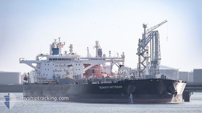
SEAWAYS HATTERAS
Tanker
Current Trip
| Time Travelled | 42 days |
|---|---|
| Remaining Time | 5 days |
| Distance Travelled | 10317.04 nm |
| Remaining Distance | 1293.18 nm |
| AVG Speed | 11.9 Knopen |
| MAX Speed | 16 Knopen |
| AVG Wind | 11.8 knots |
| MAX Wind | 28.9 knots |
| MIN Temp | 1.4°C / 34.52°F |
| MAX Temp | 29.9°C / 85.82°F |
| Diepgang | 9.5 M |
| Positie ontvangen | 1 m geleden |
Current Position
| Lengtegraad | 1.24430° |
|---|---|
| Breedtegraat | 50.93874° |
| Status | Under way using engine |
| Snelheid | 11.7 Knopen |
| Koers | 225.8° |
| Gebied | English Channel |
| Station | T-AIS |
| Positie ontvangen | 1 m geleden |
Info
Information
The current position of SEAWAYS HATTERAS is in English Channel with coordinates 50.93874° / 1.24430° as reported on 2024-04-30 06:10 by AIS to our vessel tracker app. The vessel's current speed is 11.7 Knopen and is heading at the port of ALGECIRAS. The estimated time of arrival as calculated by MyShipTracking vessel tracking app is 2024-05-05 07:26 LT
The vessel SEAWAYS HATTERAS (IMO: 9730414, MMSI: 538007597) is a Tanker It's sailing under the flag of [MH] Marshall Is.
In this page you can find informations about the vessels current position, last detected port calls, and current voyage information. If the vessels is not in coverage by AIS you will find the latest position.
The current position of SEAWAYS HATTERAS is detected by our AIS receivers and we are not responsible for the reliability of the data. The last position was recorded while the vessel was in Coverage by the Ais receivers of our vessel tracking app.
The current draught of SEAWAYS HATTERAS as reported by AIS is 9.5 meters
Weather
| Temperature | 10.8°C / 51.44°F |
|---|---|
| Wind Speed | 10 knots |
| Direction | 167° SSE |
| Pressure | 1014 hPa |
| Humidity | 85.1 % |
| Cloud Coverage | 91 % |
Featured Company
Most Visited Ports (Last year)
| Port | Arrivals | |
|---|---|---|
| 4 | ||
| 2 | ||
| 2 | ||
| 1 | ||
| 1 | ||
| 1 |
Last Trips
| Origin | Departure | Destination | Arrival | Distance | |
|---|---|---|---|---|---|
| 2024-02-11 17:45 | 2024-03-14 04:29 | 5920.60 nm | |||
| 2024-01-12 06:24 | 2024-02-10 15:05 | 7703.51 nm |
Events
| Tijd | Evenement | Details | Positie / Bestemming | Info |
|---|---|---|---|---|
| 2024-04-30 05:04 | Gevonden in zee | United Kingdom part of the English Channel |
51.07767 / 1.47133
English Channel
ALGECIRAS
|
Snelheid: 10.2 kn Koers: 231.2° |
| 2024-04-30 02:14 | ETA Changed | 2024/05/04 20:00 2024/06/04 20:00 |
51.43508 / 1.93695
ALGECIRAS
|
Snelheid: 11.9 kn Koers: 239.9° |
| 2024-04-29 23:50 | Wijzig zee gebeid | United Kingdom part of the North Sea Belgian part of the North Sea |
51.79087 / 2.46440
North Sea
|
Snelheid: 12.9 kn Koers: 220.2° |
| 2024-04-29 23:26 | Wijzig zee gebeid | Belgian part of the North Sea Dutch part of the North Sea |
51.85811 / 2.54983
North Sea
|
Snelheid: 12.9 kn Koers: 215.3° |
| 2024-04-29 22:59 | Wijzig zee gebeid | Dutch part of the North Sea United Kingdom part of the North Sea |
51.94865 / 2.60145
North Sea
|
Snelheid: 13.4 kn Koers: 192° |
| 2024-04-29 22:38 | Destination Changed | ALGECIRAS ARZEW |
52.01971 / 2.59713
ALGECIRAS
|
Snelheid: 12.5 kn Koers: 177.3° |
| 2024-04-29 22:38 | ETA Changed | 2024/06/04 20:00 2024/05/08 01:00 |
52.01971 / 2.59713
ALGECIRAS
|
Snelheid: 12.5 kn Koers: 177.3° |
| 2024-04-29 21:46 | Status Changed | Under way using engine Default |
52.19474 / 2.68042
ARZEW
|
Snelheid: 12.4 kn Koers: 211° |
| 2024-04-29 21:45 | Status Changed | Default Under way using engine |
52.19861 / 2.68422
ARZEW
|
Snelheid: 12.2 kn Koers: 205.1° |
| 2024-04-29 21:35 | Wijzig zee gebeid | United Kingdom part of the North Sea Dutch part of the North Sea |
52.22868 / 2.70817
North Sea
ARZEW
|
Snelheid: 12.2 kn Koers: 205.2° |