
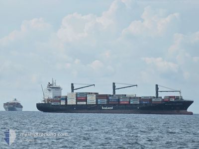
SEALAND PHILADELPHIA
Container Ship
Current Trip
| Time Travelled | 13 h, 42 mins |
|---|---|
| Remaining Time | 2 days |
| Distance Travelled | 138.63 nm |
| Remaining Distance | 797.36 nm |
| AVG Speed | 10.1 Knopen |
| MAX Speed | 13.4 Knopen |
| AVG Wind | 7.6 knots |
| MAX Wind | 14 knots |
| MIN Temp | 28.3°C / 82.94°F |
| MAX Temp | 31.4°C / 88.52°F |
| Diepgang | 10.1 M |
| Positie ontvangen | 3 d geleden |
Current Position
| Lengtegraad | --- |
|---|---|
| Breedtegraat | --- |
| Status | At anchor |
| Snelheid | 0.2 Knopen |
| Koers | 262° |
| Gebied | North Pacific Ocean |
| Station | T-AIS |
| Positie ontvangen | 3 d geleden |
Info
Information
The current position of SEALAND PHILADELPHIA is in North Pacific Ocean with coordinates 12.48250° / -87.25304° as reported on 2025-03-14 21:10 by AIS to our vessel tracker app. The vessel's current speed is 0.2 Knopen and is heading at the port of BALBOA. The estimated time of arrival as calculated by MyShipTracking vessel tracking app is 2025-03-20 07:04 LT
The vessel SEALAND PHILADELPHIA (IMO: 9383247, MMSI: 636017155) is a Container Ship that was built in 2008 ( 17 Jaar oud ). It's sailing under the flag of [LR] Liberia.
In this page you can find informations about the vessels current position, last detected port calls, and current voyage information. If the vessels is not in coverage by AIS you will find the latest position.
The current position of SEALAND PHILADELPHIA is detected by our AIS receivers and we are not responsible for the reliability of the data. The last position was recorded while the vessel was in Coverage by the Ais receivers of our vessel tracking app.
The current draught of SEALAND PHILADELPHIA as reported by AIS is 10.1 meters
Weather
| Temperature | 29.4°C / 84.92°F |
|---|---|
| Wind Speed | 3 knots |
| Direction | 338° NNW |
| Pressure | 1013.8 hPa |
| Humidity | 65.5 % |
| Cloud Coverage | 75 % |
Featured Company
Last Port Calls
| Port | Arrival | Departure | Time In Port |
|---|---|---|---|
| 2025-03-15 16:00 | 2025-03-17 11:14 | 1 d | |
| 2025-03-10 01:03 | 2025-03-11 03:51 | 1 d | |
| 2025-02-10 20:53 | 2025-02-13 11:31 | 2 d | |
| 2025-02-07 07:59 | 2025-02-07 22:07 | 14 h | |
| 2025-02-05 00:36 | 2025-02-06 00:38 | 1 d | |
| 2025-01-28 11:11 | 2025-01-30 02:55 | 1 d | |
| 2025-01-24 08:59 | 2025-01-24 21:08 | 12 h | |
| 2025-01-21 15:38 | 2025-01-22 17:50 | 1 d | |
| 2025-01-13 16:00 | 2025-01-15 21:51 | 2 d | |
| 2025-01-10 03:25 | 2025-01-10 14:44 | 11 h |
Most Visited Ports (Last year)
| Port | Arrivals | |
|---|---|---|
| 17 | ||
| 12 | ||
| 8 | ||
| 8 | ||
| 7 | ||
| 7 |
Last Trips
| Origin | Departure | Destination | Arrival | Distance | |
|---|---|---|---|---|---|
| 2025-03-11 03:51 | 2025-03-15 16:00 | 727.33 nm | |||
| 2025-02-13 11:31 | 2025-03-10 01:03 | 41.08 nm | |||
| 2025-02-07 22:07 | 2025-02-10 20:53 | 866.57 nm | |||
| 2025-02-06 00:38 | 2025-02-07 07:59 | 513.62 nm | |||
| 2025-01-30 02:55 | 2025-02-05 00:36 | 1618.64 nm | |||
| 2025-01-24 21:08 | 2025-01-28 11:11 | 874.08 nm | |||
| 2025-01-22 17:50 | 2025-01-24 08:59 | 515.66 nm | |||
| 2025-01-15 21:51 | 2025-01-21 15:38 | 1602.35 nm | |||
| 2025-01-10 14:44 | 2025-01-13 16:00 | 869.04 nm | |||
| 2025-01-04 22:55 | 2025-01-10 03:25 | 870.63 nm |
Events
| Tijd | Evenement | Details | Positie / Bestemming | Info |
|---|---|---|---|---|
| 2025-03-17 17:14 | Vertrekhaven |
|
12.48032 / -87.19897
PABLB ANCH
|
Snelheid: Koers: 22° |
| 2025-03-15 22:25 | Stop beweging |
12.48211 / -87.16763
[NI] CORINTO
|
Snelheid: Koers: 22° |
|
| 2025-03-15 22:00 | Aankomsthaven |
|
12.48211 / -87.16763
[NI] CORINTO
|
Snelheid: 4.1 kn Koers: 35° |
| 2025-03-15 21:03 | Start beweging | 4.67 nm, West of CORINTO |
12.47894 / -87.24551
PABLB ANCH
|
Snelheid: 3.7 kn Koers: 101° |
| 2025-03-14 21:22 | Status Changed | Default At anchor |
12.48226 / -87.25300
PABLB ANCH
|
Snelheid: 0.2 kn Koers: 262° |
| 2025-03-14 21:10 | Buitenbereik |
12.48250 / -87.25304
North Pacific Ocean
|
Snelheid: 0.2 kn Koers: 5.7° |
|
| 2025-03-14 20:43 | Status Changed | At anchor Default |
12.48300 / -87.25324
PABLB ANCH
|
Snelheid: 0.3 kn Koers: 255° |
| 2025-03-14 20:43 | Binnenbereik |
12.48300 / -87.25324
North Pacific Ocean
|
Snelheid: 0.1 kn Koers: 179.9° |
|
| 2025-03-14 19:25 | Status Changed | Default At anchor |
12.48329 / -87.25350
PABLB ANCH
|
Snelheid: 0.1 kn Koers: 239° |
| 2025-03-14 19:22 | Buitenbereik |
12.48336 / -87.25354
North Pacific Ocean
|
Snelheid: 0.1 kn Koers: 199° |