
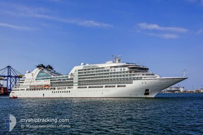
SEABOURN ENCORE
Passenger
Current Trip
| Trip Time | 13 h, 52 mins |
|---|---|
| Trip Distance | 209.60 nm |
| AVG Speed | 15.9 Knopen |
| MAX Speed | 18 Knopen |
| Diepgang | 6.8 M |
| AVG Wind | 7.3 knots |
| MAX Wind | 11.4 knots |
| MIN Temp | 13.7°C / 56.66°F |
| MAX Temp | 21.6°C / 70.88°F |
| Positie ontvangen | 16 h, 10 m geleden |
Current Position
| Lengtegraad | 31.72517° |
|---|---|
| Breedtegraat | 35.39271° |
| Status | Under way using engine |
| Snelheid | 17 Knopen |
| Koers | 327.4° |
| Gebied | Mediterranean Sea - Eastern Basin |
| Station | T-AIS |
| Positie ontvangen | 16 h, 10 m geleden |
Info
Information
The current position of SEABOURN ENCORE is in Mediterranean Sea - Eastern Basin with coordinates 35.39271° / 31.72517° as reported on 2024-05-14 20:56 by AIS to our vessel tracker app. The vessel's current speed is 17 Knopen and is currently inside the port of ANTALYA.
The vessel SEABOURN ENCORE (IMO: 9731171, MMSI: 311000464) is a Passenger It's sailing under the flag of [BS] Bahamas.
In this page you can find informations about the vessels current position, last detected port calls, and current voyage information. If the vessels is not in coverage by AIS you will find the latest position.
The current position of SEABOURN ENCORE is detected by our AIS receivers and we are not responsible for the reliability of the data. The last position was recorded while the vessel was in Coverage by the Ais receivers of our vessel tracking app.
The current draught of SEABOURN ENCORE as reported by AIS is 6.8 meters
Weather
| Temperature | 19.4°C / 66.92°F |
|---|---|
| Wind Speed | 7 knots |
| Direction | 110° ESE |
| Pressure | 1014.8 hPa |
| Humidity | 48.2 % |
| Cloud Coverage | 27 % |
Featured Company
Last Port Calls
| Port | Arrival | Departure | Time In Port |
|---|---|---|---|
| 2024-05-15 04:16 | |||
| 2024-05-14 04:01 | 2024-05-14 14:24 | 10 h | |
| 2024-05-12 02:07 | 2024-05-12 14:25 | 12 h | |
| 2024-05-11 03:58 | 2024-05-11 14:42 | 10 h | |
| 2024-05-09 03:50 | 2024-05-09 20:10 | 16 h | |
| 2024-05-08 03:55 | 2024-05-08 15:15 | 11 h | |
| 2024-05-07 03:40 | 2024-05-07 16:37 | 12 h | |
| 2024-05-05 01:48 | 2024-05-05 14:42 | 12 h | |
| 2024-05-01 04:22 | 2024-05-01 15:11 | 10 h | |
| 2024-04-30 05:24 | 2024-04-30 13:46 | 8 h |
Last Trips
| Origin | Departure | Destination | Arrival | Distance | |
|---|---|---|---|---|---|
| 2024-05-14 17:24 | 2024-05-15 07:16 | 209.60 nm | |||
| 2024-05-12 17:25 | 2024-05-14 07:01 | 567.77 nm | |||
| 2024-05-11 17:42 | 2024-05-12 05:07 | 156.45 nm | |||
| 2024-05-09 23:10 | 2024-05-11 06:58 | 276.69 nm | |||
| 2024-05-08 18:15 | 2024-05-09 06:50 | 142.94 nm | |||
| 2024-05-07 19:37 | 2024-05-08 06:55 | 114.09 nm | |||
| 2024-05-05 17:42 | 2024-05-07 06:40 | 211.10 nm | |||
| 2024-05-01 18:11 | 2024-05-05 04:48 | 532.01 nm | |||
| 2024-04-30 15:46 | 2024-05-01 07:22 | 197.86 nm | |||
| 2024-04-28 17:29 | 2024-04-30 07:24 | 414.42 nm |
Events
| Tijd | Evenement | Details | Positie / Bestemming | Info |
|---|---|---|---|---|
| 2024-05-15 04:32 | Stop beweging |
36.83629 / 30.61267
[TR] ANTALYA
|
Snelheid: 0.3 kn Koers: 32° |
|
| 2024-05-15 04:16 | Aankomsthaven |
|
36.83548 / 30.61563
[TR] ANTALYA
|
Snelheid: 2.7 kn Koers: 236° |
| 2024-05-14 21:06 | Status Changed | Default Under way using engine |
35.43167 / 31.69500
TR AYT
|
Snelheid: 17 kn Koers: 327.4° |
| 2024-05-14 20:56 | Buitenbereik |
35.39271 / 31.72517
Mediterranean Sea - Eastern Basin
TR AYT
|
Snelheid: 17 kn Koers: 327.4° |
|
| 2024-05-14 20:33 | Status Changed | Under way using engine Default |
35.29848 / 31.79609
TR AYT
|
Snelheid: 17 kn Koers: 328° |
| 2024-05-14 20:24 | Status Changed | Default Under way using engine |
35.26333 / 31.82167
TR AYT
|
Snelheid: 16.7 kn Koers: 327.9° |
| 2024-05-14 18:28 | Status Changed | Under way using engine Default |
34.81138 / 32.17148
TR AYT
|
Snelheid: 17 kn Koers: 325° |
| 2024-05-14 18:24 | Binnenbereik |
34.81138 / 32.17148
Mediterranean Sea - Eastern Basin
TR AYT
|
Snelheid: 16.6 kn Koers: 325.8° |
|
| 2024-05-14 17:22 | Status Changed | Default Under way using engine |
34.59770 / 32.41342
TR AYT
|
Snelheid: 16.7 kn Koers: 287.4° |
| 2024-05-14 17:16 | Buitenbereik |
34.58904 / 32.44615
Mediterranean Sea - Eastern Basin
TR AYT
|
Snelheid: 16.7 kn Koers: 287.4° |