

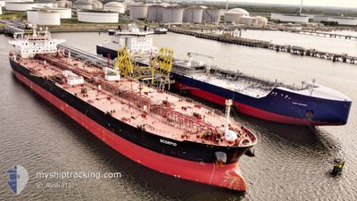
SCORPIO
Crude Oil Tanker

Current Trip
KHOR FAKKAN
| Time Travelled | 25 days |
|---|---|
| Remaining Time | --- |
| Distance Travelled | 65.72 nm |
| Remaining Distance | --- |
| AVG Speed | 15 Knopen |
| MAX Speed | 15 Knopen |
| AVG Wind | 7.6 knots |
| MAX Wind | 22 knots |
| MIN Temp | 19.1°C / 66.38°F |
| MAX Temp | 29.1°C / 84.38°F |
| Diepgang | 8.5 M |
| Positie ontvangen | 4 d geleden |
Current Position
| Lengtegraad | --- |
|---|---|
| Breedtegraat | --- |
| Status | At anchor |
| Snelheid | 0.1 Knopen |
| Koers | --- |
| Gebied | Gulf of Oman |
| Station | T-AIS |
| Positie ontvangen | 4 d geleden |
Information
The current position of SCORPIO is in Gulf of Oman with coordinates 25.33549° / 56.56144° as reported on 2025-03-21 12:14 by AIS to our vessel tracker app. The vessel's current speed is 0.1 Knopen
The vessel SCORPIO (IMO: 9389071, MMSI: 319129600) is a Crude Oil Tanker that was built in 2009 ( 16 Jaar oud ). It's sailing under the flag of [KY] Cayman Is.
In this page you can find informations about the vessels current position, last detected port calls, and current voyage information. If the vessels is not in coverage by AIS you will find the latest position.
The current position of SCORPIO is detected by our AIS receivers and we are not responsible for the reliability of the data. The last position was recorded while the vessel was in Coverage by the Ais receivers of our vessel tracking app.
The current draught of SCORPIO as reported by AIS is 8.5 meters
Weather
| Temperature | 25.4°C / 77.72°F |
|---|---|
| Wind Speed | 3 knots |
| Direction | 165° SSE |
| Pressure | 1014.6 hPa |
| Humidity | 65.9 % |
| Cloud Coverage | 2 % |


Featured Company
Last Port Calls
| Port | Arrival | Departure | Time In Port |
|---|---|---|---|
| 2025-02-26 20:39 | 2025-03-01 02:46 | 2 d | |
| 2025-02-13 11:15 | 2025-02-13 20:01 | 8 h | |
| 2025-02-01 09:21 | 2025-02-07 13:48 | 6 d | |
| 2025-01-21 09:27 | 2025-01-22 19:15 | 1 d |
Last Trips
| Origin | Departure | Destination | Arrival | Distance | |
|---|---|---|---|---|---|
| 2025-02-07 13:48 | 2025-02-26 20:39 | 4476.60 nm | |||
| 2025-02-07 13:48 | 2025-02-13 11:15 | 1641.83 nm | |||
| 2025-01-22 19:15 | 2025-02-01 09:21 | 989.16 nm | |||
| 2024-11-24 09:38 | 2025-01-21 09:27 | 10972.01 nm |
Events
| Tijd | Evenement | Details | Positie / Bestemming | Info |
|---|---|---|---|---|
| 2025-03-21 12:17 | Status Changed | Default At anchor |
25.33548 / 56.56142
KHOR FAKKAN
|
Snelheid: 0.1 kn Koers: 511° |
| 2025-03-21 12:14 | Buitenbereik |
25.33549 / 56.56144
Gulf of Oman
|
Snelheid: 0.1 kn Koers: 221.3° |
|
| 2025-03-21 11:47 | Status Changed | At anchor Default |
25.33555 / 56.56136
KHOR FAKKAN
|
Snelheid: Koers: 349° |
| 2025-03-21 11:41 | Status Changed | Default At anchor |
25.33552 / 56.56132
KHOR FAKKAN
|
Snelheid: Koers: 349° |
| 2025-03-21 10:13 | Status Changed | At anchor Default |
25.33550 / 56.56067
KHOR FAKKAN
|
Snelheid: Koers: 8° |
| 2025-03-21 10:07 | Status Changed | Default At anchor |
25.33547 / 56.56064
KHOR FAKKAN
|
Snelheid: Koers: 9° |
| 2025-03-21 09:58 | Status Changed | At anchor Default |
25.33551 / 56.56060
KHOR FAKKAN
|
Snelheid: Koers: 11° |
| 2025-03-21 09:52 | Status Changed | Default At anchor |
25.33553 / 56.56049
KHOR FAKKAN
|
Snelheid: Koers: 13° |
| 2025-03-21 09:43 | Status Changed | At anchor Default |
25.33550 / 56.56029
KHOR FAKKAN
|
Snelheid: Koers: 24° |
| 2025-03-21 09:37 | Status Changed | Default At anchor |
25.33555 / 56.56012
KHOR FAKKAN
|
Snelheid: Koers: 24° |