
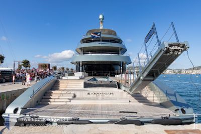
SAVANNAH
Pleasure Craft
Current Trip
GI - GIB
| Time Travelled | 6 days |
|---|---|
| Remaining Time | --- |
| Distance Travelled | 998.63 nm |
| Remaining Distance | --- |
| AVG Speed | 14 Knopen |
| MAX Speed | 16.2 Knopen |
| AVG Wind | 11.3 knots |
| MAX Wind | 15.6 knots |
| MIN Temp | 22.8°C / 73.04°F |
| MAX Temp | 31.6°C / 88.88°F |
| Diepgang | 3.9 M |
| Positie ontvangen | 3 d geleden |
Current Position
| Lengtegraad | -61.79328° |
|---|---|
| Breedtegraat | 28.04484° |
| Status | Under way using engine |
| Snelheid | 12.4 Knopen |
| Koers | 81.6° |
| Gebied | North Atlantic Ocean |
| Station | T-AIS |
| Positie ontvangen | 3 d geleden |
Info
Information
The current position of SAVANNAH is in North Atlantic Ocean with coordinates 28.04484° / -61.79328° as reported on 2024-05-20 02:59 by AIS to our vessel tracker app. The vessel's current speed is 12.4 Knopen
The vessel SAVANNAH (IMO: 1012517, MMSI: 538071192) is a Pleasure Craft It's sailing under the flag of [MH] Marshall Is.
In this page you can find informations about the vessels current position, last detected port calls, and current voyage information. If the vessels is not in coverage by AIS you will find the latest position.
The current position of SAVANNAH is detected by our AIS receivers and we are not responsible for the reliability of the data. The last position was recorded while the vessel was in Coverage by the Ais receivers of our vessel tracking app.
The current draught of SAVANNAH as reported by AIS is 3.9 meters
Weather
| Temperature | 22.9°C / 73.22°F |
|---|---|
| Wind Speed | 4 knots |
| Direction | 266° W |
| Pressure | 1016.5 hPa |
| Humidity | 82 % |
| Cloud Coverage | 100 % |
Featured Company
Last Port Calls
| Port | Arrival | Departure | Time In Port |
|---|---|---|---|
| 2024-05-09 19:13 | 2024-05-16 21:29 | 7 d | |
| 2024-04-11 15:01 | 2024-05-09 14:50 | 27 d | |
| 2024-04-11 14:19 | 2024-04-11 14:34 | 15 m | |
| 2024-04-10 21:44 | 2024-04-11 14:09 | 16 h | |
| 2024-04-01 15:20 | 2024-04-02 14:31 | 23 h | |
| 2024-03-22 13:14 | 2024-03-24 19:28 | 2 d | |
| 2024-03-15 18:40 | |||
| 2024-03-05 20:09 | 2024-03-05 20:23 | 13 m | |
| 2024-03-05 20:06 |
Most Visited Ports (Last year)
| Port | Arrivals | |
|---|---|---|
| 5 | ||
| 4 | ||
| 4 | ||
| 4 | ||
| 1 | ||
| 1 |
Last Trips
| Origin | Departure | Destination | Arrival | Distance | |
|---|---|---|---|---|---|
| 2024-05-09 10:50 | 2024-05-09 15:13 | 30.52 nm | |||
| 2024-04-11 10:34 | 2024-04-11 11:01 | 1.20 nm | |||
| 2024-04-11 10:09 | 2024-04-11 10:19 | 0.72 nm | |||
| 2024-04-02 10:31 | 2024-04-10 17:44 | 714.28 nm | |||
| 2024-03-24 15:28 | 2024-04-01 11:20 | 237.10 nm | |||
| 2024-03-15 14:40 | 2024-03-22 09:14 | 206.31 nm | |||
| 2024-03-05 15:06 | 2024-03-05 15:09 | 0.11 nm |
Events
| Tijd | Evenement | Details | Positie / Bestemming | Info |
|---|---|---|---|---|
| 2024-05-20 02:59 | Buitenbereik |
28.04484 / -61.79328
North Atlantic Ocean
GI - GIB
|
Snelheid: 12.4 kn Koers: 81.6° |
|
| 2024-05-20 01:21 | Binnenbereik |
27.98972 / -62.16708
North Atlantic Ocean
GI - GIB
|
Snelheid: 12.5 kn Koers: 81.2° |
|
| 2024-05-19 23:29 | Buitenbereik |
27.92652 / -62.59914
North Atlantic Ocean
GI - GIB
|
Snelheid: 12.4 kn Koers: 83.7° |
|
| 2024-05-19 21:19 | Gevonden in zee | High seas of the North Atlantic Ocean |
27.85462 / -63.08302
North Atlantic Ocean
GI - GIB
|
Snelheid: 11.8 kn Koers: 80.9° |
| 2024-05-19 21:19 | Binnenbereik |
27.85462 / -63.08302
North Atlantic Ocean
GI - GIB
|
Snelheid: 11.8 kn Koers: 80.9° |
|
| 2024-05-17 03:41 | Buitenbereik |
26.10310 / -78.58536
North Atlantic Ocean
GI - GIB
|
Snelheid: 13.8 kn Koers: 114.8° |
|
| 2024-05-16 23:20 | Wijzig zee gebeid | Bahamas part of the North Atlantic Ocean United States part of the North Atlantic Ocean |
25.94750 / -79.67221
North Atlantic Ocean
GI - GIB
|
Snelheid: 15.9 kn Koers: 64.5° |
| 2024-05-16 21:29 | Vertrekhaven |
|
25.76163 / -80.12812
GI - GIB
|
Snelheid: 11.8 kn Koers: 114° |
| 2024-05-16 21:11 | Start beweging |
25.78401 / -80.18116
[US] MIAMI
|
Snelheid: 3.1 kn Koers: 131° |
|
| 2024-05-16 20:37 | Destination Changed | GI - GIB US - MIA |
25.78652 / -80.18029
[US] MIAMI
|
Snelheid: Koers: 359° |