
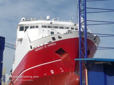
SARMIENTO DE GAMBOA
Research/Survey Vessel
Current Trip
| Trip Time | 14 days |
|---|---|
| Trip Distance | 1787.86 nm |
| AVG Speed | 5.4 Knopen |
| MAX Speed | 11.6 Knopen |
| Diepgang | 7 M |
| AVG Wind | 14.2 knots |
| MAX Wind | 26.6 knots |
| MIN Temp | 18.5°C / 65.3°F |
| MAX Temp | 22.6°C / 72.68°F |
| Positie ontvangen | 4 m geleden |
Current Position
| Lengtegraad | -16.24488° |
|---|---|
| Breedtegraat | 28.46104° |
| Status | Moored |
| Snelheid | |
| Koers | 196° |
| Gebied | North Atlantic Ocean |
| Station | T-AIS |
| Positie ontvangen | 4 m geleden |
Info
Information
The current position of SARMIENTO DE GAMBOA is in North Atlantic Ocean with coordinates 28.46104° / -16.24488° as reported on 2024-06-14 22:29 by AIS to our vessel tracker app. The vessel's current speed is 0 Knopen and is currently inside the port of TENERIFE.
The vessel SARMIENTO DE GAMBOA (IMO: 9335238, MMSI: 224713000) is a Research/Survey Vessel that was built in 2007 ( 17 Jaar oud ). It's sailing under the flag of [ES] Spain.
In this page you can find informations about the vessels current position, last detected port calls, and current voyage information. If the vessels is not in coverage by AIS you will find the latest position.
The current position of SARMIENTO DE GAMBOA is detected by our AIS receivers and we are not responsible for the reliability of the data. The last position was recorded while the vessel was in Coverage by the Ais receivers of our vessel tracking app.
The current draught of SARMIENTO DE GAMBOA as reported by AIS is 7 meters
Weather
| Temperature | 19°C / 66.2°F |
|---|---|
| Wind Speed | 11 knots |
| Direction | 4° N |
| Pressure | 1021.4 hPa |
| Humidity | 76.7 % |
| Cloud Coverage | 22 % |
Featured Company
Last Trips
| Origin | Departure | Destination | Arrival | Distance | |
|---|---|---|---|---|---|
| 2024-05-31 08:24 | 2024-06-14 16:10 | 1787.86 nm | |||
| 2024-05-07 12:51 | 2024-05-27 08:17 | 2520.55 nm | |||
| 2024-04-28 09:16 | 2024-05-01 18:51 | 712.20 nm | |||
| 2024-04-15 10:15 | 2024-04-27 08:29 | 1018.80 nm | |||
| 2024-03-30 10:33 | 2024-04-14 08:59 | 1114.28 nm |
Events
| Tijd | Evenement | Details | Positie / Bestemming | Info |
|---|---|---|---|---|
| 2024-06-14 15:47 | Status Changed | Moored Under way using engine |
28.46107 / -16.24488
[ES] TENERIFE
|
Snelheid: Koers: 196° |
| 2024-06-14 15:23 | Stop beweging |
28.46092 / -16.24504
[ES] TENERIFE
|
Snelheid: 0.3 kn Koers: 189° |
|
| 2024-06-14 15:10 | Aankomsthaven |
|
28.45356 / -16.24684
[ES] TENERIFE
|
Snelheid: 6 kn Koers: 316.3° |
| 2024-06-14 10:31 | Status Changed | Under way using engine Default |
28.27602 / -15.96292
TENERIFE
|
Snelheid: 5.5 kn Koers: 42° |
| 2024-06-14 10:15 | Status Changed | Default Under way using engine |
28.25779 / -15.98077
TENERIFE
|
Snelheid: 5.6 kn Koers: 38.8° |
| 2024-06-14 10:09 | Status Changed | Under way using engine Default |
28.25034 / -15.98754
TENERIFE
|
Snelheid: 5.4 kn Koers: 38° |
| 2024-06-14 10:07 | Status Changed | Default Under way using engine |
28.24794 / -15.98977
TENERIFE
|
Snelheid: 5.3 kn Koers: 43° |
| 2024-06-14 09:52 | Status Changed | Under way using engine Default |
28.23094 / -16.00708
TENERIFE
|
Snelheid: 5.8 kn Koers: 42° |
| 2024-06-14 09:47 | Status Changed | Default Under way using engine |
28.22527 / -16.01298
TENERIFE
|
Snelheid: 5.2 kn Koers: 40° |
| 2024-06-14 09:31 | Status Changed | Under way using engine Default |
28.20678 / -16.03110
TENERIFE
|
Snelheid: 5.1 kn Koers: 40° |