
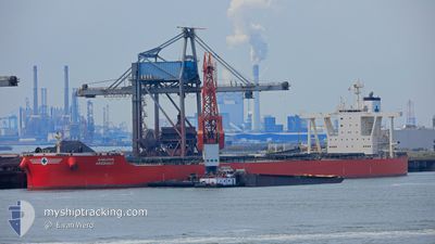
SAMJOHN ARGONAUT
Cargo
Current Trip
GN BRP
| Time Travelled | 29 days |
|---|---|
| Remaining Time | --- |
| Distance Travelled | 9081.98 nm |
| Remaining Distance | --- |
| AVG Speed | 13.3 Knopen |
| MAX Speed | 17.5 Knopen |
| AVG Wind | 10.1 knots |
| MAX Wind | 23 knots |
| MIN Temp | 19.6°C / 67.28°F |
| MAX Temp | 28.5°C / 83.3°F |
| Diepgang | 10.9 M |
| Positie ontvangen | 4 d geleden |
Current Position
| Lengtegraad | --- |
|---|---|
| Breedtegraat | --- |
| Status | Under way using engine |
| Snelheid | 15.3 Knopen |
| Koers | 325.2° |
| Gebied | South Atlantic Ocean |
| Station | T-AIS |
| Positie ontvangen | 4 d geleden |
Info
Information
The current position of SAMJOHN ARGONAUT is in South Atlantic Ocean with coordinates -33.74969° / 17.50356° as reported on 2026-01-05 19:40 by AIS to our vessel tracker app. The vessel's current speed is 15.3 Knopen
The vessel SAMJOHN ARGONAUT (IMO: 9745938, MMSI: 538007305) is a Cargo It's sailing under the flag of [MH] Marshall Is.
In this page you can find informations about the vessels current position, last detected port calls, and current voyage information. If the vessels is not in coverage by AIS you will find the latest position.
The current position of SAMJOHN ARGONAUT is detected by our AIS receivers and we are not responsible for the reliability of the data. The last position was recorded while the vessel was in Coverage by the Ais receivers of our vessel tracking app.
The current draught of SAMJOHN ARGONAUT as reported by AIS is 10.9 meters
Weather
| Temperature | 23.8°C / 74.84°F |
|---|---|
| Wind Speed | 8 knots |
| Direction | 186° S |
| Pressure | 1011.6 hPa |
| Humidity | 70.4 % |
| Cloud Coverage | 80 % |
Featured Company
Last Port Calls
| Port | Arrival | Departure | Time In Port |
|---|---|---|---|
| 2025-12-05 20:40 | 2025-12-12 00:07 | 6 d |
Most Visited Ports (Last year)
| Port | Arrivals | |
|---|---|---|
| 1 | ||
| 1 | ||
| 1 | ||
| 1 | ||
| 1 | ||
| 1 |
Last Trips
| Origin | Departure | Destination | Arrival | Distance | |
|---|---|---|---|---|---|
| 2025-10-22 01:48 | 2025-12-05 20:40 | 6945.17 nm |
Events
| Tijd | Evenement | Details | Positie / Bestemming | Info |
|---|---|---|---|---|
| 2026-01-05 19:46 | Status Changed | Default Under way using engine |
-33.72654 / 17.48455
GN BRP
|
Snelheid: 15.3 kn Koers: 325.2° |
| 2026-01-05 19:40 | Status Changed | Under way using engine Default |
-33.74969 / 17.50356
GN BRP
|
Snelheid: 15.1 kn Koers: 324° |
| 2026-01-05 19:40 | Buitenbereik |
-33.74969 / 17.50356
South Atlantic Ocean
GN BRP
|
Snelheid: 15.3 kn Koers: 325.2° |
|
| 2026-01-05 19:19 | Status Changed | Default Under way using engine |
-33.82104 / 17.56272
GN BRP
|
Snelheid: 14.8 kn Koers: 327.6° |
| 2026-01-05 19:04 | Status Changed | Under way using engine Default |
-33.87294 / 17.60173
GN BRP
|
Snelheid: 14.7 kn Koers: 327° |
| 2026-01-05 18:52 | Status Changed | Default Under way using engine |
-33.91576 / 17.63535
GN BRP
|
Snelheid: 14.8 kn Koers: 323.9° |
| 2026-01-05 17:11 | Status Changed | Under way using engine Default |
-34.26780 / 17.93519
GN BRP
|
Snelheid: 15.6 kn Koers: 324° |
| 2026-01-05 16:59 | Status Changed | Default Under way using engine |
-34.31238 / 17.97169
GN BRP
|
Snelheid: 15.6 kn Koers: 326° |
| 2026-01-05 16:43 | Status Changed | Under way using engine Default |
-34.37163 / 18.01925
GN BRP
|
Snelheid: 15.7 kn Koers: 327° |
| 2026-01-05 16:22 | Status Changed | Default Under way using engine |
-34.44565 / 18.07861
GN BRP
|
Snelheid: 15.7 kn Koers: 325.6° |