
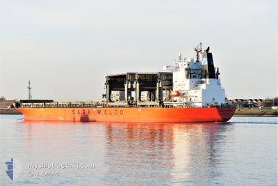
SAGA NAVIGATOR
General Cargo
Current Trip
| Trip Time | 25 days |
|---|---|
| Trip Distance | 6249.04 nm |
| AVG Speed | 10 Knopen |
| MAX Speed | 13.7 Knopen |
| Diepgang | 11.8 M |
| AVG Wind | 12 knots |
| MAX Wind | 27.8 knots |
| MIN Temp | 6.6°C / 43.88°F |
| MAX Temp | 27.3°C / 81.14°F |
| Positie ontvangen | 7 d geleden |
Current Position
| Lengtegraad | --- |
|---|---|
| Breedtegraat | --- |
| Status | Moored |
| Snelheid | |
| Koers | 59° |
| Gebied | North Sea |
| Station | T-AIS |
| Positie ontvangen | 7 d geleden |
Info
Information
The current position of SAGA NAVIGATOR is in North Sea with coordinates 51.46294° / 3.69199° as reported on 2024-12-04 08:50 by AIS to our vessel tracker app. The vessel's current speed is 0 Knopen and is currently inside the port of VLISSINGEN.
The vessel SAGA NAVIGATOR (IMO: 9371062, MMSI: 477897700) is a General Cargo that was built in 2007 ( 17 Jaar oud ). It's sailing under the flag of [HK] Hong Kong.
In this page you can find informations about the vessels current position, last detected port calls, and current voyage information. If the vessels is not in coverage by AIS you will find the latest position.
The current position of SAGA NAVIGATOR is detected by our AIS receivers and we are not responsible for the reliability of the data. The last position was recorded while the vessel was in Coverage by the Ais receivers of our vessel tracking app.
The current draught of SAGA NAVIGATOR as reported by AIS is 11.8 meters
Weather
| Temperature | 5.5°C / 41.9°F |
|---|---|
| Wind Speed | 6 knots |
| Direction | 226° SW |
| Pressure | 1025 hPa |
| Humidity | 71.9 % |
| Cloud Coverage | 72 % |
Featured Company
Last Port Calls
| Port | Arrival | Departure | Time In Port |
|---|---|---|---|
| 2024-12-04 00:43 | |||
| 2024-11-07 07:09 | 2024-11-08 15:25 | 1 d | |
| 2024-11-04 11:49 | 2024-11-05 23:28 | 1 d | |
| 2024-10-06 13:04 | 2024-10-07 20:12 | 1 d | |
| 2024-10-02 09:43 |
Most Visited Ports (Last year)
| Port | Arrivals | |
|---|---|---|
| 3 | ||
| 3 | ||
| 2 | ||
| 2 | ||
| 2 | ||
| 2 |
Last Trips
| Origin | Departure | Destination | Arrival | Distance | |
|---|---|---|---|---|---|
| 2024-11-08 12:25 | 2024-12-04 01:43 | 6249.04 nm | |||
| 2024-11-05 20:28 | 2024-11-07 04:09 | 184.59 nm | |||
| 2024-10-07 22:12 | 2024-11-04 08:49 | 7151.22 nm | |||
| 2024-10-02 11:43 | 2024-10-06 15:04 | 1135.39 nm |
Events
| Tijd | Evenement | Details | Positie / Bestemming | Info |
|---|---|---|---|---|
| 2024-12-04 08:50 | Status Changed | Default Moored |
51.46294 / 3.69199
[NL] VLISSINGEN
|
Snelheid: Koers: 59° |
| 2024-12-04 08:50 | Buitenbereik |
51.46294 / 3.69199
North Sea
[NL] VLISSINGEN
|
Snelheid: Koers: 232.4° |
|
| 2024-12-04 05:14 | Status Changed | Moored Under way using engine |
51.46293 / 3.69201
[NL] VLISSINGEN
|
Snelheid: Koers: 59° |
| 2024-12-04 01:10 | Stop beweging |
51.46257 / 3.69175
[NL] VLISSINGEN
|
Snelheid: 0.3 kn Koers: 59° |
|
| 2024-12-04 00:43 | Aankomsthaven |
|
51.44813 / 3.67207
[NL] VLISSINGEN
|
Snelheid: 7.9 kn Koers: 40.6° |
| 2024-12-03 23:44 | Wijzig zee gebeid | Dutch part of the North Sea Belgian part of the North Sea |
51.40548 / 3.34470
North Sea
NLVLI
|
Snelheid: 12.6 kn Koers: 89.5° |
| 2024-12-03 19:29 | Wijzig zee gebeid | Belgian part of the North Sea French part of the North Sea |
51.33071 / 2.36389
North Sea
NLVLI
|
Snelheid: 6.7 kn Koers: 70.1° |
| 2024-12-03 13:56 | Wijzig zee gebeid | French part of the North Sea French part of the English Channel |
51.00420 / 1.61745
North Sea
NLVLI
|
Snelheid: 7.2 kn Koers: 44.1° |
| 2024-12-03 12:16 | ETA Changed | 2024/12/03 22:00 2024/12/03 19:00 |
50.84300 / 1.43680
NLVLI
|
Snelheid: 6.6 kn Koers: 20.6° |
| 2024-12-03 09:34 | Status Changed | Under way using engine Default |
50.52265 / 1.04628
NLVLI
|
Snelheid: 10.7 kn Koers: 57° |