
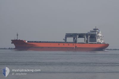
SAGA FJORD
Cargo/Container Ship
Current Trip
| Time Travelled | 12 days |
|---|---|
| Remaining Time | 1 day |
| Distance Travelled | 3739.27 nm |
| Remaining Distance | 536.54 nm |
| AVG Speed | 12.2 Knopen |
| MAX Speed | 15.9 Knopen |
| AVG Wind | 14 knots |
| MAX Wind | 33.3 knots |
| MIN Temp | 5.1°C / 41.18°F |
| MAX Temp | 19.1°C / 66.38°F |
| Diepgang | 10.7 M |
| Positie ontvangen | 9 d geleden |
Current Position
| Lengtegraad | -4.27380° |
|---|---|
| Breedtegraat | 58.75933° |
| Status | Under way using engine |
| Snelheid | 14.3 Knopen |
| Koers | 279.1° |
| Gebied | North Atlantic Ocean |
| Station | T-AIS |
| Positie ontvangen | 9 d geleden |
Info
Information
The current position of SAGA FJORD is in North Atlantic Ocean with coordinates 58.75933° / -4.27380° as reported on 2024-05-02 09:27 by AIS to our vessel tracker app. The vessel's current speed is 14.3 Knopen and is heading at the port of MOREHEAD CITY. The estimated time of arrival as calculated by MyShipTracking vessel tracking app is 2024-05-13 14:19 LT
The vessel SAGA FJORD (IMO: 9613862, MMSI: 477319400) is a Cargo/Container Ship that was built in 2013 ( 11 Jaar oud ). It's sailing under the flag of [HK] Hong Kong.
In this page you can find informations about the vessels current position, last detected port calls, and current voyage information. If the vessels is not in coverage by AIS you will find the latest position.
The current position of SAGA FJORD is detected by our AIS receivers and we are not responsible for the reliability of the data. The last position was recorded while the vessel was in Coverage by the Ais receivers of our vessel tracking app.
The current draught of SAGA FJORD as reported by AIS is 10.7 meters
Weather
| Temperature | 17.7°C / 63.86°F |
|---|---|
| Wind Speed | 20 knots |
| Direction | 355° N |
| Pressure | 1000.4 hPa |
| Humidity | 82.2 % |
| Cloud Coverage | 89 % |
Featured Company
Last Port Calls
| Port | Arrival | Departure | Time In Port |
|---|---|---|---|
| 2024-04-17 04:15 | 2024-04-29 04:00 | 11 d | |
| 2024-04-10 15:11 | 2024-04-13 17:26 | 3 d | |
| 2024-03-07 04:54 | 2024-03-08 11:47 | 1 d | |
| 2024-03-04 02:40 | 2024-03-05 16:54 | 1 d |
Most Visited Ports (Last year)
| Port | Arrivals | |
|---|---|---|
| 3 | ||
| 2 | ||
| 2 | ||
| 2 | ||
| 2 | ||
| 2 |
Last Trips
| Origin | Departure | Destination | Arrival | Distance | |
|---|---|---|---|---|---|
| 2024-04-13 19:26 | 2024-04-17 06:15 | 880.24 nm | |||
| 2024-03-08 08:47 | 2024-04-10 17:11 | 6363.62 nm | |||
| 2024-03-05 13:54 | 2024-03-07 01:54 | 164.12 nm | |||
| 2024-02-05 19:52 | 2024-03-03 23:40 | 6630.98 nm |
Events
| Tijd | Evenement | Details | Positie / Bestemming | Info |
|---|---|---|---|---|
| 2024-05-02 09:34 | Status Changed | Default Under way using engine |
58.76294 / -4.33096
MOREHEAD CITY NC
|
Snelheid: 14.3 kn Koers: 279.1° |
| 2024-05-02 09:27 | Buitenbereik |
58.75933 / -4.27380
North Atlantic Ocean
MOREHEAD CITY NC
|
Snelheid: 14.3 kn Koers: 279.1° |
|
| 2024-05-02 07:35 | Wijzig zee gebeid | United Kingdom part of the North Atlantic Ocean United Kingdom part of the North Sea |
58.72198 / -3.42773
North Atlantic Ocean
MOREHEAD CITY NC
|
Snelheid: 15.1 kn Koers: 276.1° |
| 2024-05-02 05:03 | Status Changed | Under way using engine Default |
58.68453 / -2.27597
MOREHEAD CITY NC
|
Snelheid: 13.3 kn Koers: 274° |
| 2024-05-02 05:02 | Status Changed | Default Under way using engine |
58.68432 / -2.27018
MOREHEAD CITY NC
|
Snelheid: 13.3 kn Koers: 274.5° |
| 2024-05-02 04:57 | Status Changed | Under way using engine Default |
58.68283 / -2.23229
MOREHEAD CITY NC
|
Snelheid: 13.3 kn Koers: 274° |
| 2024-05-02 04:55 | Status Changed | Default Under way using engine |
58.68217 / -2.21566
MOREHEAD CITY NC
|
Snelheid: 13.3 kn Koers: 274° |
| 2024-05-02 04:27 | Status Changed | Under way using engine Default |
58.67448 / -2.01822
MOREHEAD CITY NC
|
Snelheid: 13.4 kn Koers: 275° |
| 2024-05-02 04:26 | Status Changed | Default Under way using engine |
58.67427 / -2.01357
MOREHEAD CITY NC
|
Snelheid: 13.4 kn Koers: 274.3° |
| 2024-05-02 04:19 | Status Changed | Under way using engine Default |
58.67224 / -1.96327
MOREHEAD CITY NC
|
Snelheid: 13.4 kn Koers: 274° |