
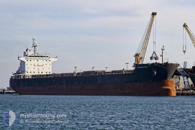
SAFESEA SINDOOR
Bulk Carrier
Current Trip
| Time Travelled | 20 days |
|---|---|
| Remaining Time | 9 h, 3 mins |
| Distance Travelled | 3622.61 nm |
| Remaining Distance | 96.00 nm |
| AVG Speed | 8.9 Knopen |
| MAX Speed | 12.9 Knopen |
| AVG Wind | 8.3 knots |
| MAX Wind | 45 knots |
| MIN Temp | 23°C / 73.4°F |
| MAX Temp | 28.7°C / 83.66°F |
| Diepgang | 14.5 M |
| Positie ontvangen | 4 d geleden |
Current Position
| Lengtegraad | --- |
|---|---|
| Breedtegraat | --- |
| Status | Under way using engine |
| Snelheid | 10.2 Knopen |
| Koers | 296.4° |
| Gebied | Malacca Strait |
| Station | T-AIS |
| Positie ontvangen | 4 d geleden |
Info
Information
The current position of SAFESEA SINDOOR is in Malacca Strait with coordinates 5.66263° / 97.64611° as reported on 2025-12-07 05:03 by AIS to our vessel tracker app. The vessel's current speed is 10.2 Knopen and is heading at the port of ENNORE. The estimated time of arrival as calculated by MyShipTracking vessel tracking app is 2025-12-12 05:05 LT
The vessel SAFESEA SINDOOR (IMO: 9461063, MMSI: 538007308) is a Bulk Carrier that was built in 2010 ( 15 Jaar oud ). It's sailing under the flag of [MH] Marshall Is.
In this page you can find informations about the vessels current position, last detected port calls, and current voyage information. If the vessels is not in coverage by AIS you will find the latest position.
The current position of SAFESEA SINDOOR is detected by our AIS receivers and we are not responsible for the reliability of the data. The last position was recorded while the vessel was in Coverage by the Ais receivers of our vessel tracking app.
The current draught of SAFESEA SINDOOR as reported by AIS is 14.5 meters
Weather
| Temperature | 26.3°C / 79.34°F |
|---|---|
| Wind Speed | 16 knots |
| Direction | 41° NE |
| Pressure | 1013.5 hPa |
| Humidity | 68.2 % |
| Cloud Coverage | 49 % |
Featured Company
Last Port Calls
| Port | Arrival | Departure | Time In Port |
|---|---|---|---|
| 2025-11-21 06:16 | |||
| 2025-10-20 10:54 | 2025-10-23 23:58 | 3 d |
Most Visited Ports (Last year)
| Port | Arrivals | |
|---|---|---|
| 2 | ||
| 2 | ||
| 1 | ||
| 1 | ||
| 1 | ||
| 1 |
Last Trips
| Origin | Departure | Destination | Arrival | Distance | |
|---|---|---|---|---|---|
| 2025-09-30 00:19 | 2025-10-20 10:54 | 4331.93 nm |
Events
| Tijd | Evenement | Details | Positie / Bestemming | Info |
|---|---|---|---|---|
| 2025-12-07 05:07 | Status Changed | Default Under way using engine |
5.66878 / 97.63403
IN ENR
|
Snelheid: 10.2 kn Koers: 296.4° |
| 2025-12-07 05:03 | Buitenbereik |
5.66263 / 97.64611
Malacca Strait
IN ENR
|
Snelheid: 10.2 kn Koers: 296.4° |
|
| 2025-12-07 01:15 | Status Changed | Under way using engine Default |
5.34861 / 98.22010
IN ENR
|
Snelheid: 10.7 kn Koers: 310° |
| 2025-12-07 01:10 | Status Changed | Default Under way using engine |
5.33706 / 98.23334
IN ENR
|
Snelheid: 10.8 kn Koers: 310° |
| 2025-12-07 01:06 | Gevonden in zee | Indonesian part of the Malacca Strait |
5.33057 / 98.24103
Malacca Strait
IN ENR
|
Snelheid: 10.8 kn Koers: 310° |
| 2025-12-07 01:06 | Status Changed | Under way using engine Default |
5.33057 / 98.24103
IN ENR
|
Snelheid: 10.8 kn Koers: 310° |
| 2025-12-07 01:06 | Binnenbereik |
5.33057 / 98.24103
Malacca Strait
IN ENR
|
Snelheid: 10.8 kn Koers: 310° |
|
| 2025-12-05 17:57 | Status Changed | Default Under way using engine |
2.17117 / 102.01939
IN ENR
|
Snelheid: 10.1 kn Koers: 311.3° |
| 2025-12-05 17:51 | Buitenbereik |
2.16084 / 102.03097
Malacca Strait
IN ENR
|
Snelheid: 10.1 kn Koers: 311.3° |
|
| 2025-12-05 17:48 | Status Changed | Under way using engine Default |
2.15531 / 102.03722
IN ENR
|
Snelheid: 10 kn Koers: 312° |