
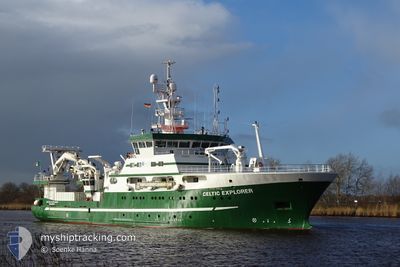
RV CELTIC EXPLORER
Research/Survey Vessel
Current Trip
| Time Travelled | 5 days |
|---|---|
| Remaining Time | --- |
| Distance Travelled | 384.22 nm |
| Remaining Distance | --- |
| AVG Speed | 9.4 Knopen |
| MAX Speed | 11.8 Knopen |
| AVG Wind | 16.4 knots |
| MAX Wind | 21 knots |
| MIN Temp | 11.9°C / 53.42°F |
| MAX Temp | 15.4°C / 59.72°F |
| Diepgang | 6.1 M |
| Positie ontvangen | 3 h, 35 m geleden |
Current Position
| Lengtegraad | -6.80839° |
|---|---|
| Breedtegraat | 48.43393° |
| Status | Under way using engine |
| Snelheid | 7.2 Knopen |
| Koers | 274.8° |
| Gebied | Celtic Sea |
| Station | T-AIS |
| Positie ontvangen | 3 h, 35 m geleden |
Info
Information
The current position of RV CELTIC EXPLORER is in Celtic Sea with coordinates 48.43393° / -6.80839° as reported on 2024-06-13 22:07 by AIS to our vessel tracker app. The vessel's current speed is 7.2 Knopen
The vessel RV CELTIC EXPLORER (IMO: 9244439, MMSI: 250487000) is a Research/Survey Vessel that was built in 2002 ( 22 Jaar oud ). It's sailing under the flag of [IE] Ireland.
In this page you can find informations about the vessels current position, last detected port calls, and current voyage information. If the vessels is not in coverage by AIS you will find the latest position.
The current position of RV CELTIC EXPLORER is detected by our AIS receivers and we are not responsible for the reliability of the data. The last position was recorded while the vessel was in Coverage by the Ais receivers of our vessel tracking app.
The current draught of RV CELTIC EXPLORER as reported by AIS is 6.1 meters
Weather
| Temperature | 14.9°C / 58.82°F |
|---|---|
| Wind Speed | 17 knots |
| Direction | 266° W |
| Pressure | 1008 hPa |
| Humidity | 86.1 % |
| Cloud Coverage | 31 % |
Featured Company
Last Port Calls
| Port | Arrival | Departure | Time In Port |
|---|---|---|---|
| 2024-06-06 05:57 | 2024-06-08 19:26 | 2 d | |
| 2024-05-30 12:14 | |||
| 2024-05-08 19:31 | 2024-05-10 08:56 | 1 d | |
| 2024-04-26 20:16 | 2024-05-01 22:19 | 5 d | |
| 2024-04-21 03:37 | 2024-04-22 17:14 | 1 d | |
| 2024-04-10 12:09 | 2024-04-12 22:36 | 2 d |
Last Trips
| Origin | Departure | Destination | Arrival | Distance | |
|---|---|---|---|---|---|
| 2024-05-30 12:14 | 2024-06-06 05:57 | 1682.15 nm | |||
| 2024-05-01 22:19 | 2024-05-08 19:31 | 1684.53 nm | |||
| 2024-04-22 17:14 | 2024-04-26 20:16 | 107.87 nm | |||
| 2024-04-12 22:36 | 2024-04-21 03:37 | 335.88 nm | |||
| 2024-03-18 18:19 | 2024-04-10 12:09 | 1705.26 nm |
Events
| Tijd | Evenement | Details | Positie / Bestemming | Info |
|---|---|---|---|---|
| 2024-06-13 22:07 | Buitenbereik |
48.43393 / -6.80839
Celtic Sea
GALWAY
|
Snelheid: 7.2 kn Koers: 274.8° |
|
| 2024-06-13 20:27 | Binnenbereik |
48.43456 / -6.47865
Celtic Sea
GALWAY
|
Snelheid: 7.8 kn Koers: 269.4° |
|
| 2024-06-13 18:42 | Buitenbereik |
48.43406 / -6.59365
Celtic Sea
GALWAY
|
Snelheid: 8.2 kn Koers: 273.1° |
|
| 2024-06-13 18:42 | Gevonden in zee | French part of the Celtic Sea |
48.43406 / -6.59365
Celtic Sea
GALWAY
|
Snelheid: 8.2 kn Koers: 273.1° |
| 2024-06-13 18:42 | Binnenbereik |
48.43406 / -6.59365
Celtic Sea
GALWAY
|
Snelheid: 8.2 kn Koers: 273.1° |
|
| 2024-06-09 20:37 | Buitenbereik |
51.22274 / -9.63138
Celtic Sea
GALWAY
|
Snelheid: 10.9 kn Koers: 140.9° |
|
| 2024-06-09 19:20 | Wijzig zee gebeid | Irish part of the Celtic Sea Irish part of the North Atlantic Ocean |
51.42213 / -9.85788
Celtic Sea
GALWAY
|
Snelheid: 11.7 kn Koers: 147.5° |
| 2024-06-09 18:08 | Start beweging | 6.52 nm, South East of BERE ISLAND |
51.54882 / -9.71909
GALWAY
|
Snelheid: 6.4 kn Koers: 258.1° |
| 2024-06-09 17:43 | Status Changed | Under way using engine At anchor |
51.54969 / -9.71472
GALWAY
|
Snelheid: 0.5 kn Koers: 310° |
| 2024-06-09 11:01 | Status Changed | At anchor Under way using engine |
51.54980 / -9.71487
GALWAY
|
Snelheid: 0.4 kn Koers: 263° |