
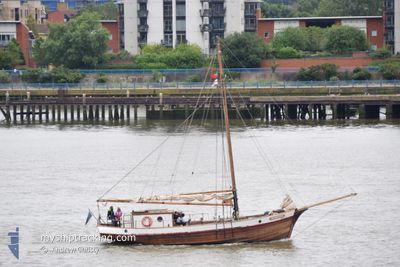
RUNBJARN
Sailing
Current Trip
| Trip Time | 10 h, 7 mins |
|---|---|
| Trip Distance | 42.63 nm |
| AVG Speed | 5.4 Knopen |
| MAX Speed | 6.8 Knopen |
| Diepgang | --- |
| AVG Wind | 10.8 knots |
| MAX Wind | 12 knots |
| MIN Temp | 8.3°C / 46.94°F |
| MAX Temp | 9.6°C / 49.28°F |
| Positie ontvangen | 3 h, 58 m geleden |
Current Position
| Lengtegraad | --- |
|---|---|
| Breedtegraat | --- |
| Status | Default |
| Snelheid | |
| Koers | --- |
| Gebied | Gulf of Finland |
| Station | T-AIS |
| Positie ontvangen | 3 h, 58 m geleden |
Info
Information
The current position of RUNBJARN is in Gulf of Finland with coordinates 59.45294° / 24.73688° as reported on 2024-12-30 11:03 by AIS to our vessel tracker app. The vessel's current speed is 0 Knopen and is currently inside the port of HUNDIPEA.
The vessel RUNBJARN (MMSI: 276002810) is a Sailing It's sailing under the flag of [EE] Estonia.
In this page you can find informations about the vessels current position, last detected port calls, and current voyage information. If the vessels is not in coverage by AIS you will find the latest position.
The current position of RUNBJARN is detected by our AIS receivers and we are not responsible for the reliability of the data. The last position was recorded while the vessel was in Coverage by the Ais receivers of our vessel tracking app.
Weather
| Temperature | 2.5°C / 36.5°F |
|---|---|
| Wind Speed | 20 knots |
| Direction | 285° WNW |
| Pressure | 1000.7 hPa |
| Humidity | 70.6 % |
| Cloud Coverage | 100 % |
Featured Company
Last Port Calls
| Port | Arrival | Departure | Time In Port |
|---|---|---|---|
| 2024-10-13 17:25 | |||
| 2024-10-12 14:03 | 2024-10-13 07:18 | 17 h | |
| 2024-10-11 17:37 | 2024-10-12 10:33 | 16 h | |
| 2024-10-10 15:31 | 2024-10-11 08:36 | 17 h | |
| 2024-10-10 14:54 | 2024-10-10 15:21 | 27 m | |
| 2024-10-05 16:05 | 2024-10-10 14:30 | 4 d | |
| 2024-10-05 15:23 | 2024-10-05 15:30 | 7 m | |
| 2024-10-05 13:23 |
Last Trips
| Origin | Departure | Destination | Arrival | Distance | |
|---|---|---|---|---|---|
| 2024-10-13 10:18 | 2024-10-13 20:25 | 42.63 nm | |||
| 2024-10-12 13:33 | 2024-10-12 17:03 | 16.00 nm | |||
| 2024-10-11 11:36 | 2024-10-11 20:37 | 51.60 nm | |||
| 2024-10-10 18:21 | 2024-10-10 18:31 | 0.78 nm | |||
| 2024-10-10 17:30 | 2024-10-10 17:54 | 1.50 nm | |||
| 2024-10-05 18:30 | 2024-10-05 19:05 | 1.34 nm | |||
| 2024-10-05 16:23 | 2024-10-05 18:23 | 3.29 nm |
Events
| Tijd | Evenement | Details | Positie / Bestemming | Info |
|---|---|---|---|---|
| 2024-12-30 11:03 | Buitenbereik |
59.45294 / 24.73688
Gulf of Finland
[EE] HUNDIPEA
|
Snelheid: Koers: 511° |
|
| 2024-12-30 03:39 | Binnenbereik |
59.45293 / 24.73693
Gulf of Finland
[EE] HUNDIPEA
|
Snelheid: 0.1 kn Koers: 511° |
|
| 2024-12-30 02:24 | Buitenbereik |
59.45293 / 24.73692
Gulf of Finland
[EE] HUNDIPEA
|
Snelheid: 0.1 kn Koers: 511° |
|
| 2024-12-29 15:45 | Binnenbereik |
59.45294 / 24.73692
Gulf of Finland
[EE] HUNDIPEA
|
Snelheid: Koers: 511° |
|
| 2024-12-29 13:57 | Buitenbereik |
59.45294 / 24.73686
Gulf of Finland
[EE] HUNDIPEA
|
Snelheid: Koers: 511° |
|
| 2024-12-29 08:30 | Binnenbereik |
59.45293 / 24.73697
Gulf of Finland
[EE] HUNDIPEA
|
Snelheid: Koers: 511° |
|
| 2024-12-29 07:27 | Buitenbereik |
59.45295 / 24.73695
Gulf of Finland
[EE] HUNDIPEA
|
Snelheid: Koers: 511° |
|
| 2024-12-29 06:48 | Binnenbereik |
59.45294 / 24.73690
Gulf of Finland
[EE] HUNDIPEA
|
Snelheid: 0.1 kn Koers: 511° |
|
| 2024-12-29 05:33 | Buitenbereik |
59.45296 / 24.73697
Gulf of Finland
[EE] HUNDIPEA
|
Snelheid: Koers: 511° |
|
| 2024-12-29 04:30 | Binnenbereik |
59.45292 / 24.73689
Gulf of Finland
[EE] HUNDIPEA
|
Snelheid: 0.1 kn Koers: 511° |