
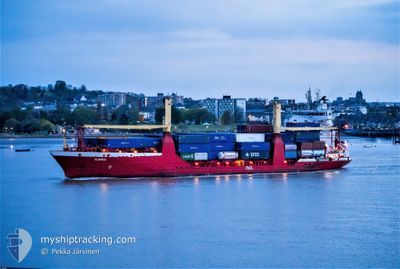
RUMBA
Container Ship
Current Trip
PTPDL
| Time Travelled | 5 days |
|---|---|
| Remaining Time | --- |
| Distance Travelled | 1119.20 nm |
| Remaining Distance | --- |
| AVG Speed | 12.6 Knopen |
| MAX Speed | 16.5 Knopen |
| AVG Wind | 10.3 knots |
| MAX Wind | 25 knots |
| MIN Temp | 18.2°C / 64.76°F |
| MAX Temp | 25.7°C / 78.26°F |
| Diepgang | 5.5 M |
| Positie ontvangen | 3 m geleden |
Current Position
| Lengtegraad | -25.66452° |
|---|---|
| Breedtegraat | 37.73523° |
| Status | Moored |
| Snelheid | |
| Koers | 275° |
| Gebied | North Atlantic Ocean |
| Station | T-AIS |
| Positie ontvangen | 3 m geleden |
Info
Information
The current position of RUMBA is in North Atlantic Ocean with coordinates 37.73523° / -25.66452° as reported on 2024-07-27 07:39 by AIS to our vessel tracker app. The vessel's current speed is 0 Knopen
The vessel RUMBA (IMO: 9264714, MMSI: 255801970) is a Container Ship that was built in 2003 ( 21 Jaar oud ). It's sailing under the flag of [PT] Portugal.
In this page you can find informations about the vessels current position, last detected port calls, and current voyage information. If the vessels is not in coverage by AIS you will find the latest position.
The current position of RUMBA is detected by our AIS receivers and we are not responsible for the reliability of the data. The last position was recorded while the vessel was in Coverage by the Ais receivers of our vessel tracking app.
The current draught of RUMBA as reported by AIS is 5.5 meters
Weather
| Temperature | 22.4°C / 72.32°F |
|---|---|
| Wind Speed | 10 knots |
| Direction | 313° NW |
| Pressure | 1018.5 hPa |
| Humidity | 89.9 % |
| Cloud Coverage | --- |
Featured Company
Last Port Calls
| Port | Arrival | Departure | Time In Port |
|---|---|---|---|
| 2024-07-15 07:45 | 2024-07-21 20:18 | 6 d | |
| 2024-07-03 14:21 | 2024-07-06 00:35 | 2 d | |
| 2024-07-03 14:08 | 2024-07-03 14:12 | 4 m | |
| 2024-06-28 14:04 | 2024-06-29 13:20 | 23 h | |
| 2024-06-27 22:06 | 2024-06-28 02:48 | 4 h | |
| 2024-06-26 16:53 | 2024-06-26 18:23 | 1 h | |
| 2024-06-25 15:16 | 2024-06-25 19:50 | 4 h | |
| 2024-06-25 11:44 | 2024-06-25 14:17 | 2 h | |
| 2024-06-24 06:49 | 2024-06-25 00:38 | 17 h | |
| 2024-06-23 20:03 | 2024-06-23 23:15 | 3 h |
Last Trips
| Origin | Departure | Destination | Arrival | Distance | |
|---|---|---|---|---|---|
| 2024-07-06 00:35 | 2024-07-15 07:45 | 1908.57 nm | |||
| 2024-07-03 14:12 | 2024-07-03 14:21 | 0.79 nm | |||
| 2024-06-29 13:20 | 2024-07-03 14:08 | 1394.57 nm | |||
| 2024-06-28 02:48 | 2024-06-28 14:04 | 117.06 nm | |||
| 2024-06-26 18:23 | 2024-06-27 22:06 | 357.28 nm | |||
| 2024-06-25 19:50 | 2024-06-26 16:53 | 275.82 nm | |||
| 2024-06-25 14:17 | 2024-06-25 15:16 | 12.01 nm | |||
| 2024-06-25 00:38 | 2024-06-25 11:44 | 152.44 nm | |||
| 2024-06-23 23:15 | 2024-06-24 06:49 | 97.49 nm | |||
| 2024-06-23 02:20 | 2024-06-23 20:03 | 214.36 nm |
Events
| Tijd | Evenement | Details | Positie / Bestemming | Info |
|---|---|---|---|---|
| 2024-07-26 23:31 | Status Changed | Moored Under way using engine |
37.73539 / -25.66454
PTPDL
|
Snelheid: Koers: 275° |
| 2024-07-26 23:31 | Status Changed | Under way using engine Moored |
37.73538 / -25.66454
PTPDL
|
Snelheid: Koers: 275° |
| 2024-07-26 23:30 | Status Changed | Moored Under way using engine |
37.73539 / -25.66453
PTPDL
|
Snelheid: Koers: 275° |
| 2024-07-26 23:26 | Stop beweging |
37.73542 / -25.66454
PTPDL
|
Snelheid: 0.3 kn Koers: 274° |
|
| 2024-07-26 20:48 | ETA Changed | 2024/07/26 23:00 2024/07/26 23:30 |
37.96984 / -26.07397
PTPDL
|
Snelheid: 12.2 kn Koers: 131.7° |
| 2024-07-26 20:36 | Draught Changed | 5.5 5.7 |
37.99773 / -26.11203
PTPDL
|
Snelheid: 12 kn Koers: 135.4° |
| 2024-07-26 20:36 | Destination Changed | PTPDL PTPRV |
37.99773 / -26.11203
PTPDL
|
Snelheid: 12 kn Koers: 135.4° |
| 2024-07-26 20:36 | ETA Changed | 2024/07/26 23:30 2024/07/26 07:00 |
37.99773 / -26.11203
PTPDL
|
Snelheid: 12 kn Koers: 135.4° |
| 2024-07-26 20:30 | Status Changed | Under way using engine Default |
38.01261 / -26.13028
PTPRV
|
Snelheid: 11.7 kn Koers: 134° |
| 2024-07-26 20:25 | Status Changed | Default Under way using engine |
38.02397 / -26.14430
PTPRV
|
Snelheid: 11.7 kn Koers: 133.3° |