
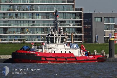
RT TASMAN
Tug
Current Trip
| Time Travelled | 2 days |
|---|---|
| Remaining Time | --- |
| Distance Travelled | 77.04 nm |
| Remaining Distance | --- |
| AVG Speed | 7.9 Knopen |
| MAX Speed | 11.4 Knopen |
| AVG Wind | 4.9 knots |
| MAX Wind | 10.8 knots |
| MIN Temp | 27.7°C / 81.86°F |
| MAX Temp | 30°C / 86°F |
| Diepgang | 6.4 M |
| Positie ontvangen | 14 h, 34 m geleden |
Current Position
| Lengtegraad | 104.16512° |
|---|---|
| Breedtegraat | 1.25078° |
| Status | Under way using engine |
| Snelheid | 8.3 Knopen |
| Koers | 83° |
| Gebied | Singapore Strait |
| Station | T-AIS |
| Positie ontvangen | 14 h, 34 m geleden |
Info
Information
The current position of RT TASMAN is in Singapore Strait with coordinates 1.25078° / 104.16512° as reported on 2024-06-17 01:14 by AIS to our vessel tracker app. The vessel's current speed is 8.3 Knopen and is heading at the port of PORT LOUIS. The estimated time of arrival as calculated by MyShipTracking vessel tracking app is 2024-07-07 12:00 LT
The vessel RT TASMAN (IMO: 9556909, MMSI: 311000872) is a Tug that was built in 2011 ( 13 Jaar oud ). It's sailing under the flag of [BS] Bahamas.
In this page you can find informations about the vessels current position, last detected port calls, and current voyage information. If the vessels is not in coverage by AIS you will find the latest position.
The current position of RT TASMAN is detected by our AIS receivers and we are not responsible for the reliability of the data. The last position was recorded while the vessel was in Coverage by the Ais receivers of our vessel tracking app.
The current draught of RT TASMAN as reported by AIS is 6.4 meters
Weather
| Temperature | 29.2°C / 84.56°F |
|---|---|
| Wind Speed | 9 knots |
| Direction | 216° SW |
| Pressure | 1010.3 hPa |
| Humidity | 71.8 % |
| Cloud Coverage | 59 % |
Featured Company
Events
| Tijd | Evenement | Details | Positie / Bestemming | Info |
|---|---|---|---|---|
| 2024-06-17 01:21 | Status Changed | Default Under way using engine |
1.25251 / 104.18158
MU-PLU
|
Snelheid: 8.3 kn Koers: 83° |
| 2024-06-17 01:14 | Status Changed | Under way using engine Default |
1.25078 / 104.16512
MU-PLU
|
Snelheid: 8.4 kn Koers: 83° |
| 2024-06-17 01:14 | Buitenbereik |
1.25078 / 104.16512
Singapore Strait
MU-PLU
|
Snelheid: 8.3 kn Koers: 83° |
|
| 2024-06-17 00:45 | Status Changed | Default Under way using engine |
1.24289 / 104.09911
MU-PLU
|
Snelheid: 8.1 kn Koers: 85.1° |
| 2024-06-16 22:44 | Wijzig zee gebeid | Indonesian part of the Singapore Strait Singaporean part of the Singapore Strait |
1.18634 / 103.83988
Singapore Strait
MU-PLU
|
Snelheid: 9.9 kn Koers: 114.8° |
| 2024-06-16 21:59 | Start beweging | 2.44 nm, South West of SINGAPORE |
1.23616 / 103.82004
MU-PLU
|
Snelheid: 3.4 kn Koers: 247° |
| 2024-06-16 20:55 | Status Changed | Under way using engine At anchor |
1.23553 / 103.81978
MU-PLU
|
Snelheid: 0.1 kn Koers: 265° |
| 2024-06-16 17:58 | Status Changed | At anchor Default |
1.23544 / 103.81973
MU-PLU
|
Snelheid: 0.1 kn Koers: 284° |
| 2024-06-16 17:55 | Status Changed | Default At anchor |
1.23543 / 103.81973
MU-PLU
|
Snelheid: Koers: 276° |
| 2024-06-16 13:46 | Status Changed | At anchor Default |
1.23553 / 103.81966
MU-PLU
|
Snelheid: 0.1 kn Koers: 268° |