
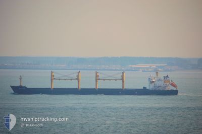
ROYAL STAR
Bulk Carrier
Current Trip
| Time Travelled | 2 h, 42 mins |
|---|---|
| Remaining Time | --- |
| Distance Travelled | 7.51 nm |
| Remaining Distance | --- |
| AVG Speed | 5.2 Knopen |
| MAX Speed | 7.3 Knopen |
| AVG Wind | 10.5 knots |
| MAX Wind | 12.8 knots |
| MIN Temp | 22.1°C / 71.78°F |
| MAX Temp | 22.9°C / 73.22°F |
| Diepgang | 5.4 M |
| Positie ontvangen | 44 m geleden |
Current Position
| Lengtegraad | 29.74264° |
|---|---|
| Breedtegraat | 31.19334° |
| Status | At anchor |
| Snelheid | 0.1 Knopen |
| Koers | 65° |
| Gebied | Mediterranean Sea - Eastern Basin |
| Station | T-AIS |
| Positie ontvangen | 44 m geleden |
Info
Information
The current position of ROYAL STAR is in Mediterranean Sea - Eastern Basin with coordinates 31.19334° / 29.74264° as reported on 2024-05-16 16:34 by AIS to our vessel tracker app. The vessel's current speed is 0.1 Knopen
The vessel ROYAL STAR (IMO: 9223813, MMSI: 352986184) is a Bulk Carrier that was built in 2001 ( 23 Jaar oud ). It's sailing under the flag of [PA] Panama.
In this page you can find informations about the vessels current position, last detected port calls, and current voyage information. If the vessels is not in coverage by AIS you will find the latest position.
The current position of ROYAL STAR is detected by our AIS receivers and we are not responsible for the reliability of the data. The last position was recorded while the vessel was in Coverage by the Ais receivers of our vessel tracking app.
The current draught of ROYAL STAR as reported by AIS is 5.4 meters
Weather
| Temperature | 22.1°C / 71.78°F |
|---|---|
| Wind Speed | 11 knots |
| Direction | 66° ENE |
| Pressure | 1018.7 hPa |
| Humidity | 66 % |
| Cloud Coverage | --- |
Featured Company
Last Port Calls
| Port | Arrival | Departure | Time In Port |
|---|---|---|---|
| 2024-04-30 10:20 | 2024-05-16 14:36 | 16 d | |
| 2024-03-31 07:39 | 2024-04-19 11:11 | 19 d | |
| 2024-03-20 11:56 | 2024-03-25 06:43 | 4 d | |
| 2024-03-10 00:59 |
Most Visited Ports (Last year)
| Port | Arrivals | |
|---|---|---|
| 4 | ||
| 3 | ||
| 2 | ||
| 2 | ||
| 1 | ||
| 1 |
Last Trips
| Origin | Departure | Destination | Arrival | Distance | |
|---|---|---|---|---|---|
| 2024-04-19 13:11 | 2024-04-30 12:20 | 1263.72 nm | |||
| 2024-03-25 08:43 | 2024-03-31 09:39 | 1218.56 nm | |||
| 2024-03-10 02:59 | 2024-03-20 13:56 | 623.50 nm |
Events
| Tijd | Evenement | Details | Positie / Bestemming | Info |
|---|---|---|---|---|
| 2024-05-16 16:40 | Status Changed | Default At anchor |
31.19332 / 29.74270
EG ALY
|
Snelheid: 0.1 kn Koers: 65° |
| 2024-05-16 16:25 | Status Changed | At anchor Default |
31.19357 / 29.74251
EG ALY
|
Snelheid: 0.4 kn Koers: 44° |
| 2024-05-16 16:25 | Stop beweging | 4.32 nm, North West of EL DEKHEILA |
31.19357 / 29.74251
EG ALY
|
Snelheid: 0.1 kn Koers: 76° |
| 2024-05-16 16:19 | Status Changed | Default At anchor |
31.19317 / 29.74289
EG ALY
|
Snelheid: 0.7 kn Koers: 13° |
| 2024-05-16 16:08 | Status Changed | At anchor Under way using engine |
31.19293 / 29.74444
EG ALY
|
Snelheid: 0.5 kn Koers: 352° |
| 2024-05-16 15:48 | Status Changed | Under way using engine Default |
31.18831 / 29.73693
EG ALY
|
Snelheid: 4.2 kn Koers: 82° |
| 2024-05-16 15:45 | Status Changed | Default Under way using engine |
31.18816 / 29.73307
EG ALY
|
Snelheid: 3.5 kn Koers: 69° |
| 2024-05-16 14:39 | Status Changed | Under way using engine Default |
31.16094 / 29.82907
EG ALY
|
Snelheid: 5.8 kn Koers: 279° |
| 2024-05-16 14:36 | Vertrekhaven |
|
31.16038 / 29.83435
EG ALY
|
Snelheid: 6.2 kn Koers: 254° |
| 2024-05-16 14:12 | Status Changed | Default Under way using engine |
31.18542 / 29.86398
[EG] ALEXANDRIA
|
Snelheid: 4.8 kn Koers: 216° |