

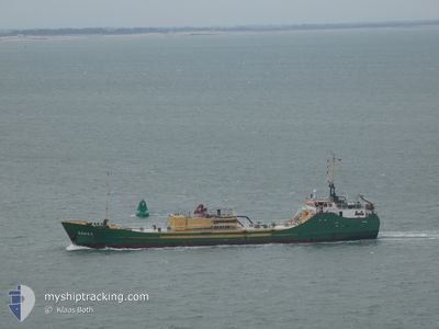
RONEZ
Cement Carrier

Current Trip
| Time Travelled | 1 day |
|---|---|
| Remaining Time | 12 h, 57 mins |
| Distance Travelled | 240.97 nm |
| Remaining Distance | 245.12 nm |
| AVG Speed | 8.6 Knopen |
| MAX Speed | 10.9 Knopen |
| AVG Wind | 10.8 knots |
| MAX Wind | 27 knots |
| MIN Temp | 5.4°C / 41.72°F |
| MAX Temp | 9°C / 48.2°F |
| Diepgang | 3.7 M |
| Positie ontvangen | 14 h, 28 m geleden |
Current Position
| Lengtegraad | --- |
|---|---|
| Breedtegraat | --- |
| Status | Under way using engine |
| Snelheid | 8.7 Knopen |
| Koers | 306° |
| Gebied | North Sea |
| Station | T-AIS |
| Positie ontvangen | 14 h, 28 m geleden |
Information
The current position of RONEZ is in North Sea with coordinates 55.36366° / 4.52984° as reported on 2025-02-21 21:25 by AIS to our vessel tracker app. The vessel's current speed is 8.7 Knopen and is heading at the port of ABERDEEN. The estimated time of arrival as calculated by MyShipTracking vessel tracking app is 2025-02-23 00:50 LT
The vessel RONEZ (IMO: 8102476, MMSI: 232003642) is a Cement Carrier that was built in 1982 ( 43 Jaar oud ). It's sailing under the flag of [GB] United Kingdom.
In this page you can find informations about the vessels current position, last detected port calls, and current voyage information. If the vessels is not in coverage by AIS you will find the latest position.
The current position of RONEZ is detected by our AIS receivers and we are not responsible for the reliability of the data. The last position was recorded while the vessel was in Coverage by the Ais receivers of our vessel tracking app.
The current draught of RONEZ as reported by AIS is 3.7 meters
Weather
| Temperature | 7.5°C / 45.5°F |
|---|---|
| Wind Speed | 14 knots |
| Direction | 189° S |
| Pressure | 1005.4 hPa |
| Humidity | 97.2 % |
| Cloud Coverage | 100 % |


Featured Company
Last Port Calls
| Port | Arrival | Departure | Time In Port |
|---|---|---|---|
| 2025-02-17 00:49 | 2025-02-20 21:51 | 3 d | |
| 2025-02-08 13:54 | 2025-02-14 17:54 | 6 d | |
| 2025-02-07 09:07 | 2025-02-08 08:31 | 23 h | |
| 2025-02-03 21:00 | 2025-02-05 07:51 | 1 d | |
| 2025-01-30 23:49 | 2025-02-01 06:41 | 1 d | |
| 2025-01-29 18:44 | 2025-01-30 06:29 | 11 h | |
| 2025-01-23 03:22 | 2025-01-23 21:47 | 18 h | |
| 2025-01-20 08:42 | 2025-01-20 20:25 | 11 h | |
| 2025-01-16 19:19 | 2025-01-18 09:11 | 1 d | |
| 2025-01-15 07:08 | 2025-01-16 16:07 | 1 d |
Most Visited Ports (Last year)
| Port | Arrivals | |
|---|---|---|
| 23 | ||
| 22 | ||
| 17 | ||
| 16 | ||
| 11 | ||
| 9 |
Last Trips
| Origin | Departure | Destination | Arrival | Distance | |
|---|---|---|---|---|---|
| 2025-02-14 17:54 | 2025-02-17 01:49 | 557.25 nm | |||
| 2025-02-08 08:31 | 2025-02-08 13:54 | 36.76 nm | |||
| 2025-02-05 07:51 | 2025-02-07 09:07 | 368.04 nm | |||
| 2025-02-01 06:41 | 2025-02-03 21:00 | 595.32 nm | |||
| 2025-01-30 07:29 | 2025-01-30 23:49 | 129.28 nm | |||
| 2025-01-23 21:47 | 2025-01-29 19:44 | 500.15 nm | |||
| 2025-01-20 21:25 | 2025-01-23 03:22 | 442.52 nm | |||
| 2025-01-18 09:11 | 2025-01-20 09:42 | 347.86 nm | |||
| 2025-01-16 16:07 | 2025-01-16 19:19 | 27.28 nm | |||
| 2025-01-13 06:29 | 2025-01-15 07:08 | 360.50 nm |
Events
| Tijd | Evenement | Details | Positie / Bestemming | Info |
|---|---|---|---|---|
| 2025-02-21 21:57 | Status Changed | Default Under way using engine |
55.40760 / 4.42058
GBABD
|
Snelheid: 8.7 kn Koers: 306° |
| 2025-02-21 21:25 | Buitenbereik |
55.36366 / 4.52984
North Sea
GBABD
|
Snelheid: 8.7 kn Koers: 306° |
|
| 2025-02-21 20:17 | ETA Changed | 2025/02/23 03:00 2025/02/23 05:00 |
55.26762 / 4.76814
GBABD
|
Snelheid: 9.3 kn Koers: 307.3° |
| 2025-02-21 19:17 | Status Changed | Under way using engine Default |
55.18393 / 4.97910
GBABD
|
Snelheid: 8.9 kn Koers: 302° |
| 2025-02-21 19:00 | Binnenbereik |
55.18393 / 4.97910
North Sea
GBABD
|
Snelheid: 9 kn Koers: 304.7° |
|
| 2025-02-21 04:23 | Status Changed | Default Under way using engine |
53.84562 / 8.04389
GBABD
|
Snelheid: 9.9 kn Koers: 294.9° |
| 2025-02-21 04:21 | Buitenbereik |
53.84246 / 8.05505
North Sea
GBABD
|
Snelheid: 9.9 kn Koers: 294.9° |
|
| 2025-02-20 21:51 | Vertrekhaven |
|
53.11849 / 8.70063
GBABD
|
Snelheid: 9.7 kn Koers: 283° |
| 2025-02-20 21:35 | Start beweging |
53.09834 / 8.74014
[DE] BREMEN
|
Snelheid: 4.4 kn Koers: 344° |
|
| 2025-02-20 20:41 | Status Changed | Under way using engine Moored |
53.09559 / 8.74081
[DE] BREMEN
|
Snelheid: Koers: 159° |