

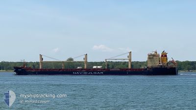
RODOPI
Bulk Carrier

Current Trip
| Time Travelled | 3 days |
|---|---|
| Remaining Time | --- |
| Distance Travelled | 888.62 nm |
| Remaining Distance | --- |
| AVG Speed | 11.1 Knopen |
| MAX Speed | 13.2 Knopen |
| AVG Wind | 11.1 knots |
| MAX Wind | 23.5 knots |
| MIN Temp | 6.2°C / 43.16°F |
| MAX Temp | 15.6°C / 60.08°F |
| Diepgang | 9.8 M |
| Positie ontvangen | 23 h, 14 m geleden |
Current Position
| Lengtegraad | --- |
|---|---|
| Breedtegraat | --- |
| Status | Under way using engine |
| Snelheid | 11.3 Knopen |
| Koers | 355.2° |
| Gebied | North Sea |
| Station | T-AIS |
| Positie ontvangen | 23 h, 14 m geleden |
Information
The current position of RODOPI is in North Sea with coordinates 51.98018° / 2.70501° as reported on 2025-03-23 09:45 by AIS to our vessel tracker app. The vessel's current speed is 11.3 Knopen
The vessel RODOPI (IMO: 9498274, MMSI: 229013000) is a Bulk Carrier that was built in 2012 ( 13 Jaar oud ). It's sailing under the flag of [MT] Malta.
In this page you can find informations about the vessels current position, last detected port calls, and current voyage information. If the vessels is not in coverage by AIS you will find the latest position.
The current position of RODOPI is detected by our AIS receivers and we are not responsible for the reliability of the data. The last position was recorded while the vessel was in Coverage by the Ais receivers of our vessel tracking app.
The current draught of RODOPI as reported by AIS is 9.8 meters
Weather
| Temperature | 6.3°C / 43.34°F |
|---|---|
| Wind Speed | 10 knots |
| Direction | 355° N |
| Pressure | 1016.8 hPa |
| Humidity | 91 % |
| Cloud Coverage | 63 % |


Featured Company
Last Port Calls
| Port | Arrival | Departure | Time In Port |
|---|---|---|---|
| 2025-03-19 16:40 | 2025-03-20 19:29 | 1 d | |
| 2025-03-14 20:42 | 2025-03-14 21:53 | 1 h | |
| 2025-03-11 20:28 | 2025-03-14 18:50 | 2 d | |
| 2025-03-03 00:31 | 2025-03-07 19:30 | 4 d | |
| 2025-02-09 18:04 | 2025-02-13 13:01 | 3 d | |
| 2025-01-06 06:07 | 2025-01-09 22:27 | 3 d |
Most Visited Ports (Last year)
| Port | Arrivals | |
|---|---|---|
| 5 | ||
| 2 | ||
| 2 | ||
| 1 | ||
| 1 | ||
| 1 |
Last Trips
| Origin | Departure | Destination | Arrival | Distance | |
|---|---|---|---|---|---|
| 2025-03-14 21:53 | 2025-03-19 16:40 | 747.97 nm | |||
| 2025-03-14 18:50 | 2025-03-14 20:42 | 8.88 nm | |||
| 2025-03-07 19:30 | 2025-03-11 20:28 | 952.66 nm | |||
| 2025-02-13 13:01 | 2025-03-03 00:31 | 3249.20 nm | |||
| 2025-01-09 22:27 | 2025-02-09 18:04 | 2105.23 nm | |||
| 2024-12-26 17:17 | 2025-01-06 06:07 | 2812.40 nm |
Events
| Tijd | Evenement | Details | Positie / Bestemming | Info |
|---|---|---|---|---|
| 2025-03-24 03:10 | Stop beweging | 17.67 nm, East of GRIMSBY |
53.60917 / .42340
GBHUL
|
Snelheid: 0.3 kn Koers: 18° |
| 2025-03-23 09:50 | Status Changed | Default Under way using engine |
51.99568 / 2.70306
GBHUL
|
Snelheid: 11.3 kn Koers: 355.2° |
| 2025-03-23 09:45 | Buitenbereik |
51.98018 / 2.70501
North Sea
GBHUL
|
Snelheid: 11.3 kn Koers: 355.2° |
|
| 2025-03-23 08:55 | Wijzig zee gebeid | Dutch part of the North Sea Belgian part of the North Sea |
51.82890 / 2.62363
North Sea
GBHUL
|
Snelheid: 11.7 kn Koers: 19.5° |
| 2025-03-23 07:05 | Gevonden in zee | Belgian part of the North Sea |
51.54336 / 2.27199
North Sea
GBHUL
|
Snelheid: 11.9 kn Koers: 41.2° |
| 2025-03-23 07:05 | Status Changed | Under way using engine Default |
51.54336 / 2.27199
GBHUL
|
Snelheid: 11.9 kn Koers: 41° |
| 2025-03-23 06:57 | Status Changed | Default Under way using engine |
51.52176 / 2.24150
GBHUL
|
Snelheid: 11.9 kn Koers: 41.1° |
| 2025-03-23 06:52 | Status Changed | Under way using engine Default |
51.50922 / 2.22384
GBHUL
|
Snelheid: 11.9 kn Koers: 41° |
| 2025-03-23 06:46 | Status Changed | Default Under way using engine |
51.49418 / 2.20271
GBHUL
|
Snelheid: 12 kn Koers: 41.5° |
| 2025-03-23 06:10 | Gevonden in zee | French part of the North Sea |
51.40556 / 2.07803
North Sea
GBHUL
|
Snelheid: 11.9 kn Koers: 40.4° |