

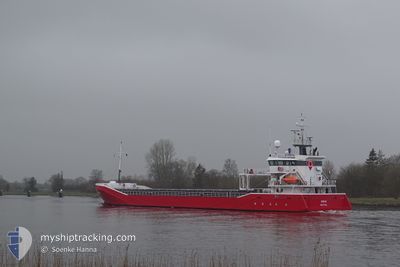
ROBIJN
General Cargo

Current Trip
| Trip Time | 2 days |
|---|---|
| Trip Distance | 550.42 nm |
| AVG Speed | 9.8 Knopen |
| MAX Speed | 12.2 Knopen |
| Diepgang | 5.3 M |
| AVG Wind | 9.7 knots |
| MAX Wind | 19.3 knots |
| MIN Temp | -2.9°C / 26.78°F |
| MAX Temp | 3.6°C / 38.48°F |
| Positie ontvangen | 2 d geleden |
Current Position
| Lengtegraad | --- |
|---|---|
| Breedtegraat | --- |
| Status | Under way using engine |
| Snelheid | 9.8 Knopen |
| Koers | 12.1° |
| Gebied | Gulf of Bothnia |
| Station | T-AIS |
| Positie ontvangen | 2 d geleden |
Information
The current position of ROBIJN is in Gulf of Bothnia with coordinates 60.83097° / 19.19672° as reported on 2025-03-20 14:05 by AIS to our vessel tracker app. The vessel's current speed is 9.8 Knopen and is currently inside the port of VEITSILUOTO.
The vessel ROBIJN (IMO: 9423669, MMSI: 245909000) is a General Cargo that was built in 2008 ( 17 Jaar oud ). It's sailing under the flag of [NL] Netherlands.
In this page you can find informations about the vessels current position, last detected port calls, and current voyage information. If the vessels is not in coverage by AIS you will find the latest position.
The current position of ROBIJN is detected by our AIS receivers and we are not responsible for the reliability of the data. The last position was recorded while the vessel was in Coverage by the Ais receivers of our vessel tracking app.
The current draught of ROBIJN as reported by AIS is 5.3 meters
Weather
| Temperature | 0.8°C / 33.44°F |
|---|---|
| Wind Speed | 14 knots |
| Direction | 215° SW |
| Pressure | 1022.1 hPa |
| Humidity | 85.4 % |
| Cloud Coverage | 80 % |


Featured Company
Last Port Calls
| Port | Arrival | Departure | Time In Port |
|---|---|---|---|
| 2025-03-22 06:46 | |||
| 2025-03-18 18:07 | 2025-03-19 19:00 | 1 d | |
| 2025-03-17 00:14 | 2025-03-17 21:34 | 21 h | |
| 2025-03-15 21:47 | 2025-03-15 22:29 | 42 m | |
| 2025-03-13 03:14 | 2025-03-15 14:50 | 2 d | |
| 2025-03-12 19:17 | 2025-03-12 19:42 | 24 m | |
| 2025-03-07 10:29 | 2025-03-08 13:23 | 1 d | |
| 2025-02-28 14:53 | 2025-03-04 16:55 | 4 d | |
| 2025-02-22 08:28 | 2025-02-26 10:38 | 4 d | |
| 2025-02-18 08:09 | 2025-02-21 13:32 | 3 d |
Most Visited Ports (Last year)
| Port | Arrivals | |
|---|---|---|
| 3 | ||
| 3 | ||
| 3 | ||
| 3 | ||
| 3 | ||
| 3 |
Last Trips
| Origin | Departure | Destination | Arrival | Distance | |
|---|---|---|---|---|---|
| 2025-03-19 19:00 | 2025-03-22 06:46 | 550.42 nm | |||
| 2025-03-17 21:34 | 2025-03-18 18:07 | 226.95 nm | |||
| 2025-03-15 22:29 | 2025-03-17 00:14 | 254.12 nm | |||
| 2025-03-15 14:50 | 2025-03-15 21:47 | 66.40 nm | |||
| 2025-03-12 19:42 | 2025-03-13 03:14 | 66.92 nm | |||
| 2025-03-08 13:23 | 2025-03-12 19:17 | 872.00 nm | |||
| 2025-03-04 16:55 | 2025-03-07 10:29 | 252.31 nm | |||
| 2025-02-26 10:38 | 2025-02-28 14:53 | 541.49 nm | |||
| 2025-02-21 13:32 | 2025-02-22 08:28 | 165.52 nm | |||
| 2025-02-17 14:47 | 2025-02-18 08:09 | 169.36 nm |
Events
| Tijd | Evenement | Details | Positie / Bestemming | Info |
|---|---|---|---|---|
| 2025-03-22 04:46 | Stop beweging |
65.68867 / 24.61268
[FI] VEITSILUOTO
|
Snelheid: 0.3 kn Koers: 5° |
|
| 2025-03-22 04:46 | Aankomsthaven |
|
65.68867 / 24.61268
[FI] VEITSILUOTO
|
Snelheid: 1.1 kn Koers: 352° |
| 2025-03-22 03:50 | Start beweging | 2.55 nm, South East of AJOS |
65.62298 / 24.55718
FIKEM
|
Snelheid: 7.2 kn Koers: 23° |
| 2025-03-22 03:18 | Stop beweging | 2.68 nm, South East of AJOS |
65.61979 / 24.55363
FIKEM
|
Snelheid: Koers: 25° |
| 2025-03-22 03:06 | Start beweging | 3.06 nm, South of AJOS |
65.61063 / 24.53204
FIKEM
|
Snelheid: 7.3 kn Koers: 54° |
| 2025-03-22 02:54 | Stop beweging | 3.32 nm, South of AJOS |
65.60554 / 24.51365
FIKEM
|
Snelheid: Koers: 55° |
| 2025-03-22 02:22 | Start beweging | 7.08 nm, South of AJOS |
65.54770 / 24.43136
FIKEM
|
Snelheid: 9.7 kn Koers: 37° |
| 2025-03-22 01:38 | Stop beweging | 7.51 nm, South of AJOS |
65.54145 / 24.42101
FIKEM
|
Snelheid: Koers: 35° |
| 2025-03-21 22:58 | Start beweging |
65.40784 / 23.70058
FIKEM
|
Snelheid: 5.1 kn Koers: 92° |
|
| 2025-03-21 22:30 | Stop beweging |
65.40795 / 23.69501
FIKEM
|
Snelheid: Koers: 104° |